


Get to know Jianghan District
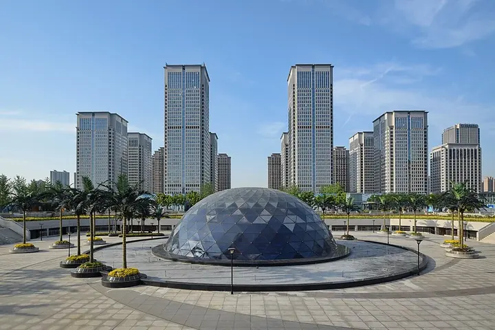
Photo adjustments
Full frame retained; proportionally resized and converted to WebP. No retouching or changes to the photographed subject. Card displays may crop the view.
- Administrative area
- District · 市辖区
- Part of
- Wuhan
- Chinese name
- 江汉区
- Local areas
- District guide
Area & population
- Area in the source
- 33.43 km²
- Population · 2020
- 647,932
Source: cited geographic source, as of the dates shown.
Setting and landscape
Across the water, Jianghan faces Wuchang (武昌区) and Hanyang (汉阳区) districts; to the north it reaches Zhanggong Dike (张公堤) and the border with Dongxihu District (东西湖区), while Jiang'an (江岸区) lies to the east and Qiaokou (硚口区) to the west. The district is narrow in the south and wide in the north, and the ground falls from south to north; the district government likens its outline to a torch leaning towards the northwest.
History
Jianghan is where the old town of Hankou began. During the Chenghua (成化) reign of the Ming dynasty (1465–1487) the lower Han River changed course and began joining the Yangtze north of Tortoise Hill (龟山), which split Hankou off from Hanyang. By the late Ming and early Qing, Hankou was counted among the empire's "four great towns" with Foshan (佛山), Zhuxian (朱仙镇) and Jingdezhen (景德镇), and in the Republican era it was called the "Chicago of the East".
In 1899 the Huguang viceroy Zhang Zhidong (张之洞) set up Xiakou subprefecture (夏口厅) in Hankou. The Nationalist government created Hankou city in 1926 and a year later built its city hall on the site of the Tianyuan charity hall (天元善堂) in today's Minzhu Street (民主街). The area became Wuhan's Third District in November 1950 and took the name Jianghan in July 1952.
What to see
South of Jinghan Avenue (京汉大道) lies the old Hankou historic quarter, with the Jianghan Customs House (江汉关), the old Water Tower (水塔), Minzhong Leyuan (民众乐园), Tongren Lane (铜人巷), Jijiazui (集家嘴) and Longwangmiao (龙王庙). Jianghan Road Pedestrian Street (江汉路步行街) is a century-old shopping street known as Wuhan's museum of 20th-century architecture; the Ministry of Commerce named it a national model pedestrian street in July 2021.
Zhongshan Park (中山公园) lies in the district's middle section, along with Huayuandao (花园道) at Xibeihu (西北湖), an arts and shopping street made from eight low-rise factory buildings and an office block of a former car-repair company, converted from 2008. The northern section holds Hankou Railway Station (汉口火车站), 120 years old, which the district lists among China's largest European-style stations, and the Red T fashion quarter (红T时尚创意街区), which occupies an old garment factory park and has hosted Wuhan Fashion Week.
Food
Old Hankou's long-established eateries cluster in the southern quarter, among them Cailinji (蔡林记), Sijimei (四季美), Laotongcheng (老通城) and Dehualou (德华楼). Xuesong Road (雪松路), less than a kilometre long, gathers more than 50 popular restaurants and was tidied up as a food street from 2019.
Highlights
- Jianghan Road Pedestrian Street 江汉路步行街: Century-old shopping street called Wuhan's museum of 20th-century architecture; named a national model pedestrian street in July 2021.
- Jianghan Customs House 江汉关: One of the landmarks of the old Hankou historic quarter south of Jinghan Avenue.
- Huayuandao 花园道: Arts and shopping street at Xibeihu in eight converted factory buildings and an office block, reworked from 2008.
- Xuesong Road 雪松路: Street under a kilometre long with more than 50 popular restaurants.
Sources for this guide
江汉区 - 维基百科,自由的百科全书 · Wikipedia (Chinese) · CC BY-SA 4.0
江汉概况 - 基本概况 - 魅力江汉 - 武汉市江汉区人民政府 · Jianghan District People's Government, Wuhan
逛吃逛吃 - 江汉风貌 - 魅力江汉 - 武汉市江汉区人民政府 · Jianghan District People's Government, Wuhan
Original English written from the listed sources and checked sentence by sentence against quoted extracts by a separate reviewer. Updated 2026-09-24.
Explore Jianghan District
Core places to explore, with English and Chinese names.
Places to explore around Jianghan District
 Jianghan Road pedestrian shopping street in Hankou, Wuhan ·
 Plan your visit
Getting there
Jianghan District is about 3 km in a straight line from central Wuhan. Search for 江汉区 in a map app to find stations and your accommodation.
Where to stay →Build your route
Start with Jianghan Road Pedestrian Street. The linked place guides have entrance and visit details.
Continue with Wuhan →More in Wuhan
Sources & geographic information
Administrative names and parent areas: Official geographic directory · Reference date 2026-09-06.
Some facts checked against 江汉区 — Wikipedia contributors, CC BY-SA 4.0.
Photo: Jianghan Road Pedestrian Street · User:Vmenkov · CC BY-SA 3.0. Full frame retained; proportionally resized and converted to WebP. No retouching or changes to the photographed subject. Card displays may crop the view.

Map data © OpenStreetMap contributors. Pins mark approximate centres, not entrances or boundaries.