


Get to know Hannan District
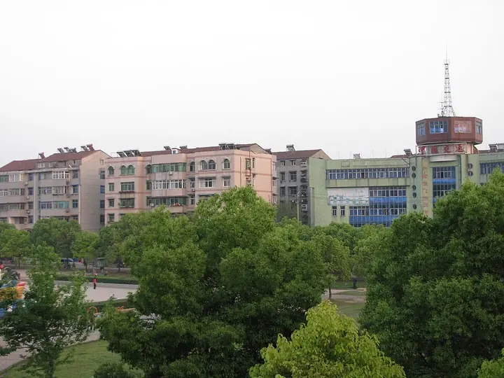
Photo adjustments
Full frame retained; proportionally resized and converted to WebP. No retouching or changes to the photographed subject. Card displays may crop the view.
- Administrative area
- District · 市辖区
- Part of
- Wuhan
- Chinese name
- 汉南区
- Local areas
- District guide
Area & population
- Area in the source
- 287.70 km²
- Population · 2020
- 145,103
Source: cited geographic source, as of the dates shown.
Setting and landscape
The Hannan area is higher in the southeast and lower in the northwest, higher along its rivers and lower in the middle, and runs as a band along the Yangtze. The northeast has scattered low hills among small lakes; the rest is broad plain built up by river deposits and silted lakes, at about 20.7 to 26 metres above sea level. The Yangtze enters at Xingou village (新沟村) and flows past the Dengnan (邓南街道) and Shamao (纱帽街道) subdistricts, while the Tongshun River (通顺河) runs from Xiangkou (湘口街道) through Dengnan and Dongjing (东荆街道) towards the Yangtze.
Across the development zone and Hannan, the zone government records more than 220 kinds of wild birds, including the Baer's pochard (青头潜鸭), Oriental stork (东方白鹳), black stork (黑鹳) and Siberian crane (白鹤). Edible wild plants of the area include Selenge wormwood shoots (藜蒿), lake lotus root, water bamboo, water caltrop and fox nuts.
History
The zone government places Hannan in the ancient Yunmeng marshes (云梦泽), in the land of Chu (楚). From 606 it belonged to Hanyang County (汉阳县), until October 1957, when it was divided between Hanyang's Dengnan district (邓南区) and the Dongchengyuan Farm (东城垸农场). The Hannan Farm Administration was formed in March 1978, and Hannan District was created on 19 January 1984, sharing offices with the farm administration. The district government sits in Shamao subdistrict.
Getting oriented
Describing the development zone and Hannan together, the zone government places Jiangxia District (江夏区), Hongshan District (洪山区) and Jiayu County (嘉鱼县) across the Yangtze, Honghu (洪湖市) and Xiantao (仙桃市) to the west, and Caidian (蔡甸区) and Hanyang (汉阳区) districts to the north. On the Yangtze in the southwest of the development zone is Wuhan Hannan Airport (武汉汉南机场), which the zone government calls the city's only general-aviation airport; a general aviation and satellite industrial park set up in 2015 is based there.
Highlights
- Wuhan Hannan Airport 武汉汉南机场: Described by the zone government as Wuhan's only general-aviation airport, on the Yangtze.
- Tongshun River 通顺河: River crossing Hannan from Xiangkou through Dengnan and Dongjing towards the Yangtze.
Sources for this guide
自然条件-武汉经济技术开发区(汉南区) · Wuhan Economic and Technological Development Zone (Hannan District)
建制沿革-武汉经济技术开发区(汉南区) · Wuhan Economic and Technological Development Zone (Hannan District)
通用航空及卫星产业园-武汉经济技术开发区(汉南区) · Wuhan Economic and Technological Development Zone (Hannan District)
汉南区 - 维基百科 · Chinese Wikipedia · CC BY-SA 4.0
Original English written from the listed sources and checked sentence by sentence against quoted extracts by a separate reviewer. Updated 2026-09-24.
Explore Hannan District
Core places to explore, with English and Chinese names.
Hannan District 汉南区
Plan your visit
Getting there
Hannan District is about 40 km in a straight line from central Wuhan. Search for 汉南区 in a map app to find stations and your accommodation.
Where to stay →More in Wuhan
Sources & geographic information
Administrative names and parent areas: Official geographic directory · Reference date 2026-09-06.
Some facts checked against 汉南区 — Wikipedia contributors, CC BY-SA 4.0.
Map data © OpenStreetMap contributors. Pins mark approximate centres, not entrances or boundaries.