


Get to know Qingshan District
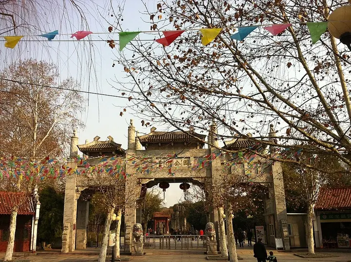
Photo adjustments
Full frame retained; proportionally resized and converted to WebP. No retouching or changes to the photographed subject. Card displays may crop the view.
- Administrative area
- District · 市辖区
- Part of
- Wuhan
- Chinese name
- 青山区
- Local areas
- District guide
Area & population
- Area in the source
- 68.40 km²
- Population · 2020
- 431,818
Source: cited geographic source, as of the dates shown.
Setting and landscape
Qingshan adjoins Wuchang District (武昌区) to the west and Hongshan District (洪山区) to the south, while the Yangtze wraps round its east and north, with Tianxing Island (天兴洲) and Jiang'an District (江岸区) across the water. The river flows from southwest to northeast past Qingshan and then turns almost at right angles to the southeast; it widens from 1,060 metres at the gap between Tortoise and Snake hills to 3,800 metres at Qingshan town. Inland the ground is half low hills, rising no higher than 74 metres, and half plain, with Beihu (北湖), Zhuzi (竹子湖) and Qingtan (清潭湖) lakes and about 40 kilometres of shoreline on Yanxi Lake (严西湖).
The name means "green hill": Chinese Wikipedia explains that among the yellow soil, sand and gravel of the riverbanks, boatmen saw only this one small hill on the south bank as green.
History
Qingshan became the gateway to Wuchang once Sun Quan (孙权) built that city. The district government records that Eastern Wu kept a navy at the rocky point of Qingshanji (青山矶) in the Three Kingdoms period. Huangpi county (黄陂县) moved its seat there in 1236 for 40 years to escape war north of the river, and the Yuan general Bayan (伯颜) seized Qingshanji in 1274 before taking Wuchang and Hanyang. The poet Lu You (陆游) wrote it into his travel diary Ru Shu Ji (入蜀记) in 1170. In the late Qing, viceroy Zhang Zhidong (张之洞) used it as a training ground for the Hubei New Army.
On 12 May 1954 the Wuhan Iron and Steel Company was sited at Qingshan, and the district government was formed on 15 February 1955. The first phase of the works took 137,000 mu of land and moved 12,500 villagers. By 1972 steelmaking, metallurgical construction, shipbuilding, petrochemical and power plants had turned Qingshan into a national industrial base.
What to see
The residential west of the district includes Honggangcheng (红钢城), built in 1956, where the plane trees are more than 30 years old. The district also contains Qingshan Park (青山公园), and its north–south roads are named Jianshe ("construction"), recalling the drive of the workers who built the steelworks. Wuhan University of Science and Technology (武汉科技大学) has its campus in the district.
Highlights
- Qingshanji 青山矶: Riverside rock held by Eastern Wu's navy and taken by Bayan in 1274 before Wuchang fell.
- Honggangcheng 红钢城: Residential quarter built in 1956, shaded by plane trees more than 30 years old.
- Yanxi Lake 严西湖: Lake with about 40 kilometres of shoreline in the district.
Sources for this guide
青山区 (武汉市) - 维基百科,自由的百科全书 · Wikipedia (Chinese) · CC BY-SA 4.0
初识青山(位置面积、地形、河流水系)- 武汉市青山区人民政府(武汉化工区管委会) · Qingshan District People's Government, Wuhan (district archives)
初识青山(历史沿革)- 武汉市青山区人民政府(武汉化工区管委会) · Qingshan District People's Government, Wuhan (district archives)
Original English written from the listed sources and checked sentence by sentence against quoted extracts by a separate reviewer. Updated 2026-09-24.
Explore Qingshan District
Core places to explore, with English and Chinese names.
Qingshan District 青山区
Plan your visit
Getting there
Qingshan District is about 10 km in a straight line from central Wuhan. Search for 青山区 in a map app to find stations and your accommodation.
Where to stay →More in Wuhan
Sources & geographic information
Administrative names and parent areas: Official geographic directory · Reference date 2026-09-06.
Some facts checked against 青山区 (武汉市) — Wikipedia contributors, CC BY-SA 4.0.
Map data © OpenStreetMap contributors. Pins mark approximate centres, not entrances or boundaries.