


Get to know Chang'an District
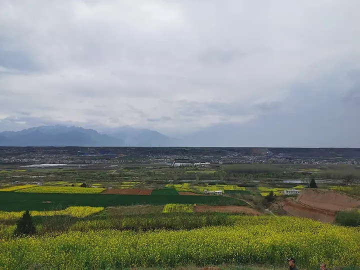
Photo adjustments
Full frame retained; proportionally resized and converted to WebP. No retouching or changes to the photographed subject. Card displays may crop the view.
- Administrative area
- District · 市辖区
- Part of
- Xi’an
- Chinese name
- 长安区
- Local areas
- District guide
Area & population
- Area in the source
- 1,594.00 km²
- Population · 2019
- 1,045,300
Source: cited geographic source, as of the dates shown.
Setting and landscape
Elevations range from 384.7 metres to 2,886.7 metres, generally falling from south-east to north-west. The district government says a third of the Qinling's 72 valleys (峪) fall within Chang'an. Its main rivers, the Feng (沣河) and the Chan (浐河), both belong to the Wei River (渭河) system. Geothermal fields lie along the northern foot of the Qinling around Guodu (郭杜), Weiqu (韦曲), Duqu (杜曲) and Dongda (东大), and the provincial Niubeiliang Nature Reserve (牛背梁自然保护区) protects takin.
History
Chang'an County was created in 202 BC under the founding Han emperor, its name meaning 'lasting order and long peace' (长治久安). A county of that name existed for most of the following two thousand years, and in June 2002 it became a district of Xi'an, with its seat at Weiqu. Earlier still, in the eleventh century BC, the Western Zhou kings Wen and Wu built their capitals Fengjing (丰京) and Haojing (镐京) at Mawang (马王) and Doumen (斗门), now part of Xi'an's Fengdong New City (沣东新城). The novelist Liu Qing (柳青) lived here for 14 years and wrote 'The Builders' (创业史).
What to see
The pagoda of Xingjiao Temple (兴教寺) is on the World Heritage List, and the Hejiaying drum music (何家营鼓乐) of the district is recognised by UNESCO as intangible heritage. The Guanzhong Folk Art Museum (关中民俗博物院) and the Shaanxi Archaeology Museum (陕西考古博物馆) are both in the district. The Nanwutai (南五台) mountain has become known for photographs of star trails, and a ginkgo said to have been planted by the Tang emperor Taizong (唐太宗) is more than a thousand years old.
Food and local products
The district government names more than ten traditional vegetables by place of origin, among them the lotus root of Dongda, the cabbage of Wuxing (五星), the chives of Weiqu, the flowering chives of Huangliang (黄良) and the stem lettuce of Dayu (大峪). From the mountains come chestnuts, Sichuan pepper and black wood-ear fungus.
Highlights
- Xingjiao Temple Pagoda 兴教寺塔: Inscribed on the World Heritage List.
- Hejiaying Drum Music 何家营鼓乐: Folk drum music recognised by UNESCO as intangible cultural heritage.
- Shaanxi Archaeology Museum 陕西考古博物馆: Named by the district government with the Guanzhong Folk Art Museum as places to see the past.
- Nanwutai 南五台: Mountain in the district known for star-trail photographs.
- Dongda Lotus Root 东大莲藕: One of the district's named traditional vegetables.
Sources for this guide
长安概况-西安市长安区人民政府 · Chang'an District People's Government, Xi'an
自然地理-西安市长安区人民政府 · Chang'an District People's Government, Xi'an
历史沿革-西安市长安区人民政府 · Chang'an District People's Government, Xi'an
Original English written from the listed sources and checked sentence by sentence against quoted extracts by a separate reviewer. Updated 2026-09-25.
Explore Chang'an District
Core places to explore, with English and Chinese names.
Places to explore around Chang'an District
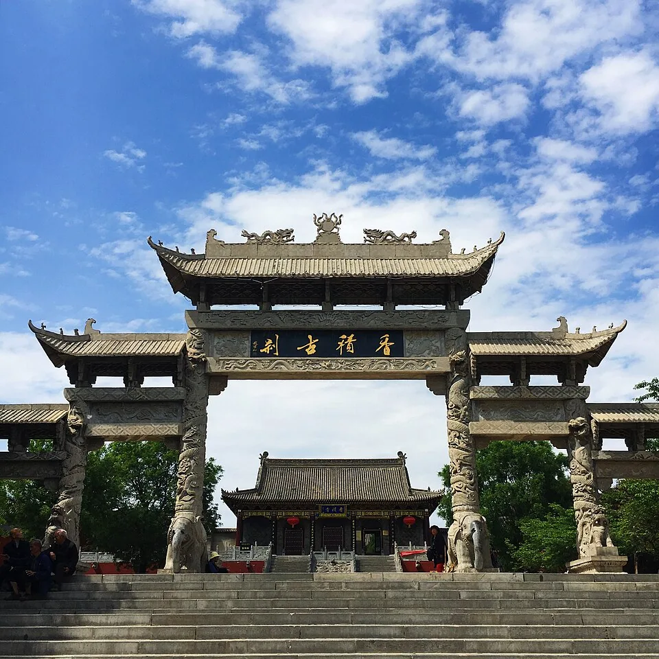 Xiangji Temple · 香积寺. Photo: 2018-04-30.
Xiangji Temple香积寺
Xiangji Temple in Chang’an District is associated with Shandao and the development of Pure Land Buddhism. The strongest historic landmark is Shandao Pagoda, an eleven-storey surviving brick tower in the western courtyard. The…
Read the place guide →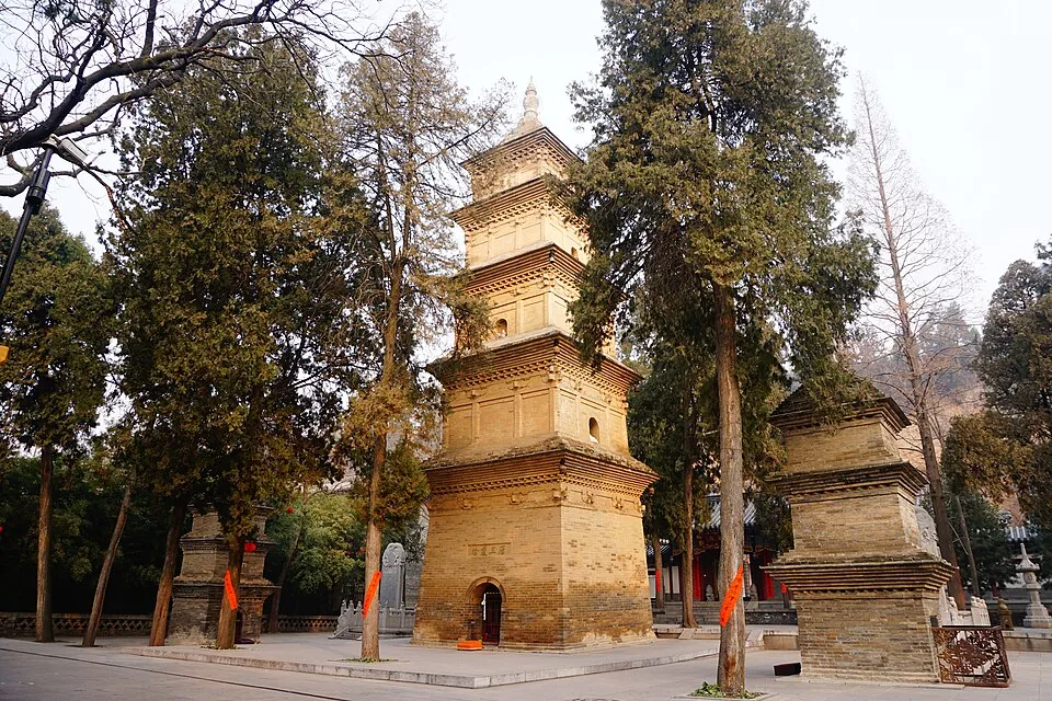 Xingjiao Temple · 兴教寺. Photo: 2017-02-05 09:46:32.
Xingjiao Temple兴教寺
Xingjiao Temple stands on Shaoling Plateau in Duqu, south of Xi’an. Its three relic pagodas commemorate Xuanzang and the monks Kuiji and Woncheuk, linking this small temple to the transmission and study of Buddhist texts…
Read the place guide → AI illustration · AI 示意图(仅供参考,非该地点实拍)
South Wutai Temple Area南五台寺庙区
South Wutai is a cluster of steep, temple-crowned heights on the Qinling’s northern edge. The five named terraces include Guanyin, Wenshu, Qingliang, Lingying and Sheshen. Lingying’s narrow rocky profile is especially…
Read the place guide →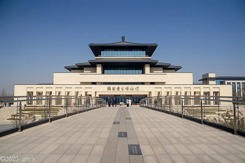 Entrance facade of Shaanxi Archaeology Museum. Photograph date recorded by the source: 2023-11-26 12:06:53.
Shaanxi Archaeology Museum陕西考古博物馆
Shaanxi Archaeology Museum explains how the province’s history is recovered, using excavations and conservation as the organizing thread. Finds such as the carved stone heads from Shimao and Shangguan Wan’er’s epitaph sit within…
Read the place guide → Cuihua Mountain's rocky peak rising above forest near Xi'an · 西安市长安区翠华山山峰景观 Source-recorded photograph date: 2018-07-22.
Cuihua Mountain翠华山
Cuihuashan (翠华山) is a mountain in Chang'an District, Xi'an, Shaanxi, about 20 km from the city's built-up area, whose landscape is made by the wreckage of an ancient landslide. It is designated Cuihuashan National Geopark and forms one of the eight scenic areas of the Qinling Zhongnanshan Global Geopark.
Read the place guide → AI illustration · AI 示意图(仅供参考,非该地点实拍)
Nanwutai Mountain南五台
Nanwutai (南五台), anciently called Taiyishan, stands on the northern foot of the Qinling about 25 km south of Xi'an, in the Wutai subdistrict of Chang'an District, Shaanxi. Its scenic area puts the summit at 1,688 metres across a planned area of 10.71 square kilometres, and it is a national AAAA tourist scenic area and a core scenic area of the Qinling Zhongnanshan Global Geopark.
Read the place guide →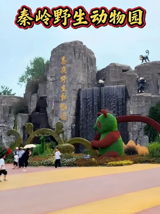 Qinling Wildlife Park · 秦岭野生动物园
Qinling Wildlife Park秦岭野生动物园
Xi'an Qinling Wildlife Park (西安秦岭野生动物园), in Chang'an District, Xi'an, Shaanxi, opened to the public on 1 May 2004. It is a zoological park whose collection stood at more than 200 species and over 6,000 animals when its twentieth anniversary was reported in 2024.
Read the place guide →Plan your visit
Getting there
Chang'an District is about 10 km in a straight line from central Xi’an. Search for 长安区 in a map app to find stations and your accommodation.
Where to stay →Build your route
Xiangji Temple and Xingjiao Temple are about 15 km apart in a straight line. The linked place guides have entrance and visit details.
Continue with Xi’an →More in Xi’an
Sources & geographic information
Administrative names and parent areas: Official geographic directory · Reference date 2026-09-06.
Photo: Xiangji Temple · Cscen · CC BY-SA 4.0. Converted to WebP and resized without changing the subject or cropping the source frame.

Photo: Xingjiao Temple · 汤馥鳞 · CC BY-SA 4.0. Converted to WebP and resized without changing the subject or cropping the source frame.

Photo: Shaanxi Archaeology Museum · Ghrkya · CC BY-SA 4.0. Full frame retained; proportionally resized and converted to WebP. No retouching or changes to the photographed subject. Card displays may crop the view.

Photo: Cuihua Mountain · 沧海夜风 · CC BY-SA 4.0. Full frame retained; proportionally resized and converted to WebP. No retouching or changes to the photographed subject. Card displays may crop the view.

Photo: Qinling Wildlife Park · Source photographer · License not provided. EXIF orientation normalized; resized without changing aspect ratio; converted to WebP. No subject edits.
Map data © OpenStreetMap contributors. Pins mark approximate centres, not entrances or boundaries.