


Get to know Zhouzhi County
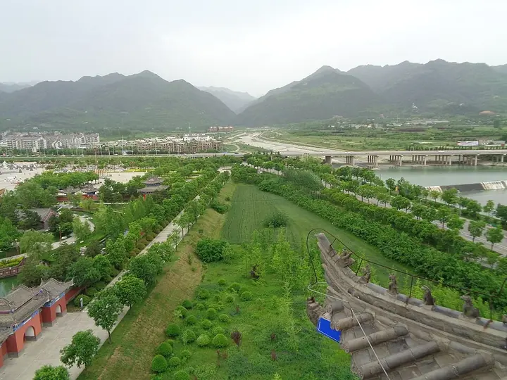
Photo adjustments
Full frame retained; proportionally resized and converted to WebP. No retouching or changes to the photographed subject. Card displays may crop the view.
- Administrative area
- County · 县
- Part of
- Xi’an
- Chinese name
- 周至县
- Local areas
- County guide
Area & population
- Area in the source
- 2,974.00 km²
- Population · 2019
- 672,605
Source: cited geographic source, as of the dates shown.
Setting and landscape
Until 1964 the name was written with older characters, Zhouzhi (盩厔), which describe the land: 'the mountains wind and the waters bend'. The county rises from the Guanzhong (关中) plain in the north-east to the Qinling in the south-west. Fifteen rivers run through the county, and the county government describes Zhouzhi as a main water source for Xi'an. The county's forests are home to giant pandas, golden snub-nosed monkeys and takin.
History
A county under the old name was established in 104 BC, in the Western Han. Zhouzhi was historically known as 'golden Zhouzhi' (金周至). The county government also names it as the home of Zhao Gongming (赵公明), worshipped as a god of wealth, and of the Confucian scholar Li Erqu (李二曲).
What to see
Louguantai (楼观台) is where Laozi (老子) is said to have taught the 'Daodejing' (道德经); it is called the 'foremost blessed land under heaven' and has more than 60 historic sites. Xianyou Temple (仙游寺), on the Heishui River (黑水河), is linked to Bai Juyi (白居易), who wrote 'The Song of Everlasting Sorrow' (长恨歌) there. Its Fawang Pagoda (法王塔), a nationally protected monument, is known for the Sui dynasty Buddhist relics unearthed there.
Food and local products
Zhouzhi holds the title 'capital of Chinese kiwifruit', and the county government describes it as the world's largest kiwifruit-growing base. Zhouzhi kiwifruit carries a geographical-indication certification from the Ministry of Agriculture and Rural Affairs, and Zhouzhi cornelian cherry (山茱萸) is also a geographical-indication product. Zhouzhi embroidery (周至刺绣) is regarded as representative of Shaanxi embroidery (秦绣), and the county has long been called a 'home of embroidery'.
Highlights
- Louguantai 楼观台: Where Laozi is said to have taught the Daodejing; more than 60 historic sites.
- Xianyou Temple 仙游寺: Temple where Bai Juyi wrote 'The Song of Everlasting Sorrow'.
- Fawang Pagoda 法王塔: National protected monument at Xianyou Temple, known for Sui dynasty relics unearthed there.
- Zhouzhi Kiwifruit 周至猕猴桃: Geographical-indication product of the county.
- Zhouzhi Embroidery 周至刺绣: Representative of Shaanxi embroidery.
Sources for this guide
基本县情-西安市周至县人民政府 · Zhouzhi County People's Government
周至县 - 维基百科,自由的百科全书 · Wikipedia · CC BY-SA 4.0
Original English written from the listed sources and checked sentence by sentence against quoted extracts by a separate reviewer. Updated 2026-09-25.
Explore Zhouzhi County
Core places to explore, with English and Chinese names.
Places to explore around Zhouzhi County
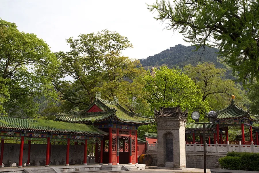 Pavilions, a stele and a tree-filled courtyard at Louguantai, Zhouzhi County, Shaanxi; 19 April 2015.
Louguantai楼观台
Louguantai is a Daoist mountain-foot site in Zhouzhi, traditionally associated with Laozi’s transmission of the Daodejing. Its principal visit rises toward Shuojing Terrace, where later temple buildings occupy a wooded elevation…
Read the place guide → AI illustration · AI 示意图(仅供参考,非该地点实拍)
Qinling Four Treasures Science Park秦岭四宝科学公园
Qinling Four Treasures Science Park grew from a wildlife rescue and research base near Louguantai. Its central subjects are the giant panda, crested ibis, golden snub-nosed monkey and takin. The visit works best as a comparison…
Read the place guide → AI illustration · AI 示意图(仅供参考,非该地点实拍)
Xianyou Temple仙游寺
Xianyou Temple near Mazhao is best known for Fawang Pagoda, a square, seven-storey brick tower with Sui origins. Construction of the Heihe reservoir required the tower to be dismantled and rebuilt on higher ground north of its…
Read the place guide → AI illustration · AI 示意图(仅供参考,非该地点实拍)
Zhouzhi Old County Town Official Route周至老县城正规游览线路
Lao Xiancheng (周至老县城) is not a county town but a small mountain village in Houzhenzi town, Zhouzhi County, Xi'an, named because it was the seat of the Qing dynasty's Foping sub-prefecture. Its former office town survives with its walls, built from stones taken from the banks of the Xu river and therefore known as the stone city, and the site is listed in the fourth batch of Shaanxi's provincial protected cultural relics units. The village was listed in 2016 in the fourth batch of China's traditional villages.
Read the place guide →Plan your visit
Getting there
Zhouzhi County is about 70 km in a straight line from central Xi’an. Search for 周至县 in a map app to find stations and your accommodation.
Where to stay →Build your route
Louguantai and Qinling Four Treasures Science Park are less than 1 km apart. The linked place guides have entrance and visit details.
Continue with Xi’an →More in Xi’an
Sources & geographic information
Administrative names and parent areas: Official geographic directory · Reference date 2026-09-06.
Some facts checked against 周至县 — Wikipedia contributors, CC BY-SA 4.0.
Photo: Louguantai · Jmhullot · CC BY 3.0. Proportionally resized and converted to WebP without cropping, retouching or changing the photographed subject.

Map data © OpenStreetMap contributors. Pins mark approximate centres, not entrances or boundaries.