


Get to know Wuhou District

Photo adjustments
Wikimedia thumbnail; fitted to the ranking-card frame.
- Administrative area
- District · 市辖区
- Part of
- Chengdu
- Chinese name
- 武侯区
- Local areas
- District guide
Area & population
- Area in the source
- 76.56 km²
- Population · 2020 census
- 1,855,186
- Administrative seat
- Jiangxijie Subdistrict
Source: cited geographic source, as of the dates shown.
Setting and landscape
The district is flat, sloping gently from north-west to south-east at an average of about 502 metres above sea level, on alluvial fans and floodplain deposits. Qingyang District (青羊区) lies to the north and Shuangliu District (双流区) to the south and west.
History
Cuqiao (簇桥) is regarded as one of the starting points of the Southern Silk Road and was a centre of the Sichuan silk trade; in the Tang and Song it was called Cocoon Bridge (茧桥). Under King Zhao of Qin, the governor Li Bing (李冰) built the Changxing Bridge (长星桥), later known as Wanli Bridge (万里桥), over the Jin River (锦江) at Laonanmen (老南门), just north of today's district. Liu Bei (刘备), ruler of Shu Han, was buried at Huiling (惠陵) in the southern outskirts of Chengdu in 223. The district was formed in September 1990 when central Chengdu's districts were redrawn.
What to see
The Wuhou Shrine combines Liu Bei's tomb, the Temple of Emperor Zhaolie (汉昭烈庙) and Zhuge Liang's shrine, merged in the early Ming so that ruler and minister are worshipped together; the present halls date from 1672. Statues of Guan Yu (关羽) and Zhang Fei (张飞) stand in the side halls, and among the cypresses behind the gate is the Three Excellences Stele (三绝碑), with a text by the Tang chancellor Pei Du (裴度), calligraphy by Liu Gongchuo (柳公绰) and carving by the mason Lu Jian (鲁建). The shrine museum also takes in the Liu Xiang Mausoleum (刘湘陵园) and the Jinli (锦里) folk-custom street.
Wangjiang Tower (望江楼), originally the Chongli Pavilion (崇丽阁), stands in Wangjiang Tower Park; it is a four-storey timber tower 27.98 metres high whose lower two storeys are square and upper two octagonal. Sichuan University Museum (四川大学博物馆), on Wangjiang Road, grew from the West China Union University antiquities museum founded in 1914 and holds more than 80,000 historical objects as well as large plant and animal specimen collections. Tianfu Furong Garden (天府芙蓉园) and Tiexiang Temple Water Street (铁像寺水街) are among the district's other sights.
Highlights
- Wuhou Shrine 武侯祠: Joint shrine to Liu Bei and Zhuge Liang with Liu Bei's tomb; halls rebuilt in 1672.
- Jinli 锦里: Folk-custom street forming part of the Wuhou Shrine Museum grounds.
- Wangjiang Tower 望江楼: Four-storey timber tower 27.98 m high, square below and octagonal above.
- Sichuan University Museum 四川大学博物馆: Founded as a university antiquities museum in 1914; over 80,000 historical objects.
Sources for this guide
武侯区 - 维基百科,自由的百科全书 · Chinese Wikipedia · CC BY-SA 4.0
成都武侯祠 - 维基百科,自由的百科全书 · Chinese Wikipedia · CC BY-SA 4.0
望江楼 - 维基百科,自由的百科全书 · Chinese Wikipedia · CC BY-SA 4.0
博物馆简介-四川大学博物馆 · Sichuan University Museum
Original English written from the listed sources and checked sentence by sentence against quoted extracts by a separate reviewer. Updated 2026-09-25.
Explore Wuhou District
Core places to explore, with English and Chinese names.
Places to explore around Wuhou District
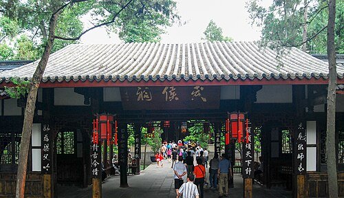 Wuhou Memorial Temple · 武侯祠
Wuhou Shrine武侯祠
Wuhou Shrine commemorates Zhuge Liang and the Shu figures associated with the Three Kingdoms period. Statues in the temple halls turn those historical and literary names into a sequence of people, while gardens provide a quieter…
Read the place guide →Jinli Pedestrian Street · 锦里Jinli Street锦里
Jinli is a rebuilt traditional-style commercial street beside Wuhou Shrine. Qing-style shopfronts frame a pedestrian route filled with Sichuan snacks, craft shops and souvenir stalls. The Three Kingdoms theme connects the street…
Read the place guide → Pond and rockery in Wangjianglou Park · 望江楼公园池塘与假山 Photograph date recorded by the source: 26 September 2015, 01:15:40.
Wangjianglou Park望江楼公园
Wangjianglou Park brings together bamboo gardens, riverside architecture and the memory of Tang poet Xue Tao. Chongli Pavilion is the landmark above the Jin River, while Xue Tao’s Well and the poetry displays give the garden a…
Read the place guide →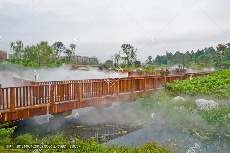 Tianfu Furong Garden · 天府芙蓉园
Tianfu Furong Garden天府芙蓉园
Tianfu Furong Garden uses hibiscus, Chengdu’s city flower, as the theme of a larger planted landscape. Flower fields, aromatic planting, autumn-colour woodland and lawns provide different sections to explore. Its appearance…
Read the place guide → Sichuan University Museum · 四川大学博物馆
Sichuan University Museum四川大学博物馆
Sichuan University Museum combines natural history, archaeology, everyday life and art in its rebuilt riverside museum. Specimens and recreated environments follow southwest China from the Sichuan Basin into the highlands…
Read the place guide →Plan your visit
Getting there
Wuhou District is about 8 km in a straight line from central Chengdu. Search for 武侯区 in a map app to find stations and your accommodation.
Where to stay →Build your route
Wuhou Shrine and Jinli Street are less than 1 km apart. The linked place guides have entrance and visit details.
Continue with Chengdu →More in Chengdu
Sources & geographic information
Administrative names and parent areas: Official geographic directory · Reference date 2026-09-06.
Some facts checked against 武侯区 — Wikipedia contributors, CC BY-SA 4.0.
Some facts checked against 成都武侯祠 — Wikipedia contributors, CC BY-SA 4.0.
Some facts checked against 望江楼 — Wikipedia contributors, CC BY-SA 4.0.
Photo: Wuhou Shrine · Shizhao · CC BY-SA 3.0. Wikimedia thumbnail; fitted to the ranking-card frame.

Photo: Jinli Street · BenBen · CC BY 1.0. Wikimedia thumbnail; fitted to the ranking-card frame.

Photo: Wangjianglou Park · Daderot · Daderot — Rock in pool - Wangjianglou Park - Chengdu, China - DSC06113.jpg — CC0 · CC0. The exact downloaded source bytes are separately retained and hashed. Prepared JPEG is proportionally reduced to a maximum 720-pixel long edge; full frame retained, no subject alteration. Final website rendition: full frame retained, proportionally resized to at most 720 pixels and converted to WebP. No additional retouching or subject alteration. Card displays may crop the view.

Photo: Tianfu Furong Garden · Source photographer · License not provided. EXIF orientation normalized; resized without changing aspect ratio; converted to WebP. No subject edits.
Photo: Sichuan University Museum · Daderot · CC0. EXIF orientation normalized; resized without changing aspect ratio; converted to WebP. No subject edits.

Map data © OpenStreetMap contributors. Pins mark approximate centres, not entrances or boundaries.