


Get to know Anzhou District
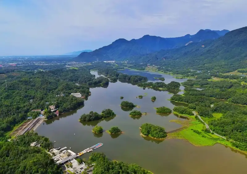
Photo adjustments
EXIF orientation normalized; resized without changing aspect ratio; converted to WebP. No subject edits.
- Administrative area
- District · 市辖区
- Part of
- Mianyang
- Chinese name
- 安州区
- Local areas
- District guide
Area & population
- Area in the source
- 1,404.00 km²
- Population · 2020
- 372,962
- Administrative seat
- Huagai
Source: cited geographic source, as of the dates shown.
What to see
Luofu Mountain stands about two kilometres southwest of Sangzao Town (桑枣镇). Its karst landscape includes the twelve Jinping peaks (锦屏十二峰), caves, rock formations, springs and valleys. Feiming Chan Monastery (飞鸣禅院) is another stop highlighted by the Anzhou tourism bureau. At Baishui Lake, twenty-three islands break up the water, with hills surrounding the lake landscape. The bureau’s suggestions include lakeside cycling and visiting Shating Book House (沙汀书屋).
Mountains and seasons
Qianfo Gorge (千佛峡) has spring rhododendrons, autumn foliage and winter snow. Luofu’s resort area combines mountain walking with hot-spring bathing. Local food names listed by the tourism bureau include Jiaoyazi duck (焦鸭子), guhuatang sweets (谷花糖) and hongsu (红酥).
Sources for this guide
罗浮山_旅游景区_绵阳市人民政府 · Mianyang City Government
来安州旅游,感受诗意生活_绵阳市安州区人民政府 · Anzhou District Culture, Radio, Television and Tourism Bureau
Original English written from the listed sources and checked sentence by sentence against quoted extracts by a separate reviewer. Updated 2026-09-27.
Explore Anzhou District
Core places to explore, with English and Chinese names.
Anzhou District 安州区
Plan your visit
Getting there
Anzhou District is about 15 km in a straight line from central Mianyang. Search for 安州区 in a map app to find stations and your accommodation.
Where to stay →More in Mianyang
Sources & geographic information
Administrative names and parent areas: Official geographic directory · Reference date 2026-09-06.
Map data © OpenStreetMap contributors. Pins mark approximate centres, not entrances or boundaries.