


Get to know Beichuan Qiang Autonomous County
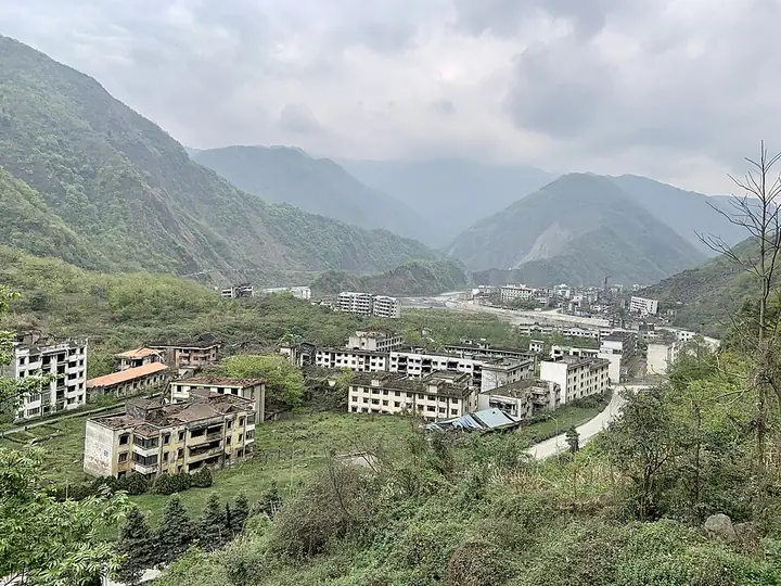
Photo adjustments
Full-frame source proportionally resized and converted to WebP for display. No subject alteration. Source-supplied marks and edits remain; cards may crop the view.
- Administrative area
- Autonomous county · 自治县
- Part of
- Mianyang
- Chinese name
- 北川羌族自治县
- Local areas
- Autonomous county guide
Area & population
- Area in the source
- 3,112.00 km²
- Population · 2020
- 174,132
- Administrative seat
- Yongchang
Source: cited geographic source, as of the dates shown.
Setting and landscape
Beichuan borders Jiangyou (江油市) to the east, Anzhou District (安州区) to the south, Mao County (茂县) to the west, and Songpan (松潘县) and Pingwu (平武县) to the north. Its three main rivers are the Tongkou (通口河), Anchang (安昌河) and Pingtong (平通河). The county government describes it as an ecological barrier on the upper Yangtze, with two national and one provincial nature reserve and a national forest park; wild animals include the giant panda and the Sichuan golden snub-nosed monkey, and protected plants include the dove tree and the Chinese yew.
History
The old name of the area is Shiquan (石泉), and local tradition holds it to be the birthplace of Yu the Great (大禹), the legendary tamer of floods. A Beichuan County was set up in 566 under the Northern Zhou, merged into Shiquan County in 651 and renamed Beichuan again in 1914. The State Council approved its conversion into a Qiang autonomous county in 2003. In the Wenchuan earthquake of 12 May 2008 most of the county reached intensity XI; the old seat of Qushan suffered worst, and landslides dammed a river to form the Tangjiashan quake lake (唐家山堰塞湖). The county town was rebuilt elsewhere, and the new town opened in February 2011.
What to see
The Beichuan Qiang City Tourist Area (北川羌城旅游区) is rated 5A, the only one in Mianyang. The 4A areas are Xiqiang Jiuhuangshan (西羌九皇山), Yaowanggu or Medicine King Valley (药王谷), the Beichuan Weisite agricultural leisure area and Xunlongshan (寻龙山). The county government lists Yaowanggu as having the world's largest forest of century-old xinyi magnolia (辛夷) medicinal trees. The county also has an earthquake ruins museum (地震遗址博物馆). China Tourism News names Shiyi (石椅羌寨), Xiwo (西窝羌寨) and Yina (伊娜羌寨) among more than 30 Qiang villages, and describes evening dancing on the Banaqia square (巴拿恰广场), whose shops sell cured pork, tea and Qiang embroidery.
Food and local products
Beichuan konjac (北川花魔芋), Beichuan cream-yellow marble (北川米黄大理石) and Beichuan Taizi tea (北川苔子茶) are Chinese geographical-indication products. The Qiang New Year (羌年) is on UNESCO's list of intangible heritage in need of urgent safeguarding.
Getting oriented
Yongchang lies 31 km from central Mianyang and 138 km from Chengdu. National roads 247 and 347 cross the county, and the Beichuan section of the Mianyang–Jiuzhaigou expressway is open.
Highlights
- Beichuan Qiang City Tourist Area 北川羌城旅游区: Rated 5A; the only 5A scenic area in Mianyang.
- Yaowanggu 药王谷: 4A area listed by the county government as having the world's largest forest of century-old xinyi magnolia medicinal trees.
- Xiqiang Jiuhuangshan 西羌九皇山: One of the county's four 4A scenic areas.
- Tangjiashan quake lake 唐家山堰塞湖: Formed when the 2008 earthquake dammed a river above the old county town.
- Beichuan Taizi tea 北川苔子茶: Chinese geographical-indication product.
Sources for this guide
北川羌族自治县县情简介(2024年) · Beichuan Qiang Autonomous County People's Government
借力文旅融合 北川全域旅游步入“快车道” · China Tourism News
北川羌族自治县 · Wikipedia (Chinese) · CC BY-SA 4.0
Original English written from the listed sources and checked sentence by sentence against quoted extracts by a separate reviewer. Updated 2026-09-25.
Explore Beichuan Qiang Autonomous County
Core places to explore, with English and Chinese names.
Places to explore around Beichuan Qiang Autonomous County
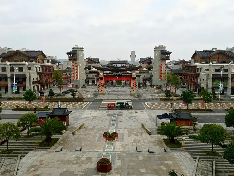 Beichuan Qiang Town Tourism Area (北川羌城旅游区), Beichuan Qiang Autonomous County. Photograph: "Beichuan, Mianyang, Sichuan, China - panoramio (11)".
Beichuan Qiang Town Tourism Area北川羌城旅游区
Beichuan's Qiang Town tourism area connects the old county-town earthquake memorial landscape with the rebuilt town and Qiang cultural venues.
Read the place guide →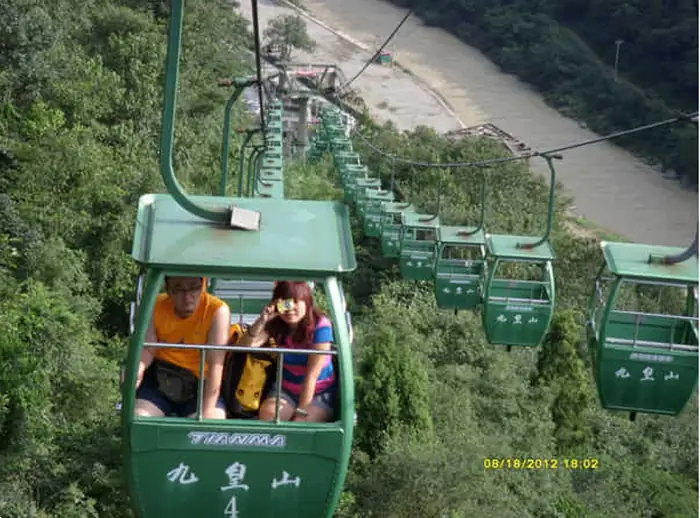 Jiuhuang Mountain · 九皇山
Jiuhuang Mountain九皇山
Jiuhuangshan is a mountain scenic area in Guixi town, in Beichuan Qiang Autonomous County, Mianyang, Sichuan, laid out on karst ground and presented around Western Qiang culture. It is a national AAAA-grade tourist area, one of four in the county.
Read the place guide →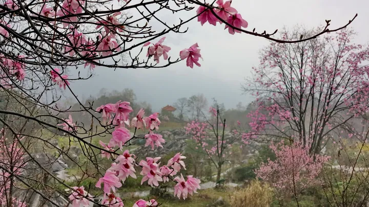 Spring blossoms in the Yaowanggu (Medicine King Valley) scenic area, Beichuan Qiang Autonomous County, Mianyang · 绵阳市北川羌族自治县药王谷春景 Source-recorded photograph date: Taken on 21 March 2016.
Medicine King Valley药王谷
Yaowanggu, the Medicine King Valley, is a wooded valley in Guixi town, Beichuan Qiang Autonomous County, Mianyang, Sichuan, immediately adjoining the Jiuhuangshan scenic area, and its subject is medicinal plants. It is a national AAAA-grade scenic area, a national forest health-and-wellness base and a provincial demonstration base for traditional-medicine health tourism.
Read the place guide →Plan your visit
Getting there
Beichuan Qiang Autonomous County is about 25 km in a straight line from central Mianyang. Search for 北川羌族自治县 in a map app to find stations and your accommodation.
Where to stay →Build your route
Beichuan Qiang Town Tourism Area and Jiuhuang Mountain are both listed here. The linked place guides have entrance and visit details.
Continue with Mianyang →More in Mianyang
Sources & geographic information
Administrative names and parent areas: Official geographic directory · Reference date 2026-09-06.
Some facts checked against 北川羌族自治县 — Wikipedia contributors, CC BY-SA 4.0.
Photo: Beichuan Qiang Town Tourism Area · ping lin · CC BY-SA 3.0. Full frame retained; EXIF orientation normalized, proportionally resized to at most 800 pixels and converted to WebP. No generated pixels or subject changes. Cards may crop the display.

Photo: Jiuhuang Mountain · Source photographer · License not provided. EXIF orientation normalized; resized without changing aspect ratio; converted to WebP. No subject edits.
Photo: Medicine King Valley · Nyx Ning · CC BY-SA 3.0. Full frame retained; proportionally resized and converted to WebP. No retouching or changes to the photographed subject. Card displays may crop the view.

Map data © OpenStreetMap contributors. Pins mark approximate centres, not entrances or boundaries.