


Get to know Santai County
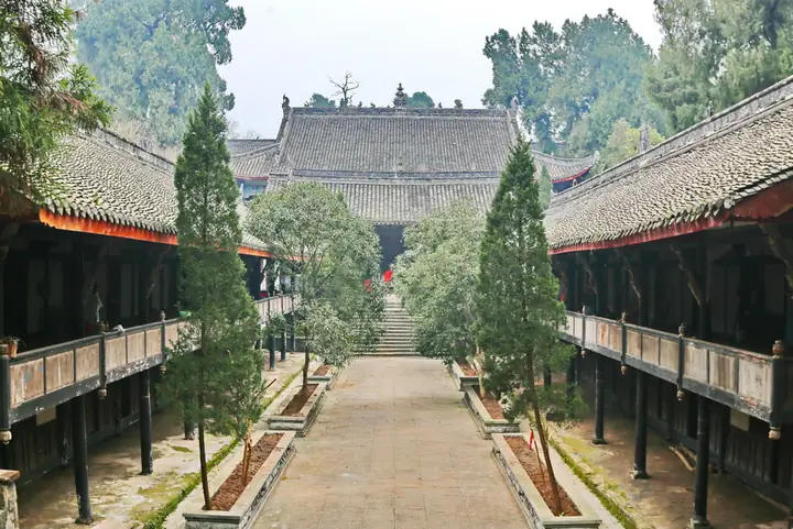
Photo adjustments
Full-frame source proportionally resized and converted to WebP for display. No subject alteration. Source-supplied marks and edits remain; cards may crop the view.
- Administrative area
- County · 县
- Part of
- Mianyang
- Chinese name
- 三台县
- Local areas
- County guide
Area & population
- Area in the source
- 2,660.58 km²
- Population · 2020 census
- 955,800
Source: cited geographic source, as of the dates shown.
The old street
Qijiang lies more than forty kilometres south of the county seat. Qiwang Street (郪王街) has stone paving, timber buildings and grey-tiled roofs, with reliefs on wooden posts and openwork carving on beams. Long covered verandas supported by wooden columns run beside the street. Dizhu Temple (帝主庙) was expanded in 1843; its theatre railings and courtyard posts carry carvings of dramatic scenes, people, flowers and animals.
Images in the cliff tombs
The Qijiang Cliff Tombs (郪江崖墓群) date from the Han and Jin periods (汉晋时期). Their carvings imitate timber architecture. Other images turn to everyday activity and animals: a farmer guiding a plough, cranes pecking at fish, and a dog catching a rat.
Sources for this guide
郪江古镇-三台县人民政府 · Santai County Government
感触斑驳岁月 寻幽郪江古镇 _地方聚焦_人民论坛网 · People’s Tribune
Original English written from the listed sources and checked sentence by sentence against quoted extracts by a separate reviewer. Updated 2026-09-26.
Explore Santai County
Core places to explore, with English and Chinese names.
Places to explore around Santai County
 AI illustration · AI
 Plan your visit
Getting there
Santai County is about 55 km in a straight line from central Mianyang. Search for 三台县 in a map app to find stations and your accommodation.
Where to stay →Build your route
Start with Qijiang Ancient Town and Han Cliff Tombs. The linked place guides have entrance and visit details.
Continue with Mianyang →More in Mianyang
Sources & geographic information
Administrative names and parent areas: Official geographic directory · Reference date 2026-09-06.
Map data © OpenStreetMap contributors. Pins mark approximate centres, not entrances or boundaries.