


Get to know Huangpi District
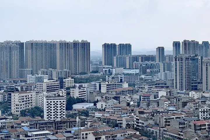
Photo adjustments
Full frame retained; proportionally resized and converted to WebP. No retouching or changes to the photographed subject. Card displays may crop the view.
- Administrative area
- District · 市辖区
- Part of
- Wuhan
- Chinese name
- 黄陂区
- Local areas
- District guide
Area & population
- Area in the source
- 2,261.00 km²
- Population · 2020 census
- 1,151,644
Source: cited geographic source, as of the dates shown.
History
According to the district government, the area belonged to the state of Huang (黄) in the Spring and Autumn period until King Cheng of Chu (楚成王) took it. At the end of the Han, Liu Biao (刘表) had his general Huang Zu (黄祖) build a fort here, called Huangcheng (黄城镇), to guard the mouth of the Han against Wu. Huangpi County was created in 579 under the Northern Zhou, was moved to Hanyang prefecture in 1729, joined Wuhan in 1983, and became a district of Wuhan in 1998, with its seat at Qianchuan (前川).
What to see
Panlongcheng lies beside Panlong Lake (盘龙湖), facing Hankou (汉口) across the Fu River (府河). Found in 1954, it has a walled town, palace foundations, high-ranking tombs and a bronze-casting site, and is dated to 1600–1300 BC. It became a national monument in 1988 and a national archaeological park in 2017, and a museum has been built at the site.
Mulan Mountain, a spur of the Dabie range about 30 km north of the district town on the east bank of the Xian River (仙河), has a main peak of over 600 m and is both a national 5A scenic area and a national geopark. It was anciently called Green Lion Mountain (青狮山) for its shape, and takes its present name from the legendary woman warrior Mulan; its complex of old buildings is protected by Hubei province. The district government counts 23 Mulan-series scenic areas, four of them rated 5A.
Food and local products
Huangpi bean-and-rice noodles (黄陂豆丝) are a taste of New Year in the district. Rice and soybeans soaked in the morning are ground into a milky batter, spread thin in a hot iron wok with a mussel shell, then peeled off as a pancake, dried on racks, rolled and cut into strips. They are stir-fried, boiled or steamed. New Year goods shops, such as those on Qijiawan Street (祁家湾街), sell them alongside glutinous rice cakes (糍粑), cured meats and Huangpi three delicacies (黄陂三鲜).
Highlights
- Panlongcheng 盘龙城: Shang walled town of 1600–1300 BC by Panlong Lake; national monument and archaeological park.
- Mulan Mountain 木兰山: National 5A scenic area and geopark named after the legendary Mulan.
- Huangpi bean-and-rice noodles 黄陂豆丝: Rice-and-soybean pancakes cooked on an iron wok, dried and cut into strips.
Sources for this guide
黄陂概况 · Huangpi District People's Government, Wuhan
历史沿革 · Huangpi District People's Government, Wuhan
木兰山 · Wikipedia (Chinese) · CC BY-SA 4.0
黄陂豆丝香 年味正绵长 · Huangpi District People's Government, Wuhan
盘龙城遗址 · Wikipedia (Chinese) · CC BY-SA 4.0
Original English written from the listed sources and checked sentence by sentence against quoted extracts by a separate reviewer. Updated 2026-09-25.
Explore Huangpi District
Core places to explore, with English and Chinese names.
Places to explore around Huangpi District
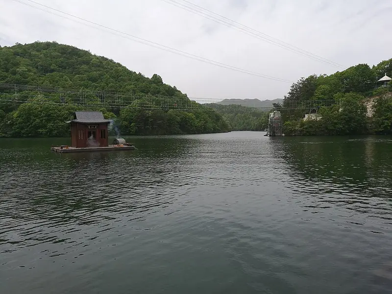 Huangpi Mulan Cultural and Ecological Tourism Area (黄陂木兰文化生态旅游区), Huangpi District. Photograph: "木兰天池 2024-04-24".
Huangpi Mulan Cultural and Ecological Tourism Area黄陂木兰文化生态旅游区
The Mulan tourism area in northern Wuhan groups four separate attractions: Mulan Mountain, Mulan Tianchi, Mulan Grassland and Mulan Yunwu Mountain.
Read the place guide →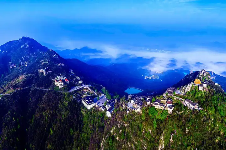 Mulan Mountain · 木兰山
Mulan Mountain木兰山
Mulan Mountain is the temple and mountain-walking destination within Huangpi's wider Mulan tourism area. Its religious buildings and local associations with the Mulan legend give it a different character from Mulan Tianchi or Mulan Grassland.
Read the place guide → The Grand Heaven Pool (大天池) at Mulan Tianchi scenic area in Huangpi District, Wuhan, with a floating pavilion · 武汉黄陂区木兰天池大天池景色,水上茶亭 Source-recorded photograph date: 2024-04-24 12:24:57.
Mulan Tianchi木兰天池
Mulan Tianchi is a forest and gorge destination in Huangpi's Changxuanling area. Waterfalls, stream pools and rock formations shape the walking experience, making it a distinct choice from the temples of Mulan Mountain.
Read the place guide → Entrance gate of Mulan Grassland scenic area, Huangpi District, Wuhan · 武汉黄陂区木兰草原景区大门 Source-recorded photograph date: Taken on 27 July 2013.
Mulan Grassland木兰草原
Mulan Grassland is a managed leisure attraction south of Mulan Mountain in Huangpi. It presents a grassland-themed setting with open lawns, activities and entertainment, rather than an expedition into the remote pastoral landscapes of northern China.
Read the place guide →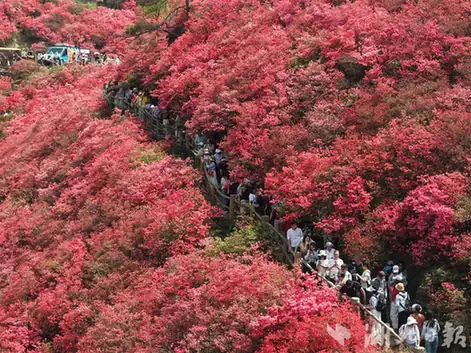 Mulan Yunwu Mountain · 木兰云雾山
Mulan Yunwu Mountain木兰云雾山
Mulan Yunwu Mountain is a Huangpi mountain destination known for spring azaleas and elevated views. Its different flower-viewing areas bloom in succession, so the name of the area matters as much as the general season.
Read the place guide → Dayuwan Village · 大余湾
Dayuwan Village大余湾
Dayuwan (大余湾) is an ancient village in Shuangquan Village, Mulan Township, in Huangpi District north of Wuhan, founded in 1369 and now protected as a Chinese Historic and Cultural Village while operating as a 4A scenic area.
Read the place guide →Local life & food
Huangpi District local specialties
黄陂区特色美食 · 1 specialties to discover
 Huangpi bean-and-rice noodles 黄陂豆丝AI dish illustration / AI 菜品示意图
The strips are soft but resilient and take up broth well. They differ from both wheat noodles and pressed soybean tofu sheets.
Source ↗Read the dish guide →All dish names · 全部菜名 (1)
More dishes from across Hubei are in the Hubei food guide.
Plan your visit
Getting there
Huangpi District is about 30 km in a straight line from central Wuhan. Search for 黄陂区 in a map app to find stations and your accommodation.
Where to stay →Build your route
Huangpi Mulan Cultural and Ecological Tourism Area and Mulan Mountain are both listed here. The linked place guides have entrance and visit details.
Continue with Wuhan →More in Wuhan
Sources & geographic information
Administrative names and parent areas: Official geographic directory · Reference date 2026-09-06.
Some facts checked against 木兰山 — Wikipedia contributors, CC BY-SA 4.0.
Some facts checked against 盘龙城遗址 — Wikipedia contributors, CC BY-SA 4.0.
Photo: Huangpi Mulan Cultural and Ecological Tourism Area · Wang31 · CC BY 4.0. Full frame retained; EXIF orientation normalized, proportionally resized to at most 800 pixels and converted to WebP. No generated pixels or subject changes. Cards may crop the display.

Photo: Mulan Mountain · Source photographer · License not provided. EXIF orientation normalized; resized without changing aspect ratio; converted to WebP. No subject edits.
Photo: Mulan Tianchi · Wang31 · CC BY 4.0. Full frame retained; proportionally resized and converted to WebP. No retouching or changes to the photographed subject. Card displays may crop the view.

Photo: Mulan Grassland · fllee · CC BY-SA 3.0. Full frame retained; proportionally resized and converted to WebP. No retouching or changes to the photographed subject. Card displays may crop the view.

Photo: Mulan Yunwu Mountain · Source photographer · License not provided. EXIF orientation normalized; resized without changing aspect ratio; converted to WebP. No subject edits.
Photo: Dayuwan Village · Source photographer · License not provided. EXIF orientation normalized; resized without changing aspect ratio; converted to WebP. No subject edits.
Map data © OpenStreetMap contributors. Pins mark approximate centres, not entrances or boundaries.