


Get to know Gannan Tibetan Autonomous Prefecture
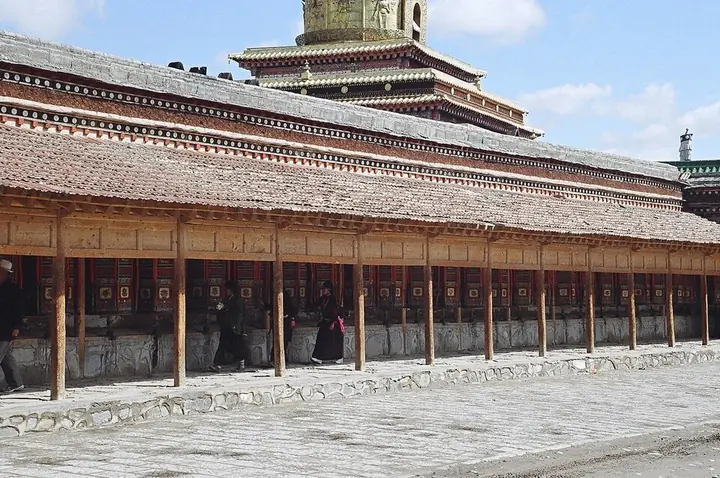
Photo adjustments
Full frame retained; proportionally resized and converted to WebP. No retouching or changes to the photographed subject. Card displays may crop the view.
- Administrative area
- Autonomous prefecture · 自治州
- Part of
- Gansu
- Chinese name
- 甘南藏族自治州
- Local areas
- 8 local areas
Area & population
- Area in the source
- 40,898.00 km²
- Population · 2010
- 689,132
- Administrative seat
- Hezuo
Source: cited geographic source, as of the dates shown.
Setting and landscape
Wide grasslands cover much of the prefecture, which falls from 4,920 m to 1,172 m in Zhouqu County (舟曲县). The Amne Machin (阿尼玛卿山) and Xiqing (西倾山) ranges rise in the west and the Min and Die mountains (岷山, 迭山) in the southeast. The Yellow River crosses the southwest; the Tao (洮河), Daxia (大夏河) and Bailong (白龙江) rivers also run through it, with Têwo (迭部) and Zhouqu counties and the Langmusi area draining to the Yangtze. The prefecture government calls it a water-conservation area for both rivers.
History
The region was Western Qiang (西羌) land in early times. After the Tibetan empire conquered the Tuyuhun (吐谷浑) in 663, the Tang–Tibet road it developed ran through Gannan. Labrang Monastery (拉卜楞寺) was founded in 1709, and the Labrang administrative bureau of 1926 became a county, renamed Xiahe (夏河) in 1928 after the Daxia River. The Gannan autonomous region was set up at Labrang in October 1953; in 1956 its seat moved to Heicuo (黑措), renamed Hezuo (合作).
What to see
Labrang Monastery, beside the Daxia River in Xiahe, is one of the six great monasteries of the Gelug school; it has been a national key cultural relic since 1982, and its medical college dates from 1782. At Langmusi (郎木寺) in Luqu County (碌曲县), the Bailong River splits the town between Gansu, with the Saichi Monastery (赛赤寺), and Sichuan, with the Geerdeng Monastery (格尔登寺); the great prayer festival of the first lunar month brings ritual dances, Tibetan opera and a Buddha display.
In Têwo County, the village of Zhagana (扎尕那), Tibetan for 'stone box', impressed the explorer Joseph Rock in 1925; he wrote of terraced wheat and highland barley fields backed by huge limestone mountains and slopes of spruce and fir. Chanding Monastery (禅定寺) stands on a terrace above the Tao River, just northwest of the Jonê (卓尼) county town.
Food and local products
The Hezuo city government names juema (蕨麻, silverweed root), highland barley and yak as Gannan's signature ingredients. Juema rice (蕨麻米饭) is half rice and half juema in one bowl, sprinkled with sugar and doused with melted butter; tsampa (糌粑) is roasted barley flour kneaded by hand with a little butter tea, dried curd and sugar; Tibetan buns (藏包) are steamed, unleavened parcels of minced beef or mutton. Juema pigs (蕨麻猪) are named for foraging juema on the grassland, and butter tea (酥油茶) is churned from butter, strong tea and salt.
Highlights
- Labrang Monastery 拉卜楞寺: Founded in 1709 by the first Jamyang, Ngawang Tsondru (阿旺宋哲); its assembly hall was enlarged to 140 pillars in 1772.
- Langmusi 郎木寺: Town on the border between Luqu and Zoige (若尔盖) in Sichuan; the Gansu bank has the Saichi Monastery, a Buddha-display terrace, a white stupa and a sky-burial site.
- Zhagana 扎尕那: Village in Yiwa Town (益哇镇), Têwo County; Joseph Rock collected plants in the area in the summer of 1925.
- Daoshihe stone-cooked mutton 刀什合: An outdoor dish: seasoned mutton and red-hot pebbles are packed into a sheep's stomach, which is tied shut so the stones cook the meat.
Sources for this guide
自然地理-甘南藏族自治州人民政府 · Gannan Tibetan Autonomous Prefecture People's Government
历史沿革-甘南藏族自治州人民政府 · Gannan Tibetan Autonomous Prefecture People's Government
甘南藏族自治州 - 维基百科,自由的百科全书 · Wikipedia (Chinese) · CC BY-SA 4.0
甘南郎木寺的“羌姆”艺术-甘南藏族自治州人民政府 · Gannan Tibetan Autonomous Prefecture People's Government
拉卜楞寺 - 维基百科,自由的百科全书 · Wikipedia (Chinese) · CC BY-SA 4.0
扎尕那 - 维基百科,自由的百科全书 · Wikipedia (Chinese) · CC BY-SA 4.0
“甘”味之甘南篇-合作市人民政府 · Hezuo Municipal People's Government
Original English written from the listed sources and checked sentence by sentence against quoted extracts by a separate reviewer. Updated 2026-09-30.
Explore Gannan Tibetan Autonomous Prefecture
Core places to explore, with English and Chinese names.
Yeliguan Tourism Area 冶力关旅游区
Dayugou Scenic Area 大峪沟
Chanding Monastery 禅定寺
Milarepa Pavilion 米拉日巴佛阁
Labrang Monastery 拉卜楞寺
Sangke Grassland 桑科草原
Ganjia Secret Land Visitor Area 甘加秘境开放游览区
Awancang Wetland Viewing Area 阿万仓湿地正规开放观景区
Gahai Lake Viewing Area 尕海湖开放观景区
Langmusi Sertri Monastery Gansu Side 郎木寺甘肃侧赛赤寺
Laga Mountain 拉尕山
Zhagana 扎尕那
Lazikou Pass 腊子口
Hezuo 合作市
Lintan County 临潭县
Jonê County 卓尼县
Zhugqu County 舟曲县
Têwo County 迭部县
Maqu County 玛曲县
Luqu County 碌曲县
Xiahe County 夏河县
Places to explore around Gannan Tibetan Autonomous Prefecture
 Yeliguan Tourism Area · 冶力关旅游区
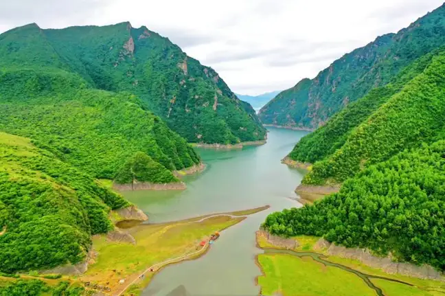
Yeliguan Tourism Area冶力关旅游区
Yeliguan in northeastern Lintan combines mountain lakes, red-rock landforms, subalpine meadows and cultivated terraces.
Read the place guide →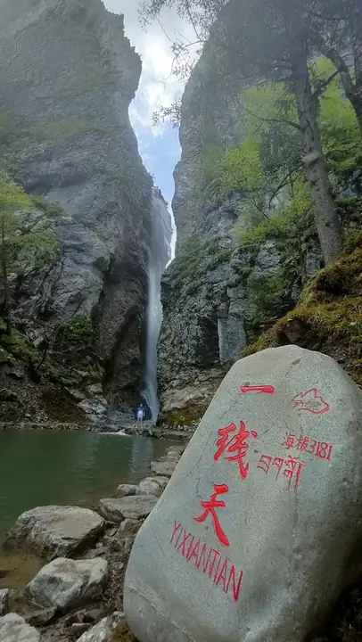 Dayugou Scenic Area · 大峪沟
Dayugou Scenic Area大峪沟
Dayugou (大峪沟) is a national AAAA-grade scenic area in Muer township, Zhuoni county, Gannan Tibetan Autonomous Prefecture, Gansu, comprising nine fan-shaped tributary gullies of the Dayugou, a Taohe river tributary that runs north to south through the area.
Read the place guide →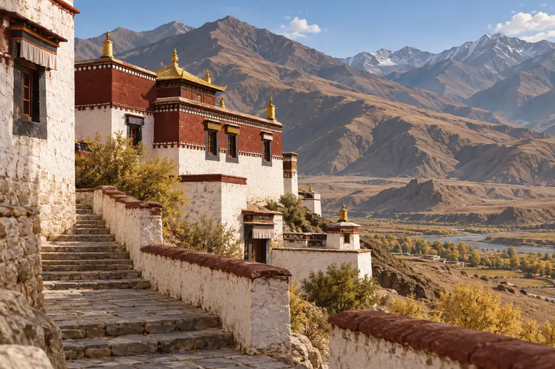 AI illustration · AI 示意图(仅供参考,非该地点实拍)
Chanding Monastery禅定寺
Chanding Temple (禅定寺), also known as the Zhuoni Temple, is a Tibetan Buddhist monastery in the county town of Zhuoni, Gannan Tibetan Autonomous Prefecture, Gansu, which took its present name from a grant by the Kangxi emperor in 1710.
Read the place guide →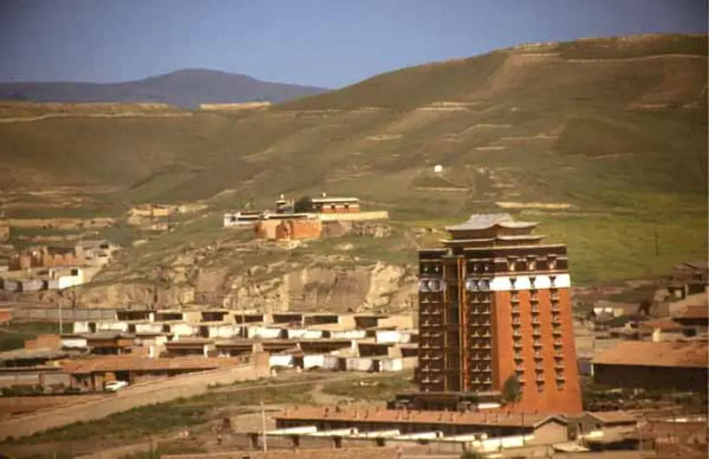 Milarepa Pavilion · 米拉日巴佛阁
Milarepa Pavilion米拉日巴佛阁
Milarepa Pavilion is a tall, red-walled religious building within the Hezuo monastery precinct. Its vertically arranged shrines bring together figures associated with different Tibetan Buddhist traditions, while paintings and…
Read the place guide →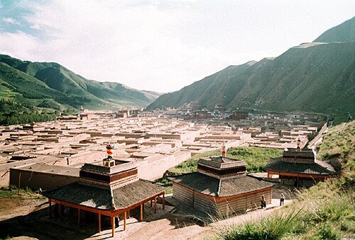 Labrang Monastery (Labuleng Si) · 拉卜楞寺
Labrang Monastery拉卜楞寺
Labrang is a working monastery and centre of learning beside the Daxia River in Xiahe. Its halls and colleges form a substantial settlement of white walls, courts and gilded roofs. The prayer-wheel route shows the monastery’s…
Read the place guide →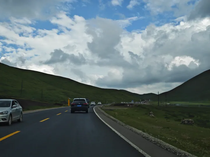 Rolling grassland hills along China National Highway 316 through the Sangke Grassland, Xiahe County · 甘肃夏河县桑科草原,316国道沿线草原风光 Source-recorded photograph date: 2023-08-10 17:25:21.
Sangke Grassland桑科草原
Sangke grassland (桑科草原) is a meadow grassland in Xiahe county, Gannan Tibetan Autonomous Prefecture, Gansu, listed in the county government's own heading as a national AA-grade tourist attraction, with 70 square kilometres of pasture at an average elevation above 3,000 m.
Read the place guide →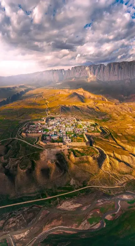 Ganjia Secret Land Visitor Area · 甘加秘境开放游览区
Ganjia Secret Land Visitor Area甘加秘境开放游览区
Ganja Mirage (甘加秘境), catalogued as an open touring area, is a plateau landscape in Ganja town, Xiahe county, Gannan Tibetan Autonomous Prefecture, Gansu, whose defining feature is 15 km of continuous Baishiya cliff above a grassland and an octagonal ancient city.
Read the place guide →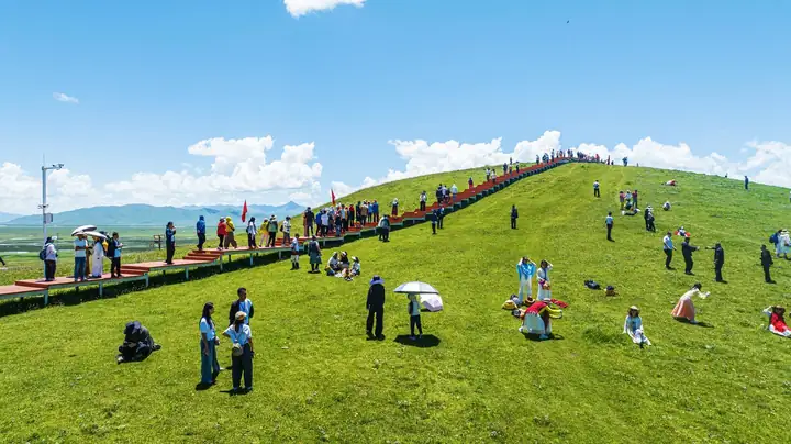 Awancang Wetland Viewing Area · 阿万仓湿地正规开放观景区
Awancang Wetland Viewing Area阿万仓湿地正规开放观景区
Awancang wetland (阿万仓湿地) is a high-altitude wetland in the Yellow River first-bend country of Maqu county, Gannan Tibetan Autonomous Prefecture, Gansu, where interwoven rivers and wet grassland make a habitat for rare birds and a viewing platform looks out over the water.
Read the place guide →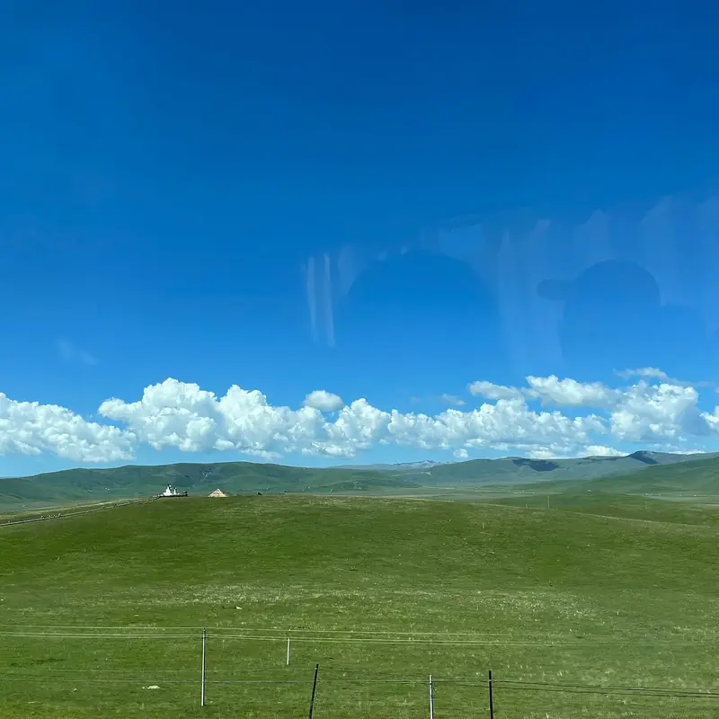 Gahai Lake Viewing Area · 尕海湖开放观景区
Gahai Lake Viewing Area尕海湖开放观景区
Gahai Lake (尕海湖), catalogued as an open viewing area, is a plateau freshwater lake in Luqu county, Gannan Tibetan Autonomous Prefecture, Gansu, set in a high-altitude wetland that is listed as a wetland of international importance and is a breeding ground for migratory birds.
Read the place guide →AI illustration · AI 示意图(仅供参考,非该地点实拍)Langmusi Sertri Monastery Gansu Side郎木寺甘肃侧赛赤寺
Sertri monastery (赛赤寺), the Gansu-side monastery of Langmusi, is a Gelug Tibetan Buddhist monastery in Langmusi town, Luqu county, Gannan Tibetan Autonomous Prefecture, Gansu, on the north bank of the Bailong river where it runs out of the Namo gorge.
Read the place guide → Laga Mountain · 拉尕山
Laga Mountain拉尕山
Lagashan (拉尕山) is a mountain scenic area on the south bank of the upper Bailong river in Zhugqu county, Gannan Tibetan Autonomous Prefecture, Gansu, listed as a national AAAA-grade tourist attraction, with a Tibetan village on its slope, red-cliff caves in its gorge and a small lake below its southern peak.
Read the place guide →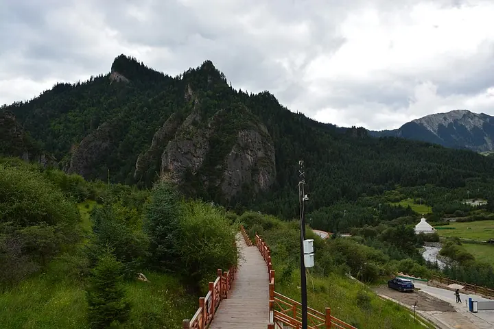 A path among the cliffs at Zhagana · 扎尕那 Photograph date recorded by the source: 2 August 2026, 14:57:08.
Zhagana扎尕那
Zhagana’s villages sit beneath an enclosure of pale limestone peaks, with forested slopes, fields and Tibetan houses filling the basin below. The setting becomes clearer as you move between the inhabited lanes and the designated…
Read the place guide →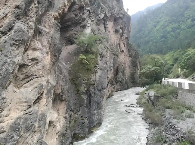 Lazikou Pass · 腊子口
Lazikou Pass腊子口
Langzha Pass (腊子口) is a narrow gorge pass in the mountains of north-eastern Têwo county, Gannan Tibetan Autonomous Prefecture, Gansu, listed as a national AAA-grade tourist attraction and also the memorial place of the Langzha Pass battle.
Read the place guide →Local life & food
Gannan Tibetan Autonomous Prefecture local specialties
甘南藏族自治州特色美食 · 11 specialties to discover
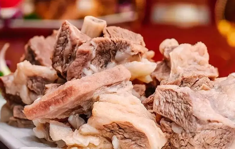 Gannan Yak Meat 甘南牦牛肉
Gannan Yak Meat (甘南牦牛肉) is the meat of the Gannan yak, a breed raised in Gannan Tibetan Autonomous Prefecture (甘南藏族自治州) on the north-eastern edge of the Qinghai-Tibet Plateau.
Read the dish guide →Photo adjustments
EXIF orientation normalized; resized without changing aspect ratio; converted to WebP. No subject edits.
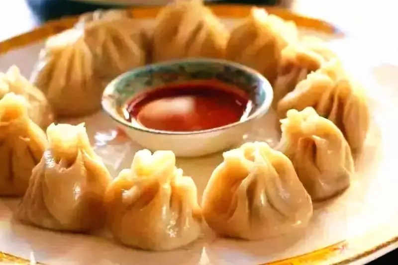 Tibetan Steamed Buns 藏包
Tibetan Steamed Buns (藏包) is the everyday name in Gannan Tibetan Autonomous Prefecture (甘南藏族自治州), southern Gansu, for guantang simian baozi (灌汤死面包子), soup-filled steamed buns made with unleavened dough and a yak-meat filling.
Read the dish guide →Photo adjustments
EXIF orientation normalized; resized without changing aspect ratio; converted to WebP. No subject edits.
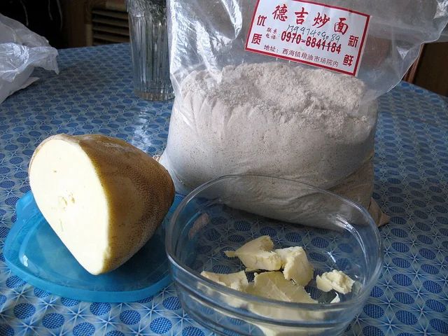 Tsampa Roasted Barley Flour 糌粑Dish photograph · see caption for context
Tsampa Roasted Barley Flour (糌粑) is flour milled from highland barley, qingke (青稞), which is roasted with its hulls still on before it is ground; pea flour is sometimes mixed in.
Source ↗Read the dish guide →
Photo adjustments
EXIF orientation applied where present; resized proportionally to at most 640 px on the long edge and encoded as WebP. No crop, retouching, recoloring or subject changes.
 Tibetan Butter Tea 酥油茶AI dish illustration · AI 菜品示意图
Tibetan Butter Tea (酥油茶) is strong brick tea churned with butter and salt into an emulsion. Chinese Wikipedia describes it as the traditional drink of China's Tibetan areas, naming Tibet, Qinghai and Sichuan among them.
Source ↗Read the dish guide → Rice with Droma Tubers 蕨麻米饭AI illustration · AI 示意图(仅供参考,非实拍)
Rice with Droma Tubers (蕨麻米饭) is a Tibetan dish of rice and droma (蕨麻), a plateau plant commonly called 'ginseng fruit' (人参果), finished with white sugar and melted butter.
Read the dish guide → Highland Barley Bread 青稞饼AI dish illustration · AI 菜品示意图
Highland Barley Bread (青稞饼) is listed among the local specialties of Gannan Tibetan Autonomous Prefecture, Gansu. The term 饼 points to cakes or flatbreads.
Read the dish guide →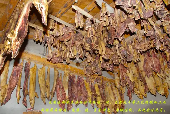 Diebu Juema Pig 迭部蕨麻猪
Diebu Juema Pig (迭部蕨麻猪) is pork from the juema pig (蕨麻猪), a small, primitive local breed of the Gannan (甘南) highlands in Gansu, which is also kept in small numbers in Diebu County (迭部县), along both banks of the Bailong River (白龙江).
Read the dish guide →Photo adjustments
EXIF orientation normalized; resized without changing aspect ratio; converted to WebP. No subject edits.
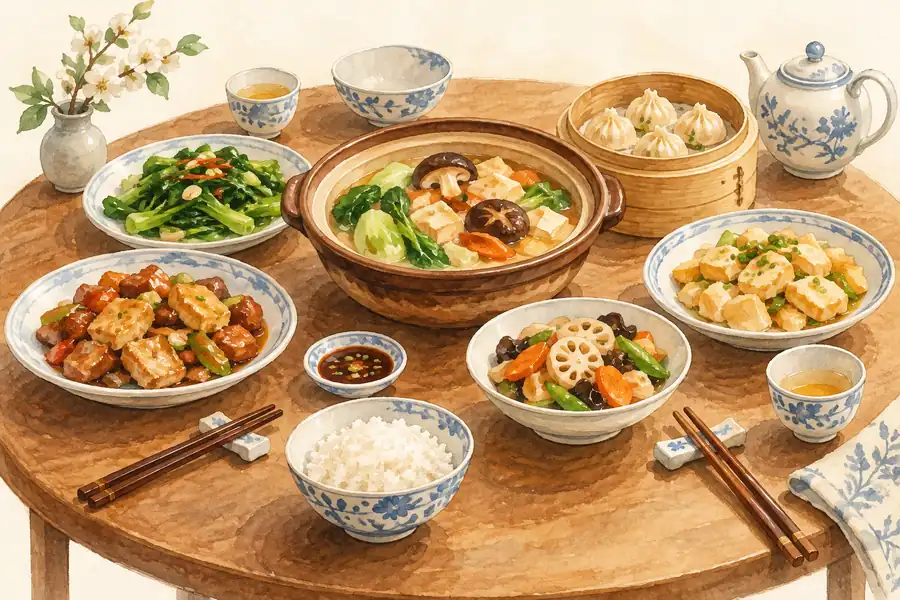 Xiahe Hoof Tendons 夏河蹄筋AI illustration · AI 示意图(仅供参考,非实拍)
Xiahe Hoof Tendons (夏河蹄筋) is a dish of sheep hoof tendons from the Gannan Tibetan Autonomous Prefecture (甘南藏族自治州), which the Hezuo (合作) city government places on the north-eastern edge of the Qinghai-Tibet Plateau.
Read the dish guide →All dish names · 全部菜名 (11)
More dishes from across Gansu are in the Gansu food guide.
Counties & districts in Gannan Tibetan Autonomous Prefecture
8 areas belong directly to Gannan Tibetan Autonomous Prefecture.
8 areas
Hezuo 合作市
Hezuo city, also known as Zö from its Tibetan name (Tibetan: གཙོས་གྲོང་ཁྱེར།, Wylie: Gtsos grong khyer), is the administrative seat of the Gannan Tibetan Autonomous Prefecture (TAP) in southern Gansu province…
Explore the area →CountyLintan County 临潭县
Lintan County is an administrative district in Gansu, China. It is one of 58 counties of Gansu. It is part of the Gannan Prefecture. Its postal code is 747500, and in 1999 its population was 148,722 people.
Explore the area →CountyJonê County 卓尼县
Jonê County (also Cone, Chone, Choni; Tibetan: ཅོ་ནེ་རྫོང་།, Wylie: co-ne rdzong, ZWPY: Jonê Zong; local pronunciation: /tɕɔLnɛ/; Chinese: 卓尼县; pinyin: Zhuōní Xiàn) is a county in the Gannan Tibetan…
Explore the area →CountyZhugqu County 舟曲县
Zhugqu County (Tibetan: འབྲུག་ཆུ་རྫོང་།), Zhugchu or Zhouqu is a county in the eastern extremity of the Gannan Tibetan Autonomous Prefecture in the south of Gansu Province, China, with the Bailong River…
Explore the area →Show fewer areas
Têwo County 迭部县
Têwo County (Tibetan: ཐེ་བོ་རྫོང་།; Chinese: 迭部县) is a county in the south of Gansu province of China, bordering Sichuan province to the south.
Explore the area →CountyMaqu County 玛曲县
Maqu County is a county of the Gannan Tibetan Autonomous Prefecture in the south of Gansu province of China, bordering the provinces of Sichuan to the east and southeast, and Qinghai to the southwest, west…
Explore the area →CountyLuqu County 碌曲县
Luqu County is a county of the Gannan Tibetan Autonomous Prefecture in the south of Gansu province, China, bordering the provinces of Sichuan to the southeast and Qinghai to the west.
Explore the area →CountyXiahe County 夏河县
Xiahe County is a county in Gannan Tibetan Autonomous Prefecture, Gansu province, China, bordering Qinghai province to the west.
Explore the area →No areas match this name.
Plan your visit
Getting there
Search for 甘南藏族自治州 in a map app to find stations and your accommodation.
Where to stay →Build your route
Yeliguan Tourism Area and Dayugou Scenic Area are both listed here. The linked place guides have entrance and visit details.
Continue with Gansu →More in Gansu
Sources & geographic information
Administrative names and parent areas: Official geographic directory · Reference date 2026-09-06.
Some facts checked against 甘南藏族自治州 — Wikipedia contributors, CC BY-SA 4.0.
Some facts checked against 拉卜楞寺 — Wikipedia contributors, CC BY-SA 4.0.
Some facts checked against 扎尕那 — Wikipedia contributors, CC BY-SA 4.0.
Photo: Yeliguan Tourism Area · Source photographer · License not provided. EXIF orientation normalized; resized without changing aspect ratio; converted to WebP. No subject edits.
Photo: Dayugou Scenic Area · Source photographer · License not provided. EXIF orientation normalized; resized without changing aspect ratio; converted to WebP. No subject edits.
Photo: Milarepa Pavilion · The original uploader was Gruschke at German Wikipedia . · CC BY-SA 3.0. EXIF orientation normalized; resized without changing aspect ratio; converted to WebP. No subject edits.

Photo: Labrang Monastery · No machine-readable author provided. Mrfish33~commonswiki assumed (based on copyright claims). · CC BY 2.5. Wikimedia thumbnail; fitted to the ranking-card frame.

Photo: Sangke Grassland · Liuxingy · CC BY-SA 4.0. Full frame retained; proportionally resized and converted to WebP. No retouching or changes to the photographed subject. Card displays may crop the view.

Photo: Ganjia Secret Land Visitor Area · Source photographer · License not provided. EXIF orientation normalized; resized without changing aspect ratio; converted to WebP. No subject edits.
Photo: Awancang Wetland Viewing Area · Source photographer · License not provided. EXIF orientation normalized; resized without changing aspect ratio; converted to WebP. No subject edits.
Photo: Gahai Lake Viewing Area · Source photographer · License not provided. EXIF orientation normalized; resized without changing aspect ratio; converted to WebP. No subject edits.
Photo: Laga Mountain · Source photographer · License not provided. EXIF orientation normalized; resized without changing aspect ratio; converted to WebP. No subject edits.
Photo: Zhagana · Jonashtand · CC BY-SA 4.0. Full frame retained; proportionally resized and converted to WebP. No retouching or changes to the photographed subject. Card displays may crop the view.

Photo: Lazikou Pass · Source photographer · License not provided. EXIF orientation normalized; resized without changing aspect ratio; converted to WebP. No subject edits.
Map data © OpenStreetMap contributors. Pins mark approximate centres, not entrances or boundaries.