


Get to know Ürümqi

Photo adjustments
Full frame retained; proportionally resized and converted to WebP. No retouching or changes to the photographed subject. Card displays may crop the view.
- Administrative area
- Prefecture-level city · 地级市
- Part of
- Xinjiang
- Chinese name
- 乌鲁木齐市
- Local areas
- 8 local areas
Area & population
- Area in the source
- 14,577.00 km²
- Population · 2020 census
- 4,054,000
- Administrative seat
- Shuimogou District
Source: cited geographic source, as of the dates shown.
Explore Ürümqi
Core places to explore, with English and Chinese names.
Urumqi Tianshan Grand Canyon 乌鲁木齐天山大峡谷
Nanshan West Baiyanggou Valley 南山西白杨沟
Tianshan Grand Canyon 天山大峡谷
Silk Road Mountain Resort 丝绸之路山地度假区
Muxutai Ecological Park 苜蓿台
International Grand Bazaar 新疆国际大巴扎
Erdaoqiao Bazaar District 二道桥街区
Shuimogou Park 水磨沟公园
Red Hill Park 红山公园
Xinjiang Regional Museum 新疆维吾尔自治区博物馆
Hongguang Mountain 红光山
Chaiwopu Lake 柴窝堡湖
Dabancheng Ancient Town 达坂城古镇
Tianshan District 天山区
Saybagh District 沙依巴克区
Xinshi District 新市区
Shuimogou District 水磨沟区
Toutunhe District 头屯河区
Dabancheng District 达坂城区
Midong District 米东区
Ürümqi County 乌鲁木齐县
Places to explore around Ürümqi
 AI illustration · AI 示意图(仅供参考,非该地点实拍)
Urumqi Tianshan Grand Canyon乌鲁木齐天山大峡谷
Urumqi Tianshan Grand Canyon is a mountain destination in Urumqi County, with forest, rock scenery and valley views.
Read the place guide → Nanshan West Baiyanggou Valley · 南山西白杨沟
Nanshan West Baiyanggou Valley南山西白杨沟
West Baiyanggou (西白杨沟) is one of the valleys of the Nanshan, or South Mountain, scenic area in Urumqi County (乌鲁木齐县), Xinjiang. The municipal register enters it as 西白杨沟(南山牧场), a 3A-grade scenic area at Baiyanggou village in Gangou Township (甘沟乡).
Read the place guide → Tianshan Grand Canyon (天山大峡谷), Ürümqi County. Photograph: "照壁山庄 - panoramio".
Tianshan Grand Canyon天山大峡谷
Spruce-forested Tianshan valleys 40 km from Ürümqi, with the pyramid-shaped Zhaobishan, Swan Lake and Kazakh summer pastures.
Read the place guide → AI illustration · AI 示意图(仅供参考,非该地点实拍)
Silk Road Mountain Resort丝绸之路山地度假区
The Silk Road Mountain Resort (丝绸之路山地度假区) is a ski and holiday resort at Pingxiliang in Shuixigou Township (水西沟镇), Urumqi County (乌鲁木齐县), Xinjiang, in the Nanshan area. The regional culture and tourism department rates its ski area SSSSS and the municipal register lists the resort as a 4A-grade scenic area.
Read the place guide →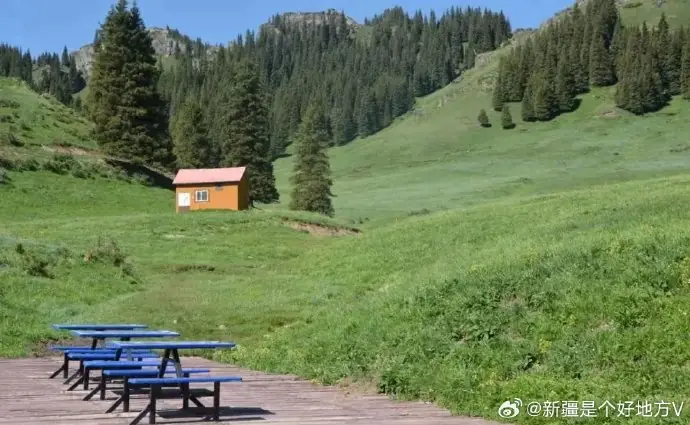 Muxutai Ecological Park · 苜蓿台
Muxutai Ecological Park苜蓿台
Muxutai (苜蓿台), entered by the municipal register as Muxutai Ecological Park (苜蓿台生态公园), is a tourism area on a summit grassland platform in Tuoli Township (托里乡), Urumqi County (乌鲁木齐县), Xinjiang, 55 km from Urumqi at 2,020 m elevation.
Read the place guide →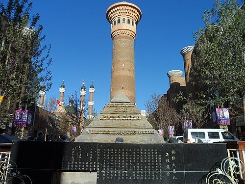 Grand Bazzar · 新疆国际大巴扎
International Grand Bazaar新疆国际大巴扎
The International Grand Bazaar is a contemporary market complex in Urumqi’s Erdaoqiao area. Patterned brickwork, arches and a tall sightseeing tower give it a distinctive silhouette, while stalls and food areas make it a lively…
Read the place guide → AI illustration · AI 示意图(仅供参考,非该地点实拍)
Erdaoqiao Bazaar District二道桥街区
Erdaoqiao (二道桥) is the commercial district in Tianshan District (天山区), Urumqi (乌鲁木齐市), Xinjiang, whose landmark is the Xinjiang International Grand Bazaar (新疆国际大巴扎). The district's culture and tourism bureau describes the bazaar as a AAAA-grade scenic area and says the Erdaoqiao commercial district has for a century been a barter centre for the region.
Read the place guide → Shuimogou Park · 水磨沟公园
Shuimogou Park水磨沟公园
Spring-fed park in Ürümqi's Shuimogou valley, named for its old watermills, with Qing exiles' pavilions, a Buddhist temple and a poetry ridge.
Read the place guide →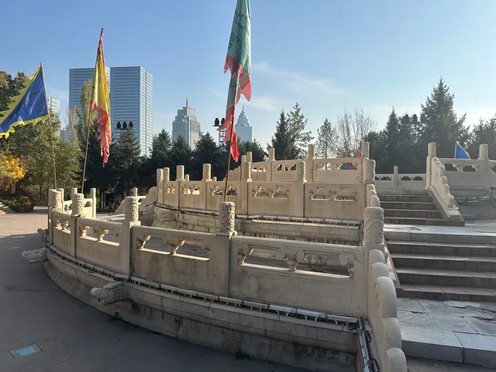 A round altar terrace at Hongshan Park (Red Hill Park), Ürümqi, with the city skyline behind · 乌鲁木齐红山公园内的圜丘式高台,背景为城市天际线 Source-recorded photograph date: 2023-10-20 16:20:39.
Red Hill Park红山公园
Hongshan Park rises above central Urumqi on a hill of reddish rock. The small brick Hongshan Pagoda is a familiar city landmark, while Yuantiaolou offers a different elevated perspective on the surrounding streets. Planted…
Read the place guide → Xinjiang Regional Museum (Qu Bowuguan) · 新疆维吾尔自治区博物馆
Xinjiang Regional Museum新疆维吾尔自治区博物馆
Xinjiang Museum brings together archaeology from the region’s deserts, oases and mountain corridors. Textiles, wooden documents, painted figures and burial finds reveal connections that are difficult to understand from ruins…
Read the place guide →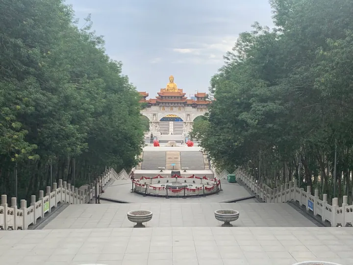 The giant golden Buddha statue atop Hongguang Mountain, seen through a tree-lined approach · 红光山金色大佛,透过林荫步道远眺 Source-recorded photograph date: 2021-06-09 11:14:42.
Hongguang Mountain红光山
Hongguang Mountain (红光山) is a national AAAA-grade scenic area in Midong District (米东区), Urumqi (乌鲁木齐市), Xinjiang, covering 10,000 mu in the north-east of the city, on a hill that was once dug for brick clay.
Read the place guide → AI illustration · AI 示意图(仅供参考,非该地点实拍)
Chaiwopu Lake柴窝堡湖
Freshwater lake 45 km south-east of Urumqi between Bogda and Tiangeer peaks, nearly dry in 2014 and restored as a national wetland park.
Read the place guide → AI illustration · AI 示意图(仅供参考,非该地点实拍)
Dabancheng Ancient Town达坂城古镇
Dabancheng ancient town (达坂城古镇) is the place the sources call Baishuijian ancient town (白水涧古镇), at the southern end of the Dabancheng basin in Dabancheng District (达坂城区), Urumqi (乌鲁木齐市), Xinjiang, at the foot of the Tianshan on the ancient Silk Road.
Read the place guide →Local life & food
Ürümqi local specialties
乌鲁木齐市特色美食 · 19 specialties to discover
 Xinjiang diced stir-fried noodles 新疆丁丁炒面AI dish illustration / AI 菜品示意图
Expect a chewy wheat bite with juicy tomato and savoury meat. It is generally less slippery than long laghman strands, while the vegetables add moisture and contrasting texture.
Source ↗Read the dish guide → Big-plate chicken 大盘鸡
Tender potatoes thicken the savory, often spicy sauce, while bone-in chicken and chewy noodles create a substantial meal.
Source ↗Read the dish guide →.jpg)
Photo adjustments
EXIF orientation applied where present; resized proportionally to at most 640 px on the long edge and encoded as WebP. No crop, retouching, recoloring or subject changes.
 Xinjiang lamb skewers 烤羊肉串AI illustration · AI 示意图
Fat renders around browned edges, giving a juicy bite and a smoky, aromatic finish.
Source ↗Read the dish guide →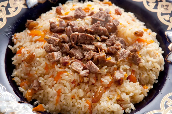 Hand-Eaten Pilaf 手抓饭
Hand-Eaten Pilaf (手抓饭) is a rice dish documented in Urumqi (乌鲁木齐). One lamb-based recipe published by the regional government combines lamb, carrots and onion, with raisins and dried apricots added before the rice finishes cooking.
Read the dish guide →
Photo adjustments
Full frame retained; proportionally resized and converted to WebP. No retouching or changes to the photographed subject. Card displays may crop the view.
 Baked samsa buns 烤包子
The shell is crisp and firm, while the center is juicy, onion-sweet and richly savory.
Source ↗Read the dish guide →
Photo adjustments
EXIF orientation applied where present; resized proportionally to at most 640 px on the long edge and encoded as WebP. No crop, retouching, recoloring or subject changes.
 Nang bread 馕
Thin nang is crisp, while thicker bread has a soft, chewy center and toasted crust. Fresh warmth brings out the wheat and topping aromas.
Source ↗Read the dish guide →
Photo adjustments
EXIF orientation applied where present; resized proportionally to at most 640 px on the long edge and encoded as WebP. No crop, retouching, recoloring or subject changes.
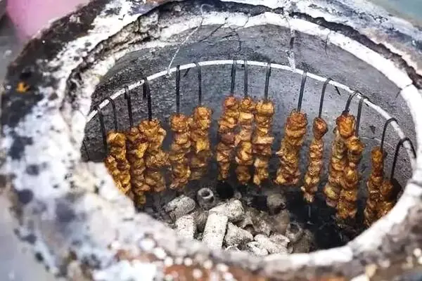 Nang Oven-Roasted Meat 馕坑肉
Nang Oven-Roasted Meat (馕坑肉) is lamb roasted inside a nang oven (馕坑), the oven in which nang flatbread is baked. In Uyghur it is called tonur kawipi, and the dish is also eaten across Central Asia.
Read the dish guide →Photo adjustments
EXIF orientation normalized; resized without changing aspect ratio; converted to WebP. No subject edits.
 Hand-Pulled Noodle Strips 拉条子
Hand-Pulled Noodle Strips (拉条子) are Xinjiang's hand-pulled noodles, boiled and then tossed with a stir-fried topping; the dish is also called banmian (拌面, 'mixed noodles'), and in Uyghur lengman.
Read the dish guide →Photo adjustments
EXIF orientation normalized; resized without changing aspect ratio; converted to WebP. No subject edits.
All dish names · 全部菜名 (19)
- Xinjiang diced stir-fried noodles · 新疆丁丁炒面
- Big-plate chicken · 大盘鸡
- Xinjiang lamb skewers · 烤羊肉串
- Hand-Eaten Pilaf · 手抓饭
- Baked samsa buns · 烤包子
- Nang bread · 馕
- Nang Oven-Roasted Meat · 馕坑肉
- Hand-Pulled Noodle Strips · 拉条子
- Xinjiang spicy fried rice noodles · 新疆炒米粉
- Numbing Pepper Chicken · 椒麻鸡
- Sheep Offal Soup · 羊杂碎
- Rack-Grilled Meat · 架子肉
- Roast Whole Lamb · 烤全羊
- Flour-Filled Sheep Lung · 面肺子
- Rice-Stuffed Lamb Sausage · 米肠子
- Kazakh dried yogurt curds · 酸奶疙瘩
- Salted Milk Tea · 奶茶
- Meatball Soup · 丸子汤
- Thin-skinned steamed dumplings · 薄皮包子
More dishes from across Xinjiang are in the Xinjiang food guide.
Counties & districts in Ürümqi
8 areas belong directly to Ürümqi.
8 areas
Tianshan District天山区
Tianshan District is one of 7 urban districts of the prefecture-level city of Ürümqi, the capital of Xinjiang Uygur Autonomous Region, Northwest China. It is a core urban district of Ürümqi.
Explore the area →DistrictSaybagh District沙依巴克区
Saybag District (Uyghur: سايباغ رايونى, romanized: Saybagh Rayoni, Saybaƣ Rayoni, Saybag Rayoni, Сайбағ Райони; Chinese: 沙依巴克区; pinyin: Shāyībākè Qū) is one of 7 urban districts of the prefecture-level city…
Explore the area →DistrictXinshi District新市区
Xinshi District is one of 7 urban districts of the prefecture-level city of Ürümqi, the capital of Xinjiang Uygur Autonomous Region, Northwest China.
Explore the area →DistrictShuimogou District水磨沟区
Shuimogou District or Bulaqtagh District is one of 7 urban districts of the prefecture-level city of Ürümqi, the capital of Xinjiang Uygur Autonomous Region, Northwest China.
Explore the area →Show fewer areas
Toutunhe District头屯河区
The Toutunhe District is one of 7 urban districts of the prefecture-level city of Ürümqi, the capital of Xinjiang Uygur Autonomous Region, Northwest China, it is located to the northwest of Ürümqi's urban…
Explore the area →DistrictDabancheng District达坂城区
Dabancheng District or Dawan Cheng (Uyghur: داۋانچىڭ رايونى, romanized: Dawanching Rayoni, Даванчиң Райони), is one of 7 urban districts of the prefecture-level city of Ürümqi, the capital of Xinjiang Uygur…
Explore the area →DistrictMidong District米东区
Midong District is one of 7 urban districts of the prefecture-level city of Ürümqi, the capital of Xinjiang Uygur Autonomous Region, Northwest China.
Explore the area →CountyÜrümqi County乌鲁木齐县
Ürümqi County (Uyghur: ئۈرۈمچى ناھىيىسى) is a county of Xinjiang Uygur Autonomous Region, Northwest China, under the administration of the prefecture-level city of Ürümqi, the capital of Xinjiang.
Explore the area →No areas match this name.
Plan your visit
Getting there
Search for 乌鲁木齐市 in a map app to find stations and your accommodation.
Where to stay →Build your route
Urumqi Tianshan Grand Canyon and Nanshan West Baiyanggou Valley are both listed here. The linked place guides have entrance and visit details.
Continue with Xinjiang →More in Xinjiang
Sources & geographic information
Administrative names and parent areas: Official geographic directory · Reference date 2026-09-06.
Background text adapted from Ürümqi — Wikipedia contributors, under CC BY-SA 4.0. Text has been shortened and reorganized; source revision 1371940690.
Photo: Nanshan West Baiyanggou Valley · Source photographer · License not provided. EXIF orientation normalized; resized without changing aspect ratio; converted to WebP. No subject edits.
Photo: Tianshan Grand Canyon · 陈琛 · CC BY-SA 3.0. Full frame retained; EXIF orientation normalized, proportionally resized to at most 800 pixels and converted to WebP. No generated pixels or subject changes. Cards may crop the display.

Photo: Muxutai Ecological Park · Source photographer · License not provided. EXIF orientation normalized; resized without changing aspect ratio; converted to WebP. No subject edits.
Photo: International Grand Bazaar · 螺钉 · CC BY-SA 4.0. Wikimedia thumbnail; fitted to the ranking-card frame.

Photo: Shuimogou Park · HaziiDozen · CC BY-SA 4.0. EXIF orientation normalized; resized without changing aspect ratio; converted to WebP. No subject edits.

Photo: Red Hill Park · HaziiDozen · CC BY-SA 4.0. Full frame retained; proportionally resized and converted to WebP. No retouching or changes to the photographed subject. Card displays may crop the view.

Photo: Xinjiang Regional Museum · HaziiDozen · CC BY-SA 4.0. Wikimedia thumbnail; fitted to the ranking-card frame.

Photo: Hongguang Mountain · HaziiDozen · CC BY-SA 4.0. Full frame retained; proportionally resized and converted to WebP. No retouching or changes to the photographed subject. Card displays may crop the view.

Map data © OpenStreetMap contributors. Pins mark approximate centres, not entrances or boundaries.