


About Xinjiang
Xinjiang at a glance
- Population
- 26,390,000Year-end resident population, entire provincial-level administrative area · 2025Source ↗
- Income per person
- 32,881Mean annual disposable income per person, all residents · 2025 · CNYSource ↗
- Languages & dialects
- Mandarin/Chinese and Uyghur (维吾尔语), alongside other community languages.Source ↗
- Geography
- Altai, Tianshan and Kunlun mountain systems frame the Junggar and Tarim basins; settlements cluster in oases.Source ↗
- Elevation
- Some basins lie below sea level: Ayding Lake depression is about 154 m below sea level, contrasting with high mountain regions.The depression figure describes a specific surveyed low point, not the lake surface or a regional average.Source ↗
- Main gateway
- UrumqiAutonomous region

Discover Xinjiang
Choose a northern, western or oasis route
Yining and the Ili valley provide a western urban-and-grassland journey, with Nalati one of several possible landscape destinations. Altay, Kanas and Hemu belong to a distant northern forest-and-lake region. Kashgar lies in the southwest, while Turpan presents another arid-basin setting. These names should first be understood as different geographic choices. Compare the full travel commitments and choose suitable bases, rather than assuming that a map of headline sights describes a practical short circuit.
Connect archaeology with everyday life
Turpan's Jiaohe ruins and interpretations of karez water systems offer complementary views of settlement and farming in an arid environment. Kashgar rewards time in streets where food, craft and residential life meet, while Urumqi can add museum context. Local communities have distinct languages, histories and contemporary routines, so use specific names and avoid a single cultural label. Ask before photographing people, homes or religious spaces, and give ordinary sitting and eating time a place beside the major visits.
Build around real connections and local meals
Bread, baked buns, polo rice, hand-pulled noodles and shared chicken dishes offer more variety than a sequence of grilled-meat meals. Particular preparations also help locate food within the region, such as Tokxun noodles or Kashgar pigeon soup. Long rail journeys and regional flights may suit different routes, with further road travel for remote areas. Confirm current visitor access, document requirements and the actual transport arrangements directly; an older travel account does not establish the conditions for your intended journey.
Explore Xinjiang
Core places to explore, with English and Chinese names.
International Grand Bazaar 新疆国际大巴扎
Tianchi / Heavenly Lake 天山天池
Urho Ghost City 乌尔禾魔鬼城
Karamay 克拉玛依
Jiaohe ruins 交河故城
Gaochang ruins 高昌故城
Bezeklik Thousand Buddha Caves 柏孜克里克千佛洞
Emin Minaret 苏公塔
Flaming Mountains 火焰山
Grape Valley 葡萄沟
Astana Tombs 阿斯塔那古墓群
Kumtag Desert · Shanshan Scenic Area 库木塔格沙漠·鄯善景区
Tuyoq 吐峪沟
Barkol Lake 巴里坤湖
Sayram Lake 赛里木湖
Ebinur Lake 艾比湖
Bosten Lake 博斯腾湖
Loulan Ruins 楼兰古城
Kizil Caves 克孜尔千佛洞
Subashi Temple 苏巴什佛寺遗址
Tianshan Mysterious Grand Canyon 天山神秘大峡谷
Kuqa 库车
Karakul (China) 喀拉库勒湖
Muztagh Ata 慕士塔格峰
Id Kah Mosque 艾提尕尔清真寺
Kashgar 喀什
Afaq Khoja Mausoleum 香妃园
Tashkurgan 塔什库尔干
Khunjerab Pass 红其拉甫口岸
Rawak Stupa 热瓦克佛寺
Melikawat Ruins 买力克阿瓦提故城
Ni'ya Ruins 尼雅遗址
Nalati Grassland 那拉提草原
Tekes 特克斯
Zhaosu 昭苏
Tacheng 塔城
Kanas Lake 喀纳斯湖
Hemu Village 禾木村
Koktokay 可可托海
Ulungur Lake 乌伦古湖
Shihezi 石河子
Urumqi 乌鲁木齐
Turpan 吐鲁番
Xinjiang Regional Museum 新疆维吾尔自治区博物馆
Red Hill Park 红山公园
Hami Kings’ Tombs 哈密回王陵
Hami Museum 哈密博物馆
Jiangbulak Viewpoint 江布拉克观景点
Bayanbulak Grassland Scenic Area 巴音布鲁克草原景区
Oytagh Glacier Park 奥依塔克冰川公园
Kalajun East Gate Visitor Center 喀拉峻东门游客服务中心
Duku Highway Museum 独库公路博物馆
Black Oil Hill Park 黑油山公园
Turpan Museum 吐鲁番博物馆
Changji Museum 昌吉博物馆
Bortala Prefecture Museum 博尔塔拉蒙古自治州博物馆
Bayangolin Prefecture Museum 巴音郭楞蒙古自治州博物馆
Tarim Poplar Forest Park 塔里木胡杨林公园
Kuqa Royal Palace 库车王府
Wensu Tomur Grand Canyon Visitor Center 温宿托木尔大峡谷游客中心
Kashgar Museum 喀什博物馆
Kashgar High Platform Houses 高台民居
Ili Prefecture Museum 伊犁哈萨克自治州博物馆
Yining Hanren Street Bazaar 伊宁汉人街大巴扎
Xinjiang Corps Reclamation Museum 新疆兵团军垦博物馆
Baisha Lake at the 185th Regiment 白沙湖景区(185团)
Zepu Golden Poplar Scenic Area 泽普金湖杨景区
Kashgar Old City 喀什古城景区
Pamir Tourism Area in Tashkurgan 帕米尔旅游区
Urumqi Tianshan Grand Canyon 乌鲁木齐天山大峡谷
Aral 359th Brigade Cultural Tourism Area 阿拉尔三五九旅文化旅游区
Tianshan Tomur Tourism Area 天山托木尔旅游区
Nanshan West Baiyanggou Valley 南山西白杨沟
Tianshan Grand Canyon 天山大峡谷
Silk Road Mountain Resort 丝绸之路山地度假区
Muxutai Ecological Park 苜蓿台
Erdaoqiao Bazaar District 二道桥街区
Shuimogou Park 水磨沟公园
Hongguang Mountain 红光山
Chaiwopu Lake 柴窝堡湖
Dabancheng Ancient Town 达坂城古镇
World Devil City 世界魔鬼城
Urho Poplar Forest 乌尔禾胡杨林
Karamay Museum 克拉玛依博物馆
Black Oil Mountain 黑油山
Dushanzi Grand Canyon 独山子大峡谷
Panjier Stone Forest 盘吉尔怪石林
Tuyugou Mazar Village 吐峪沟麻扎村
Kumtag Desert 库木塔格沙漠
Karez Folk Culture Park 坎儿井民俗园
Yiwu Poplar Forest 伊吾胡杨林
Hami Hui Prince Mansion and Tombs 哈密回王府与回王陵
Dahaidao Yardang Official Route 大海道正规开放线路
Barkol Grassland 巴里坤草原
Barkol Ancient City 巴里坤古城
Beiting Ancient City Ruins 北庭故城
Cheshi Ancient Road Hiking Section 车师古道正规徒步段
Kangjiashimenzi Rock Art 康家石门子岩画
Jiangbulake Scenic Area 江布拉克
Mori Poplar Forest and Mingsha Hill 木垒胡杨林与鸣沙山
Pingdingshan Grassland 平顶山
Guaishiyu Scenic Area 怪石峪
Wenquan County Hot Springs and River Valley 温泉县温泉与河谷
Ebinur Lake Birdwatching Area 艾比湖正规开放观鸟区
Qiemo Museum 且末博物馆
Tazhong Desert Highway Rest Stop 塔中沙漠公路正规停靠点
Gongnaisi Forest Park 巩乃斯森林公园
Bayanbulak Grassland 巴音布鲁克
Lop People's Village 罗布人村寨
Peacock River and Korla Riverfront 孔雀河与库尔勒城市河岸
Loulan Museum 楼兰博物馆
Tarim Poplar Forest 塔里木胡杨林
Yanquan Mountain Park 燕泉山
Kizilgaha Beacon Tower 克孜尔尕哈烽燧
Kuqa Old Town 库车老城
Kizil Ghost City 克孜尔魔鬼城
Tianshan Tomur Grand Canyon 天山托木尔大峡谷
Ta Village 塔村
Aksu Prefecture Museum 阿克苏地区博物馆
Kashgar Prefecture Museum 喀什地区博物馆
Taheman Wetland 塔合曼湿地
Pamir Stone City and Golden Grassland 帕米尔旅游区石头城与金草滩
Bandir Blue Lake 班迪尔蓝湖
Panlong Ancient Road Scenic Drive 盘龙古道正规公路游览
Honghai Bay Scenic Area 红海湾
Jinhuyang National Forest Park 金湖杨
Yengisar Knife Craft Exhibition 英吉沙小刀工艺展示
Yarkant Khanate Royal Tombs 叶尔羌汗国王陵
Yarkant Old Town 莎车老城
Kurban Tulum Memorial Hall 库尔班·吐鲁木纪念馆
Hotan Tuancheng Old Quarter 和田团城
Hotan Prefecture Museum 和田地区博物馆
Niya Cultural Relics Museum 尼雅文物馆
Damagou Buddhist Site Museum 达玛沟佛教遗址博物馆
Kongur Tiube Peak Highway Viewpoint 公格尔九别峰公路观景
Baisha Lake and Baisha Mountain Viewing Area 白沙湖与白沙山正规观景区
Artux Tianmen Natural Arch 阿图什天门
Liuxing Street 六星街
Kazanqi Folk Culture Scenic Area 喀赞其民俗旅游区
Ili River Scenic Area 伊犁河风景区
Xibe Ancient City 锡伯古城
Tangbula Hundred-Mile Gallery 唐布拉百里画廊
Duku Highway Qiao'erma Rest Stop 独库公路乔尔玛段正规停靠点
Kuerdening Scenic Area 库尔德宁
Qiaxi Forest Park 恰西
Nalati Grassland 那拉提
Xiata Scenic Area 夏塔
Zhaosu Grassland 昭苏草原
Zhaosu Wetland Park 昭苏湿地公园
Kalajun Grassland 喀拉峻
Tekes Bagua City 特克斯八卦城
Qiongkushitai Village 琼库什台
Kuokesu Grand Canyon 阔克苏大峡谷
Huiyuan Ancient City 惠远古城
Guozigou Valley Official Viewpoint 果子沟正规观景点
Princess Jieyou Lavender Garden 解忧公主薰衣草园
Khorgos National Gate Visitor Area 霍尔果斯国门正规参访区
Wusu Foshan National Forest Park 佛山国家森林公园
Hoboksar Ancient City Site 和布克赛尔古城遗址
Tacheng Red Building Museum 塔城红楼博物馆
Tacheng Accordion Museum 手风琴博物馆
Anjihai Grand Canyon Viewing Area 安集海大峡谷正规开放观景区
Lujiaowan Scenic Area 鹿角湾
Barluk Mountain Grassland Area 巴尔鲁克山正规开放草原区
Emin Yemili Grassland 额敏也迷里草原
Grassland Stone City 草原石城
Baihaba Village 白哈巴村
Baisha Lake 白沙湖
Birch Forest Scenic Area 白桦林景区
Keketuohai No. 3 Mine Pit and Geology Exhibition 可可托海三号矿坑与地质陈列
Five-Colour Beach 五彩滩
Kanas Scenic Area 喀纳斯
Hemu Village 禾木
Altay-Hemu Highway Open Section 阿禾公路正规开放路段
Jiangjunshan International Ski Resort 将军山国际滑雪度假区
Qinggeda Lake 青格达湖
Veterans' Spirit Exhibition Hall 老兵精神展示馆
Premier Zhou Enlai Memorial 周恩来总理纪念碑
Taklamakan-359th Brigade Cultural Tourism Area 塔克拉玛干·三五九旅文化旅游区
Kanas Scenic Area 喀纳斯景区
Nalati Scenic Area 那拉提旅游风景区
Bayanbulak 巴音布鲁克景区
Kalajun Grassland 喀拉峻
Xinjiang local specialties
新疆特色美食 · 134 specialties to discover
 Nang bread 馕
Thin nang is crisp, while thicker bread has a soft, chewy center and toasted crust. Fresh warmth brings out the wheat and topping aromas.
Source ↗Read the dish guide →Photo adjustments
EXIF orientation applied where present; resized proportionally to at most 640 px on the long edge and encoded as WebP. No crop, retouching, recoloring or subject changes.
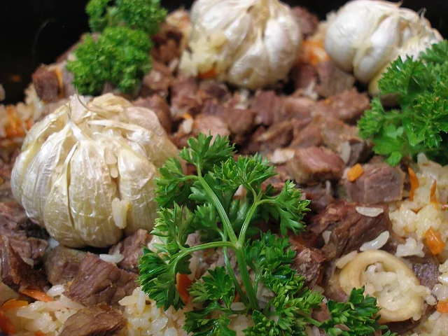 Polo rice 抓饭
The rice is rich and separate-grained, with sweet carrot, savory meat and occasional fruit sweetness rather than a sticky porridge texture.
Source ↗Read the dish guide →Photo adjustments
EXIF orientation applied where present; resized proportionally to at most 640 px on the long edge and encoded as WebP. No crop, retouching, recoloring or subject changes.
 Baked samsa buns 烤包子
The shell is crisp and firm, while the center is juicy, onion-sweet and richly savory.
Source ↗Read the dish guide →Photo adjustments
EXIF orientation applied where present; resized proportionally to at most 640 px on the long edge and encoded as WebP. No crop, retouching, recoloring or subject changes.
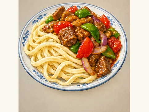 Tokxun mixed noodles 托克逊拌面AI dish illustration · AI 菜品示意图
The noodles are elastic and substantial, while peppers, tomatoes or other vegetables add juiciness and contrasting bite. Sauce and chili vary by kitchen.
Source ↗Read the dish guide → Big-plate chicken 大盘鸡
Tender potatoes thicken the savory, often spicy sauce, while bone-in chicken and chewy noodles create a substantial meal.
Source ↗Read the dish guide →Photo adjustments
EXIF orientation applied where present; resized proportionally to at most 640 px on the long edge and encoded as WebP. No crop, retouching, recoloring or subject changes.
 Kashgar pigeon soup noodles 喀什鸽子汤面AI dish illustration · AI 菜品示意图
The broth is gently rich, while pigeon meat has a firmer, more concentrated bite than the noodles.
Source ↗Read the dish guide → Xinjiang lamb skewers 烤羊肉串AI illustration · AI 示意图
Fat renders around browned edges, giving a juicy bite and a smoky, aromatic finish.
Source ↗Read the dish guide →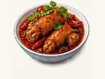 Peppery braised lamb trotters 胡辣羊蹄AI illustration · AI 示意图
The texture is sticky, gelatinous and chewy rather than meaty like a lamb chop. Spices contribute a strong savory fragrance.
Source ↗Read the dish guide →All dish names · 全部菜名 (134)
- Nang bread · 馕
- Polo rice · 抓饭
- Baked samsa buns · 烤包子
- Tokxun mixed noodles · 托克逊拌面
- Big-plate chicken · 大盘鸡
- Kashgar pigeon soup noodles · 喀什鸽子汤面
- Xinjiang lamb skewers · 烤羊肉串
- Peppery braised lamb trotters · 胡辣羊蹄
- Thin-skinned steamed dumplings · 薄皮包子
- Kashgar jelly noodles · 喀什凉粉
- Xibe griddle flatbread · 锡伯大饼
- Lamb with steamed flatbread strips · 羊肉焖饼
- Flour-filled lung and rice sausage · 面肺子与米肠子
- Chuchure lamb dumpling soup · 曲曲
- Mushroom noodle-piece soup · 野蘑菇汤饭
- Roasted goose egg · 烤鹅蛋
- Lamb leg baked inside bread · 面包羊腿
- Honey rice dumplings · 蜂蜜粽子
- Hotan roast pigeon · 烤鸽子
- Xinjiang spicy fried rice noodles · 新疆炒米粉
- Baursak fried dough · 包尔萨克
- Kazakh dried yogurt curds · 酸奶疙瘩
- Smoked horse sausage · 熏马肠
- Horse-meat naryn · 马肉那仁
- Xinjiang diced stir-fried noodles · 新疆丁丁炒面
- Xinjiang nut confection · 玛仁糖
- Xinjiang steamed oil-layered bread · 新疆油塔子
- Kashgar crock lamb soup · 喀什缸子羊肉汤
- Tacheng cheese buns · 塔城奶酪包
- Tianshan Snow Lotus Beef Steak · 天山雪莲牛排
- Boiled Smoked Horse Meat · 煮熏马肉
- Mutton Stir-Fried with Scallions · 葱爆羊肉
- Gobi Grilled Fish · 戈壁烤鱼
- Hand-Grabbed Boiled Meat · 手抓肉
- Numbing Pepper Chicken · 椒麻鸡
- Xinjiang Roast Whole Lamb · 新疆烤全羊
- Braised Meat over Nang Bread · 馕包肉
- Hand-Eaten Pilaf · 手抓饭
- Nang Oven-Roasted Meat · 馕坑肉
- Hand-Pulled Noodle Strips · 拉条子
- Sheep Offal Soup · 羊杂碎
- Rack-Grilled Meat · 架子肉
- Roast Whole Lamb · 烤全羊
- Flour-Filled Sheep Lung · 面肺子
- Rice-Stuffed Lamb Sausage · 米肠子
- Salted Milk Tea · 奶茶
- Meatball Soup · 丸子汤
- Karamay Cold Noodle Sheets · 克拉玛依凉皮
- Grilled Lamb · 烤羊肉
- Hand-Pulled Mixed Noodles · 拌面
- Sheep Offal Soup · 羊杂汤
- Wind-Dried Meat · 风干肉
- Turpan Pilaf · 吐鲁番抓饭
- Raisin Pilaf · 葡萄干抓饭
- Shanshan Pit-Roasted Whole Lamb · 鄯善烤全羊
- Raisin Nang Bread · 葡萄馕
- Hami Melon Rice · 哈密瓜饭
- Barkol Flaky Baked Bread · 巴里坤油酥馍
- Barkol Steamed Bread · 巴里坤蒸饼
- Hami Mutton with Braised Flatbread · 哈密羊肉焖饼
- Mutton Soup · 羊肉汤
- Xinjiang Yogurt · 酸奶
- Qitai Noodles with Oil-Fried Meat · 奇台过油肉拌面
- Mori Lamb · 木垒羊肉
- Changji Meatball Soup · 昌吉丸子汤
- Hutubi Pilaf · 呼图壁抓饭
- Manas Big Plate Chicken · 玛纳斯大盘鸡
- Jimsar Earthenware Hot Pot · 吉木萨尔土火锅
- Mutton and Starch Jelly Soup · 粉汤
- Hui Fried Flatbread · 油香
- Bole Roast Lamb · 博乐烤羊肉
- Wenquan Hand-Held Boiled Mutton · 温泉手把肉
- Jinghe Goji Pilaf · 精河枸杞抓饭
- Mongolian Milk Tea · 蒙古奶茶
- Korla Fragrant Pear Pilaf · 库尔勒香梨抓饭
- Yuli Lop-Style Grilled Fish · 尉犁罗布人烤鱼
- Bohu Fish Banquet · 博湖鱼宴
- Luntai Roast Lamb · 轮台烤羊
- Hejing Torghut Hand-Held Mutton · 和静土尔扈特手把肉
- Yanqi Big Plate Chicken · 焉耆大盘鸡
- Ruoqiang Red Jujube Pilaf · 若羌红枣抓饭
- Kuqa Giant Nang Bread · 库车大馕
- Kuqa Noodle Soup · 库车汤面
- Shayar Roast Lamb · 沙雅烤羊
- Wensu Thin-Skinned Buns · 温宿薄皮包子
- Xinhe Braised Pigeon · 新和卤鸽
- Awat Meat Braised in Museles Wine · 阿瓦提慕萨莱思炖肉
- Baicheng Oil Chicken · 拜城油鸡
- Aksu Roast Lamb Ribs · 阿克苏烤羊排
- Kyrgyz Hand-Grabbed Meat · 柯尔克孜手抓肉
- Artux Grilled Lamb · 阿图什烤羊肉
- Ulugqat Yak Meat · 乌恰牦牛肉
- Akqi Milk Tea · 阿合奇奶茶
- Kumis Fermented Mare's Milk · 马奶酒
- Kashgar Grilled Lamb · 喀什烤羊肉
- Mug-Braised Meat · 缸子肉
- Pigeon Soup · 鸽子汤
- Lamb Trotters · 羊蹄
- Sheep's Head · 羊头
- Iceberg Yogurt · 冰山酸奶
- Sachima Sweet Pastry · 萨其马
- Roasted Eggs · 烤蛋
- Mixed Noodles with Pigeon · 鸽子拌面
- Hotan Roasted Eggs · 和田烤蛋
- Pit-Roasted Lamb · 坑烤羊肉
- Hotan Herbal Tea · 和田药茶
- Roast Sheep's Head · 烤羊头
- Rose Jam Nang Bread · 玫瑰花酱馕
- Walnut Candy Slab · 核桃麻糖
- Ili Horse Sausage · 伊犁马肠子
- Smoked Horse Meat · 熏马肉
- Naryn Noodles with Boiled Meat · 纳仁
- Khorgos Flour-Filled Lung · 霍尔果斯面肺子
- Zhaosu Horse Meat · 昭苏马肉
- Yining Baked Buns · 伊宁烤包子
- Tacheng Air-Dried Meat · 塔城风干肉
- Tacheng Flying Goose · 塔城飞鹅
- Yumin Bashibai Lamb · 裕民巴什拜羊
- Wusu Pilaf · 乌苏抓饭
- Russian-Style Lieba Bread · 俄罗斯列巴
- Altay Fat-Tailed Sheep Hand-Grabbed Meat · 阿勒泰大尾羊手抓肉
- Burqin Grilled Fish · 布尔津烤鱼
- Cold-Water Fish Banquet · 冷水鱼宴
- Kazakh Baursak Fried Dough · 哈萨克包尔萨克
- Hemu Rustic Hot Pot · 禾木土火锅
- Dried Milk Curds · 奶疙瘩
- Shihezi Cold Noodle Sheets · 石河子凉皮
- Tarim Grilled Fish · 塔里木烤鱼
- Red Jujube Pilaf · 红枣抓饭
- Korla-Style Mixed Noodles · 库尔勒风味拌面
- Bole-Style Roast Lamb · 博乐风味烤羊肉
- Ili Smoked Horse Meat · 伊犁熏马肉
- Horse Sausage · 马肠子
- Bashibai Lamb · 巴什拜羊
Top sights in Xinjiang
 TOP1博尔塔拉州
Sayram Lake sits in a high mountain basin in Bortala, surrounded by grassland and ridges. Different shores offer different combinations of open water, meadow, wetland and woodland, so a circuit is more varied than one viewpoint…
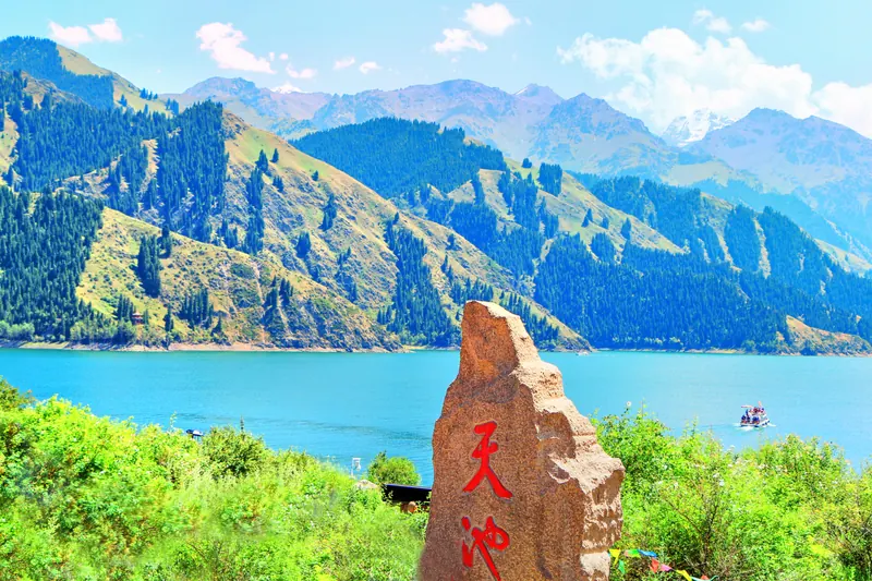 TOP2昌吉州
Tianchi lies in the Bogda section of the Tianshan, where dark conifer slopes frame an alpine lake.
 TOP3布尔津县
Kanas Scenic Area喀纳斯景区
Show on map TOP4新源县
Nalati Scenic Area那拉提旅游风景区
Show on map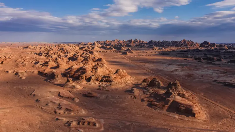 TOP5乌尔禾区
World Devil City (世界魔鬼城), also called Wuerhe Wind City (乌尔禾风城), is a wind-eroded yardang landscape in Wuerhe District (乌尔禾区), Karamay (克拉玛依市), Xinjiang.
 TOP6乌鲁木齐
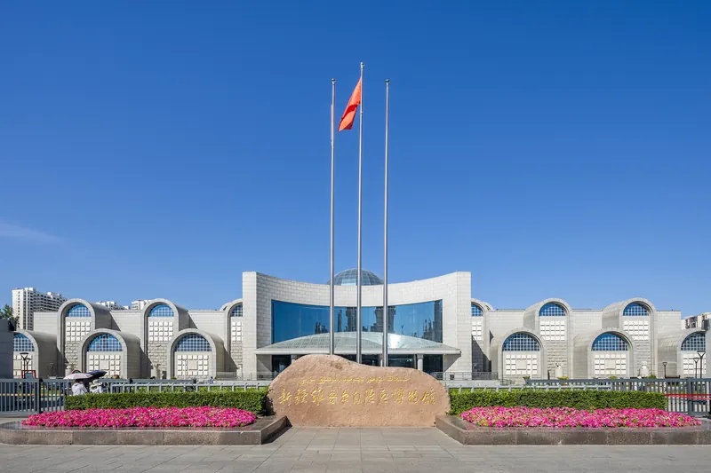
Xinjiang Museum brings together archaeology from the region’s deserts, oases and mountain corridors.
 TOP7和静县
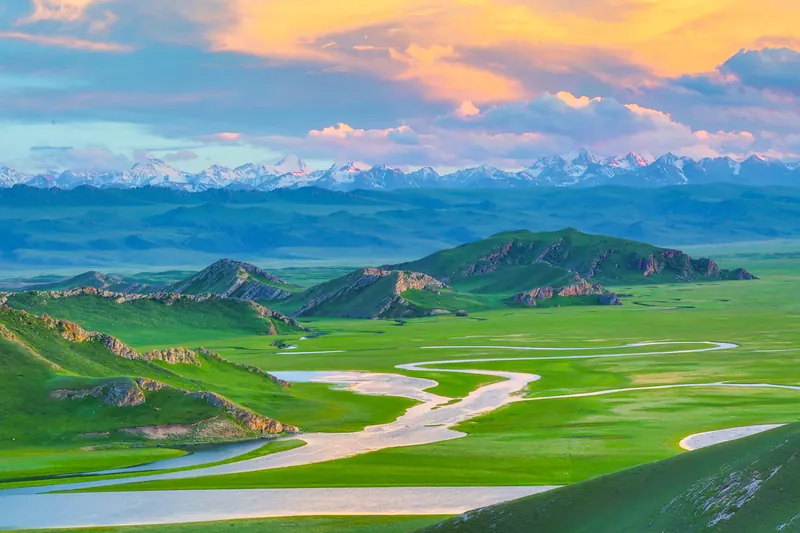
Bayanbulak巴音布鲁克景区
Show on map TOP8特克斯县
Kalajun (喀拉峻) is an international eco-tourism area in Tekes County (特克斯县), Ili Kazakh Autonomous Prefecture, Xinjiang, on the northern slopes of the Biyike mountain in the central Tianshan. The county government records that it is a world natural heritage site and a national AAAAA-level tourist attraction, and that the name means "black wilderness" in Kazakh.
 TOP9吐鲁番
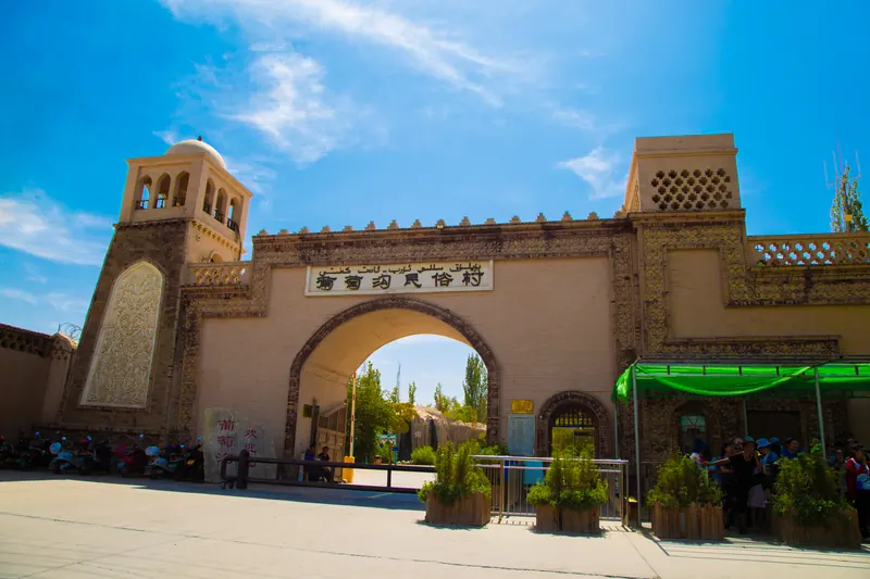
Grape Valley is an irrigated corridor beneath the Flaming Mountains northeast of Turpan. Water flowing through the valley supports vineyards that contrast sharply with the dry hills around them. The visitor area combines…
 TOP10乌鲁木齐
The International Grand Bazaar is a contemporary market complex in Urumqi’s Erdaoqiao area. Patterned brickwork, arches and a tall sightseeing tower give it a distinctive silhouette, while stalls and food areas make it a lively…
 Show on map
.jpg)


.jpg)
Change your destination on Trip.com.
Ranking source & photo credits
The first ten entries of Trip.Best Best Things to Do. Rankings reflect platform recommendations, not counts of international visitors. Read on 20 September 2026; platform pages may use cached snapshots.
- Sayram Lake: Source: Trip.com · Resized and WebP compressed; fitted to the ranking card.
- Tianshan Tianchi: Source: Trip.com · Resized and WebP compressed; fitted to the ranking card.
- Kanas Scenic Area: Source: Trip.com · Resized and WebP compressed; fitted to the ranking card.
- Nalati Scenic Area: Source: Trip.com · Resized and WebP compressed; fitted to the ranking card.
- World Mystery Town: Source: Trip.com · Resized and WebP compressed; fitted to the ranking card.
- The Xinjiang Museum: Source: Trip.com · Resized and WebP compressed; fitted to the ranking card.
- Bayanbulak: Source: Trip.com · Resized and WebP compressed; fitted to the ranking card.
- Kalajun Grassland: Source: Trip.com · Resized and WebP compressed; fitted to the ranking card.
- Grape Valley: Source: Trip.com · Resized and WebP compressed; fitted to the ranking card.
- International Grand Bazaar: Source: Trip.com · Resized and WebP compressed; fitted to the ranking card.
Cities, counties & districts in Xinjiang
27 areas belong directly to Xinjiang.
27 areas
Ürümqi乌鲁木齐市
Ürümqi is the capital and largest city of the Xinjiang Uyghur Autonomous Region in Northwestern China. With a census population of 4,054,000 in 2020, Ürümqi is the second-largest city in China's northwestern…
8 local areas →Prefecture-level cityKaramay克拉玛依市
Karamay (also spelled Karamai; Chinese: 克拉玛依, romanized: Kèlāmǎyī, Uyghur: قاراماي, romanized: Qaramay) is a prefecture-level city in the north of the Xinjiang Uyghur Autonomous Region, People's Republic of…
4 local areas →Prefecture-level cityTurpan吐鲁番市
Turpan (Uyghur: تۇرپان) or Turfan is a prefecture-level city located in the east of the autonomous region of Xinjiang, China. It has an area of 69,759 km² (26,934 sq mi) and a population of 693,988 (2020).
3 local areas →Prefecture-level cityHami哈密市
Hami, or Kumul (Uyghur: قۇمۇل, romanized: Qumul), is a prefecture-level city in eastern Xinjiang, China. It is well known for sweet Hami melons.
3 local areas →Show fewer areas
Changji Hui Autonomous Prefecture昌吉回族自治州
Changji Hui Autonomous Prefecture is an autonomous prefecture for Hui people in the mid-north of Xinjiang Uyghur Autonomous Region, Western China.
7 local areas →Autonomous prefectureBortala Mongol Autonomous Prefecture博尔塔拉蒙古自治州
Bortala Mongol Autonomous Prefecture is an autonomous prefecture in the northern Xinjiang, China. Its capital is Bole, also known as Bortala.
4 local areas →Autonomous prefectureBayingolin Mongol Autonomous Prefecture巴音郭楞蒙古自治州
Bayingolin Mongol Autonomous Prefecture is an autonomous prefecture in the southeastern Xinjiang, China. It borders Gansu to the east, Qinghai to the southeast and the Tibet Autonomous Region to the south.
9 local areas →PrefectureAksu Prefecture阿克苏地区
Aksu Prefecture is located in west-central Xinjiang, China. It has an area of 131,161 km² (50,642 sq mi) and 2.714 million inhabitants at the 2020 census whom 715,319 lived in the built-up (or metro) area…
9 local areas →Autonomous prefectureKizilsu Kyrgyz Autonomous Prefecture克孜勒苏柯尔克孜自治州
Kizilsu Kyrgyz Autonomous Prefecture is an autonomous prefecture in western Xinjiang, China, bordering Kyrgyzstan and Tajikistan. Its capital is Artush.
4 local areas →PrefectureKashgar Prefecture喀什地区
Kashgar Prefecture, also known as Kashi Prefecture, is a prefecture in southwestern Xinjiang, China, in the Tarim Basin region (roughly the southern half of Xinjiang).
13 local areas →PrefectureHotan Prefecture和田地区
Hotan Prefecture (see also § Etymology) is located in the Tarim Basin region of southwestern Xinjiang, China, bordering the Tibet Autonomous Region to the south and Union Territory of Ladakh and…
10 local areas →Autonomous prefectureIli Kazakh Autonomous Prefecture伊犁哈萨克自治州
Ili Kazakh Autonomous Prefecture is an autonomous prefecture in northern Xinjiang, China. Its capital is Yining, also known as Ghulja or Kulja.
11 local areas →PrefectureTacheng Prefecture塔城地区
Tacheng Prefecture, also known as Tarbagatay Prefecture, is located in northern Xinjiang, People's Republic of China. It has an area of 98,824 km² (38,156 sq mi) and a population of 992,444 (2020).
7 local areas →PrefectureAltay Prefecture阿勒泰地区
Altay Prefecture is a prefecture in northern Xinjiang, China. It has an area of 118,015 km² (45,566 sq mi) and a population of 561,667 (2000). It is a part of the Ili Kazakh Autonomous Prefecture.
7 local areas →County-level cityShihezi石河子市
Shihezi is a sub-prefecture-level city in Northern Xinjiang, China. It has a population of 380,130 according to the 2010 census.
Explore the area →County-level cityAral阿拉尔市
Aral (Uyghur: ئارال), also known as Alar, is a sub-prefecture-level city surrounded by Aksu Prefecture in Xinjiang Uyghur Autonomous Region, China. Aral means "island" in Uyghur.
Explore the area →County-level cityTumxuk图木舒克市
Tumxuk is a county-level city in the western part of Xinjiang, China. The eastern part of Tumxuk is surrounded by Maralbexi County, Kashgar Prefecture. The smaller western part is near Kashgar.
Explore the area →County-level cityWujiaqu五家渠市
Wujiaqu is a county-level city in the northern part of Xinjiang Uyghur Autonomous Region, China, about 40 kilometres (25 mi) north of Ürümqi.
Explore the area →County-level cityBeitun北屯市
Beitun is a city in the north of Xinjiang, China. Administratively, it is a county-level city under the direct administration of the regional government, though it is geographically located in Altay Prefecture.
Explore the area →County-level cityTiemenguan City铁门关市
Tiemenguan is a county-level city in Xinjiang Uyghur Autonomous Region, China. It is located 50 kilometres (31 mi) west of Korla and 500 kilometres (310 mi) southwest of the regional capital Ürümqi.
Explore the area →County-level cityShuanghe双河市
Shuanghe is a county-level city in Xinjiang Uyghur Autonomous Region, China. It is located 30 kilometres (19 mi) east of Bole City and 50 kilometres (31 mi) southwest of Alashankou and the border with…
Explore the area →County-level cityKokdala可克达拉市
Kokdala or Cocodala is a city in northern Xinjiang, China, bordering Kazakhstan's Almaty Region to the west. Administratively, it is a county-level city under the direct administration of the regional…
Explore the area →County-level cityKunyu昆玉市
Kunyu, also known as Kurumkash (Uyghur: قۇرۇمقاش), is a county-level city in Xinjiang Uyghur Autonomous Region, China.
Explore the area →County-level cityHuyanghe胡杨河市
Huyanghe is a county-level city in Xinjiang Uyghur Autonomous Region, China. It is geographically located in Tacheng Prefecture of Northwestern Xinjiang, but is directly administered by the 7th Division of…
Explore the area →County-level cityXinxing新星市
Xinxing is a county-level city in the Xinjiang Uyghur Autonomous Region, China. It is actually located with enclaves in Hami.
Explore the area →County-level cityBaiyang白杨市
Baiyang is a county-level city and a sub-prefectural-level city in Xinjiang Uyghur Autonomous Region, China. The county-level city implemented "division and city integration" (师市合一, shī shì héyī) with the 9th…
Explore the area →County-level cityCaohu City草湖市
Caohu City (草湖市) is a newly established county-level city directly administered by the Xinjiang Uyghur Autonomous Region.
Explore the area →No areas match this name.
Arrive, stay & get around Xinjiang
交通枢纽、住宿与天气
Urumqi乌鲁木齐
This Xinjiang entry uses Urumqi as its selected gateway city. It does not describe transport coverage across the entire region.
Airports
Urumqi Tianshan International AirportURC
乌鲁木齐天山国际机场
The airport formerly called Diwopu now uses the Tianshan name. Follow directions for the current northern terminal area.
Railway stations
Urumqi Railway Station
乌鲁木齐站
Main modern rail gateway in the western city; commonly called the high-speed railway station locally.
Urumqi South Railway Station
乌鲁木齐南站
The separate older southern rail gateway. Use the exact station shown by 12306.
Metro & city transport
Urumqi Metro Network 乌鲁木齐轨道交通线路图
The metro serves a north–south urban corridor. For the current airport terminal, follow the signed metro-transfer arrangement rather than old terminal directions.
- 1Find your stations确认起点与终点站
- 2Check interchanges查看换乘线路与站点
- 3Follow exit signs到站后按站内标识出站
 Explore the full network查看站名、线路与换乘Enlarge map点击放大线路图
Check the legend for closed, reserved or future sections. 停运、预留与规划区间,请按图例辨识。
Map edition: 2026-09-06 · Diagram reviewed 2026-09-06
Map coverage & sources 图示范围与来源说明
Original full station-order diagram of 21-station Line 1 plus the operating 2-stop airport shuttle (International Airport–International Airport North). Airport East and Line 2 Phase I north construction are excluded. Shuttle is shown as a separate service requiring interchange, not a through Line 1 ride.
Original drawing from factual station/route data; station-order topology is schematic.
Coaches, ferries & onward travel
Tianshan Airport bus services
天山国际机场机场巴士
Airport buses form part of the current terminal’s ground-transport center. Confirm the city route and stop in the airport’s transport information.
Transport reference review: 2026-09-06. Consult the operator for current services and timetables.
More about getting around
Urumqi is a major air and rail gateway, with separate regional connections toward Turpan and Kashgar. Distances make selective flights or longer rail journeys worth comparing. Allow extra time for security checks, carry your passport, and verify access before arranging remote road extensions.
Stay in Xinjiang
Choose an Urumqi base with straightforward station or airport access for a connecting itinerary. In Turpan, consider how your hotel handles excursions to scattered sites. For Kashgar, balance proximity to the historic centre with vehicle access, and confirm the property can process your booking details.
Find hotels on Trip.com →Change your destination, dates and guests on Trip.com.
Urumqi weather
The current-hour forecast loads when this section is visible. It uses MET Norway model data for the named city, not station observations.
Seasons & when to go
Turpan and desert areas can become intensely hot in summer, while uplands remain much cooler. Winters are cold, particularly in the north, and mountain access is seasonal. Pack for the actual route and elevations, with enough flexibility to change outdoor plans during extreme conditions.
Local life & communication
Several travel worlds within one vast region: Ili's mixed urban and pastoral valley, Altay's forest-and-lake north, Kashgar's Uyghur urban culture and Turpan's arid-basin heritage. Local detail matters more than a region-wide stereotype.
Uyghur, Kazakh, Han and other communities contribute distinct languages, foods and traditions across Xinjiang. Historic oasis cities and archaeological sites offer different perspectives on those connections. Ask before photographing people, and follow current guidance at religious sites, which authorities may treat as sensitive.
Language & communication
Mandarin is useful for transport arrangements; Uyghur is prominent in southern oasis communities, and Kazakh is heard in parts of the north. English spellings vary, including Kashgar and Kashi. Keep Chinese place names and confirm the exact meeting time and location in writing.
Useful local tips
- Choose Ili, Altay, or a Kashgar/Turpan heritage focus first; do not assume all can fit comfortably into one short circuit.
- Confirm the exact Chinese place name and entrance when arranging transfers, especially for Kanas, Nalati and similarly named karez attractions.
- Check the Xinjiang transport authority's current road information for long drives; a past holiday guide does not establish that a mountain road is open now.
- UK FCDO advice checked on 5 September 2026 describes passport and security checks in Xinjiang. Carry your passport and verify current requirements for the intended route and nationality.
- Ask before photographing people or entering homes, workshops and religious spaces; follow the rules of the specific place.
Sources & useful links
- China National Tourist Office: Xinjiang
- China National Tourist Office: Turpan
- Xinjiang Culture and Tourism: regional food essays
- Xinjiang Transport Department: Kashgar-themed service-area report
- Xinjiang Culture and Tourism: Tianshan holiday travel report
- Ministry of Culture and Tourism: Ili route
- Gaochang district government: cultural resources
- Xinjiang Transport Department: 2026 holiday travel guide
- UNESCO: Xinjiang Tianshan
- UK FCDO: China regional travel advice
- Ministry of Culture and Tourism: Altay visitor context
- Xinjiang — population background
- Xinjiang — languages background
- Xinjiang — geography background
- Xinjiang — elevation background
- Xinjiang — Urumqi map reference
- Xinjiang — Turpan map reference
- Xinjiang — Jiaohe ruins map reference
- Xinjiang — Gaochang ruins map reference
- Xinjiang — Kashgar map reference
- Xinjiang — Tianchi / Heavenly Lake map reference
- Xinjiang — Kanas Lake map reference
- Xinjiang — Hemu, Xinjiang map reference
- Xinjiang — Sayram Lake map reference
- Xinjiang — Id Kah Mosque map reference
- Xinjiang — Emin Minaret map reference
- Xinjiang — Bezeklik Thousand Buddha Caves map reference
- Xinjiang — Kizil Caves map reference
- Xinjiang — Subashi Temple map reference
- Xinjiang — Karakul (China) map reference
- Xinjiang — Tashkurgan map reference
- Xinjiang — Xinjiang Regional Museum map reference
- Xinjiang — Kumtag Desert map reference
- Xinjiang — Kumtag Desert (Shanshan) map reference
- Xinjiang attraction ranking source
- Xinjiang specialty reference — wlt.xinjiang.gov.cn
- Xinjiang specialty reference — wlt.xinjiang.gov.cn
- Xinjiang specialty reference — wlt.xinjiang.gov.cn
- Xinjiang specialty reference — wlt.xinjiang.gov.cn
- Destination food reference — ydyl.gansu.gov.cn
- Kashgar city government: market foods and seasoned roasted goose eggs
- Kizilsu tourism: dingding fried noodles
- Xinjiang: marentang confectionery identity
- 白沙湖景区(185团) — place reference
- 泽普金湖杨景区 — place reference
- 喀什古城景区 — place reference
- 帕米尔旅游区 — place reference
- 乌鲁木齐天山大峡谷 — place reference
- 阿拉尔三五九旅文化旅游区 — place reference
- 天山托木尔旅游区 — place reference
- 新疆油塔子 — local food reference
- 塔城奶酪包 — local food reference
- Local food reference: 天山雪莲牛排
- Local food reference: 烤全羊
- Local food reference: 油香
- Local food reference: 蒙古奶茶
- Local food reference: 马奶酒
- Local food reference: 萨其马