


Get to know Turpan
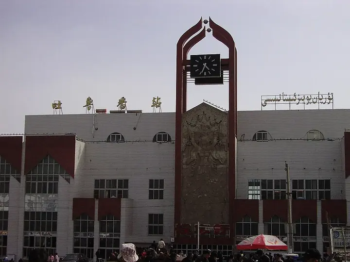
Photo adjustments
Full frame retained; proportionally resized and converted to WebP. No retouching or changes to the photographed subject. Card displays may crop the view.
- Administrative area
- Prefecture-level city · 地级市
- Part of
- Xinjiang
- Chinese name
- 吐鲁番市
- Local areas
- 3 local areas
Area & population
- Area in the source
- 69,759.00 km²
- Population · 2020
- 693,988
- Administrative seat
- Gaochang District
Source: cited geographic source, as of the dates shown.
Attractions
Turpan is home to one (known as the Tuyuq Khojam Mazar) of several caves associated with the pious Christian and Muslim legend of the Seven Sleepers.
Explore Turpan
Core places to explore, with English and Chinese names.
Jiaohe ruins 交河故城
Gaochang ruins 高昌故城
Bezeklik Thousand Buddha Caves 柏孜克里克千佛洞
Emin Minaret 苏公塔
Flaming Mountains 火焰山
Grape Valley 葡萄沟
Astana Tombs 阿斯塔那古墓群
Kumtag Desert · Shanshan Scenic Area 库木塔格沙漠·鄯善景区
Tuyoq 吐峪沟
Turpan 吐鲁番
Turpan Museum 吐鲁番博物馆
Panjier Stone Forest 盘吉尔怪石林
Tuyugou Mazar Village 吐峪沟麻扎村
Kumtag Desert 库木塔格沙漠
Karez Folk Culture Park 坎儿井民俗园
Gaochang District 高昌区
Piqan County 鄯善县
Toksun County 托克逊县
Places to explore around Turpan
 Ancient City of Jiaohe (Yarkhoto) · 交河故城
Jiaohe ruins交河故城
Jiaohe occupies a narrow plateau between two river valleys west of Turpan. The steep natural edges helped protect a city whose streets, residential quarters and Buddhist remains can still be read in the eroded earth. Much of the…
Read the place guide → Ruined earthen structures at Gaochang near Turpan, October 2005.
Gaochang ruins高昌故城
Gaochang was an important oasis city and trading centre east of Turpan. Its surviving earthen walls, inner enclosures and religious ruins reveal a much broader urban footprint than a single monument. The city’s history includes…
Read the place guide →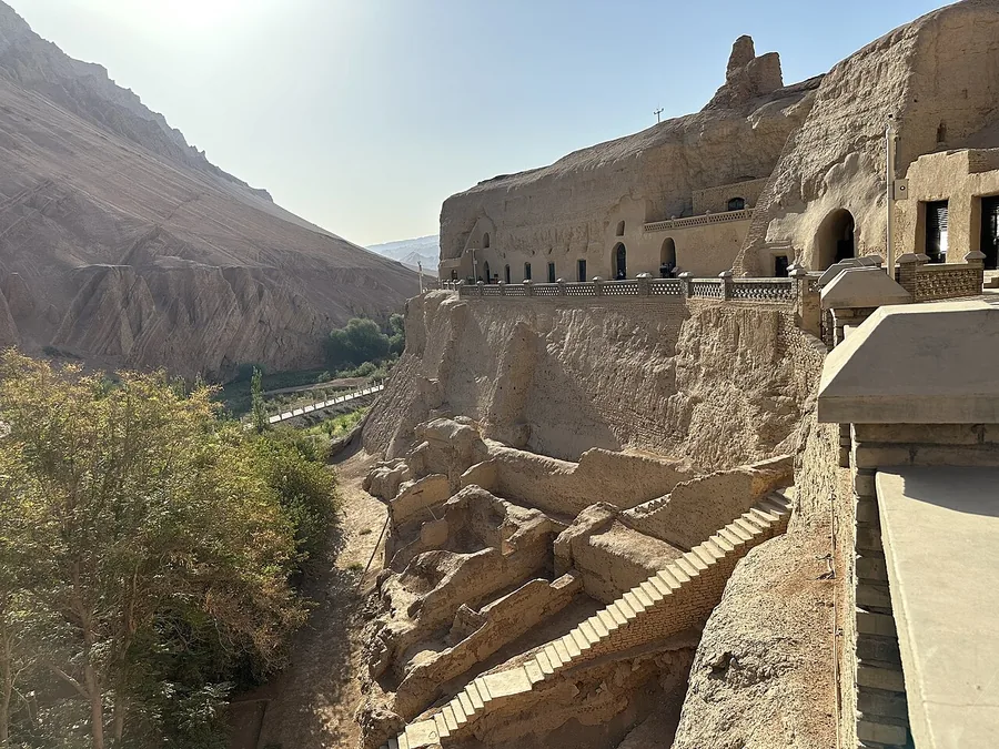 Bezeklik Thousand Buddha Caves above the Mutou valley, viewed from north to south; 20 September 2023.
Bezeklik Thousand Buddha Caves柏孜克里克千佛洞
Bezeklik’s Buddhist caves sit above the Mutou valley in the Flaming Mountains. Surviving painted surfaces and repeated Buddha imagery recall the patronage of the Uyghur kingdom of Qocho, while damaged and missing sections are an…
Read the place guide → Emin Minaret (Su Gong Ta), Turpan, Xinjiang, photographed in September 2023.
Emin Minaret苏公塔
Emin Minaret, also called Sugong Tower, is an eighteenth-century brick tower beside a mosque near Turpan. Its tapering circular form is covered with repeating geometric patterns created in the brickwork. The adjoining mosque’s…
Read the place guide → Eroded red slopes of the Flaming Mountains near Turpan, Xinjiang; 17 May 2014.
Flaming Mountains火焰山
The Flaming Mountains are a band of eroded red sandstone hills east of Turpan. Deep gullies and strong sunlight create the flame-like appearance behind their name. The landscape also became famous through Journey to the West…
Read the place guide → A vine-covered walkway in Grape Valley near Turpan, August 2017.
Grape Valley葡萄沟
Grape Valley is an irrigated corridor beneath the Flaming Mountains northeast of Turpan. Water flowing through the valley supports vineyards that contrast sharply with the dry hills around them. The visitor area combines…
Read the place guide →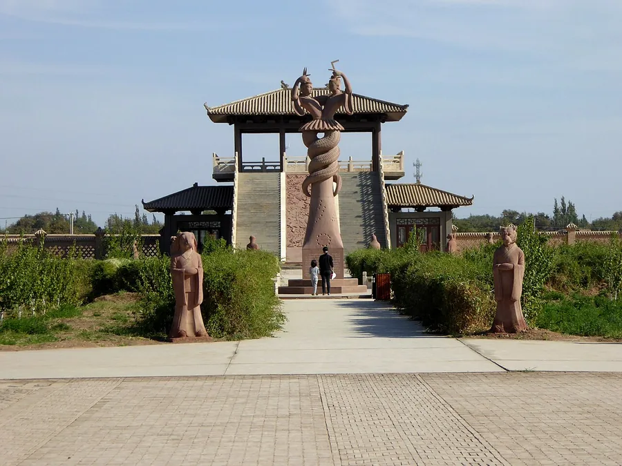 The visitor entrance and landscaped approach at the Astana Tombs, Turpan, Xinjiang; exact photograph date unknown (source upload recorded in November 2015).
Astana Tombs阿斯塔那古墓群
Astana Cemetery served communities associated with nearby Gaochang. Its underground chambers preserved textiles, documents, painted objects and human remains in the dry environment, providing unusually detailed evidence of daily…
Read the place guide → Dunes of the Kumtag Desert beside Shanshan in Xinjiang, September 2009.
Kumtag Desert · Shanshan Scenic Area库木塔格沙漠·鄯善景区
The Shanshan section of the Kumtag Desert meets the southern edge of the old town, creating a striking boundary between oasis and dunes. Wind-shaped ridges, rippled sand and the changing light are the central attraction. The…
Read the place guide → An earthen lane and planted oasis edge in Tuyoq village, Xinjiang. Photographed on 13 July 2011.
Tuyoq吐峪沟
Tuyoq is an oasis valley cutting through the Flaming Mountains in Shanshan County. Village buildings and grape cultivation occupy the greener ground beneath the dry cliffs, while nearby Buddhist cave remains add an earlier…
Read the place guide →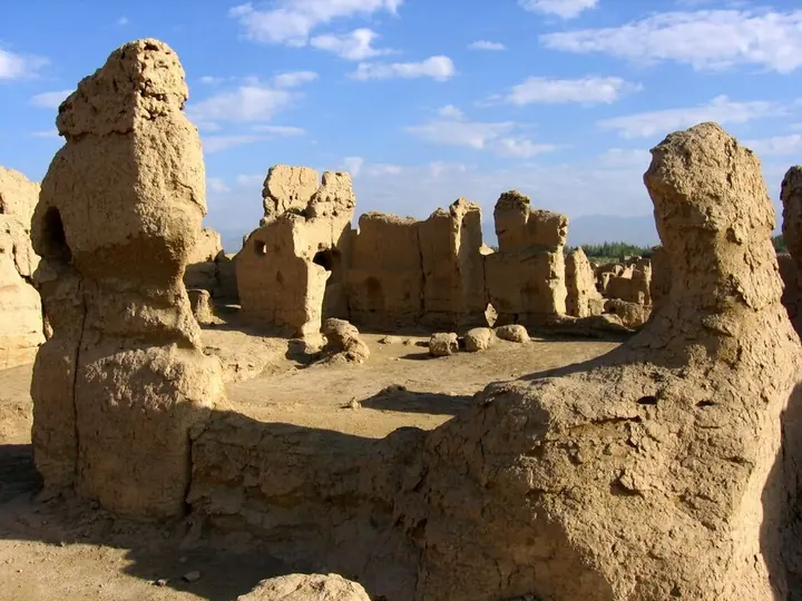 Earthen buildings at Jiaohe Ancient City, Turpan · 吐鲁番交河故城土建筑遗迹 Photograph date recorded by the source: 2 October 2005.
Turpan吐鲁番
Turpan is an oasis base for a remarkably varied archaeological landscape. Jiaohe lies west of the modern city, while Gaochang, Astana and the Flaming Mountains form a different eastern group. Museum collections connect these…
Read the place guide →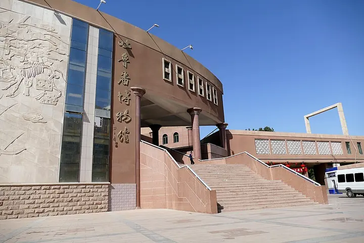 Entrance facade of Turpan Museum · 吐鲁番博物馆入口 Photograph date recorded by the source: 18 September 2015, 13:14:33.
Turpan Museum吐鲁番博物馆
Turpan Museum connects the basin’s ancient cities with the objects recovered from them. Written documents and coins reveal administration and trade, while burial displays preserve clothing and other evidence of everyday life. A…
Read the place guide →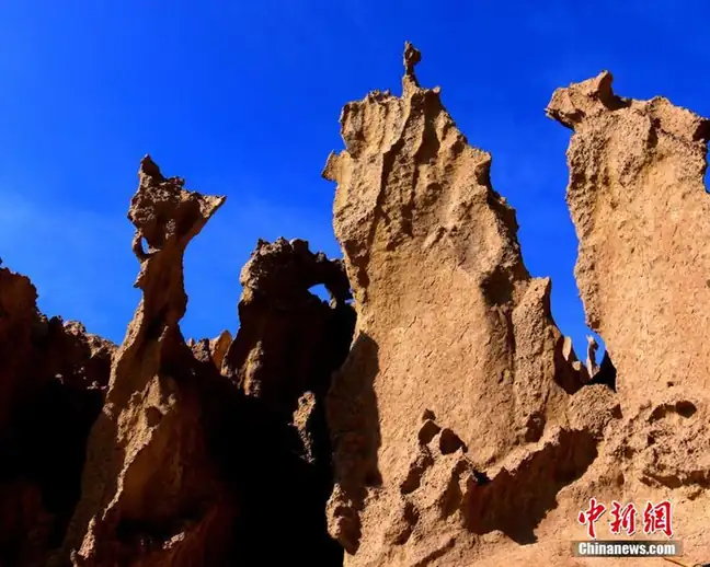 Panjier Stone Forest · 盘吉尔怪石林
Panjier Stone Forest盘吉尔怪石林
Panjier Stone Forest (盘吉尔怪石林) is a peak-forest landform on the ridge and slopes of Panjier Tage mountain in Kerjian Township (克尔碱镇), Toksun County (托克逊县), Turpan (吐鲁番市), Xinjiang.
Read the place guide →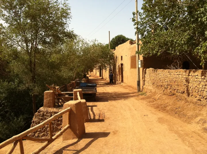 A street in Mazha Village, Tuyoq, lined with mudbrick houses · 吐峪沟麻扎村内的生土建筑街巷 Source-recorded photograph date: Taken on 13 July 2011.
Tuyugou Mazar Village吐峪沟麻扎村
Uyghur village of yellow-clay houses at the mouth of the Tuyugou gorge in Turpan, below the Ashab al-Kahf shrine.
Read the place guide →Dunes in the Shanshan-side Kumtag Desert visitor landscape, Xinjiang · 新疆鄯善库木塔格沙漠沙丘. Source-recorded photograph date: Taken on 28 September 2009.Kumtag Desert库木塔格沙漠
Kumtag Desert (库木塔格沙漠) is the desert on the eastern edge of the Turpan basin, in Shanshan County (鄯善县), Turpan (吐鲁番市), Xinjiang. It is both a national desert park and a 4A-grade scenic area.
Read the place guide →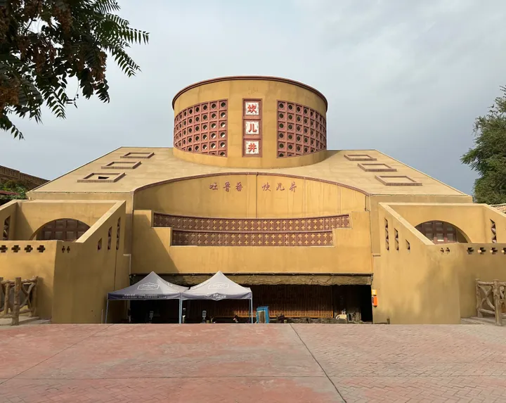 Exterior of the Karez Folk-custom Garden museum building, Gaochang District, Turpan · 吐鲁番市高昌区坎儿井民俗园 Source-recorded photograph date: 2023-09-21 09:59:52.
Karez Folk Culture Park坎儿井民俗园
Karez Folk Culture Park (坎儿井民俗园) is a tourism area built around an old karez at Xincheng Ximen village, Ya'er township, Turpan (吐鲁番市), Xinjiang. A municipal description records that it was built in July 2000 and covers 14,680 sq m.
Read the place guide →Local life & food
Turpan local specialties
吐鲁番市特色美食 · 10 specialties to discover
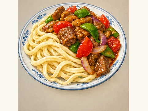 Tokxun mixed noodles 托克逊拌面AI dish illustration · AI 菜品示意图
The noodles are elastic and substantial, while peppers, tomatoes or other vegetables add juiciness and contrasting bite. Sauce and chili vary by kitchen.
Source ↗Read the dish guide →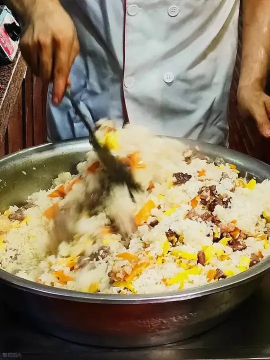 Turpan Pilaf 吐鲁番抓饭
Turpan Pilaf (吐鲁番抓饭) is the raisin pilaf of Turpan (吐鲁番), Xinjiang. Across Xinjiang pilaf is most often made with mutton and carrot, but the Turpan city government notes that the version Turpan is known for is raisin pilaf (葡萄干抓饭), cooked with raisins instead of mutton.
Read the dish guide →Photo adjustments
EXIF orientation normalized; resized without changing aspect ratio; converted to WebP. No subject edits.
 Grilled Lamb 烤羊肉
Grilled Lamb (烤羊肉) is listed among the local specialties of Karamay, Xinjiang. The name includes 羊肉 (lamb or mutton). 烤 describes roasting or grilling.
Read the dish guide →Photo adjustments
EXIF orientation normalized; resized without changing aspect ratio; converted to WebP. No subject edits.
 Baked samsa buns 烤包子
The shell is crisp and firm, while the center is juicy, onion-sweet and richly savory.
Source ↗Read the dish guide →
Photo adjustments
EXIF orientation applied where present; resized proportionally to at most 640 px on the long edge and encoded as WebP. No crop, retouching, recoloring or subject changes.
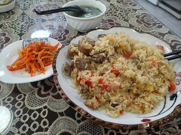 Raisin Pilaf 葡萄干抓饭
Raisin Pilaf (葡萄干抓饭) is a Turpan (吐鲁番) rice dish made with raisins, carrots and onions.
Read the dish guide →
Photo adjustments
EXIF orientation normalized; resized without changing aspect ratio; converted to WebP. No subject edits.
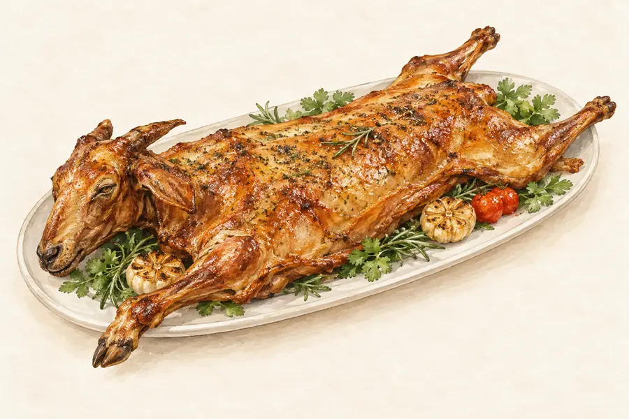 Shanshan Pit-Roasted Whole Lamb 鄯善烤全羊AI illustration · AI 示意图(仅供参考,非实拍)
Shanshan Pit-Roasted Whole Lamb (鄯善烤全羊) is listed among the local specialties of Turpan, Xinjiang. The name includes 羊 (sheep). 烤 describes roasting or grilling.
Read the dish guide → Nang bread 馕
Thin nang is crisp, while thicker bread has a soft, chewy center and toasted crust. Fresh warmth brings out the wheat and topping aromas.
Source ↗Read the dish guide →
Photo adjustments
EXIF orientation applied where present; resized proportionally to at most 640 px on the long edge and encoded as WebP. No crop, retouching, recoloring or subject changes.
 Sheep Offal Soup 羊杂碎AI illustration · AI 示意图(仅供参考,非实拍)
Sheep Offal Soup (羊杂碎) is listed among the local specialties of Ürümqi, Xinjiang. The name includes 羊杂 (sheep offal).
Read the dish guide →More dishes from across Xinjiang are in the Xinjiang food guide.
Counties & districts in Turpan
3 areas belong directly to Turpan.
3 areas
Gaochang District 高昌区
Gaochang or Karahoja (Uyghur: قاراھوجا, romanized: Qarahoja, Қарахоҗа; Chinese: 高昌; pinyin: Gāochāng), is the only district and the seat of the oasis city of Turpan, in the Xinjiang Uyghur Autonomous Region…
Explore the area →CountyPiqan County 鄯善县
Shanshan County as the official romanized name, also transliterated from Uyghur as Piqan County (Uyghur: پىچان ناھىيىسى; Chinese: 皮羌县), is a county within the Xinjiang Uyghur Autonomous Region and is under…
Explore the area →CountyToksun County 托克逊县
Toksun County is a county in Turpan, Xinjiang Uyghur Autonomous Region, China.
Explore the area →No areas match this name.
Plan your visit
Getting there
Search for 吐鲁番市 in a map app to find stations and your accommodation.
Where to stay →Build your route
Jiaohe ruins and Gaochang ruins are about 40 km apart in a straight line. The linked place guides have entrance and visit details.
Continue with Xinjiang →More in Xinjiang
Sources & geographic information
Administrative names and parent areas: Official geographic directory · Reference date 2026-09-06.
Background text adapted from Turpan — Wikipedia contributors, under CC BY-SA 4.0. Text has been shortened and reorganized; source revision 1373004574.
Photo: Jiaohe ruins · Colegota · CC BY-SA 2.5 es. Wikimedia thumbnail; fitted to the ranking-card frame.

Photo: Gaochang ruins · Colegota · CC BY-SA 2.5 es. Proportionally resized and converted to WebP without cropping, retouching or changing the photographed subject.

Photo: Bezeklik Thousand Buddha Caves · HaziiDozen · CC BY-SA 4.0. Proportionally resized and converted to WebP without cropping, retouching or changing the photographed subject.

Photo: Emin Minaret · HaziiDozen · CC BY-SA 4.0. Proportionally resized and converted to WebP without cropping, retouching or changing the photographed subject.

Photo: Flaming Mountains · liuzusai刘祖赛 · CC BY 3.0. Proportionally resized and converted to WebP without cropping, retouching or changing the photographed subject.

Photo: Grape Valley · Radosław Botev · CC BY 3.0 pl. Proportionally resized and converted to WebP without cropping, retouching or changing the photographed subject.
.jpg)
Photo: Astana Tombs · Hiroki Ogawa · CC BY 3.0. Proportionally resized and converted to WebP without cropping, retouching or changing the photographed subject.
.jpg)
Photo: Kumtag Desert · Shanshan Scenic Area · 罗布泊 · CC BY 3.0. Proportionally resized and converted to WebP without cropping, retouching or changing the photographed subject.
.jpg)
Photo: Tuyoq · Matthew Summerton · CC BY-SA 3.0. Proportionally resized and converted to WebP without cropping, retouching or changing the photographed subject.
.jpg)
Photo: Turpan · Colegota · Colegota — Turpan-jiaohe-ruinas-d16.jpg — CC BY-SA 2.5 es · CC BY-SA 2.5 es. Full frame retained; proportionally resized and converted to WebP. No retouching or changes to the photographed subject. Card displays may crop the view.

Photo: Turpan Museum · Zossolino · Zossolino — 2015-09-18-131512_-_Turpan-Museum.jpg — CC BY-SA 4.0 · CC BY-SA 4.0. Full frame retained; proportionally resized and converted to WebP. No retouching or changes to the photographed subject. Card displays may crop the view.

Photo: Panjier Stone Forest · Source photographer · License not provided. EXIF orientation normalized; resized without changing aspect ratio; converted to WebP. No subject edits.
Photo: Tuyugou Mazar Village · Matthew Summerton · CC BY-SA 3.0. Full frame retained; proportionally resized and converted to WebP. No retouching or changes to the photographed subject. Card displays may crop the view.
.jpg)
Photo: Kumtag Desert · 罗布泊 · CC BY 3.0. Full source framing retained; proportionally resized and converted to WebP. No retouching or subject alteration. Card displays may crop the view.
Photo: Karez Folk Culture Park · HaziiDozen · CC BY-SA 4.0. Full frame retained; proportionally resized and converted to WebP. No retouching or changes to the photographed subject. Card displays may crop the view.

Map data © OpenStreetMap contributors. Pins mark approximate centres, not entrances or boundaries.