


Get to know Baotou
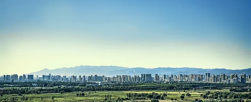
Photo adjustments
Full frame retained; proportionally resized and converted to WebP. No retouching or changes to the photographed subject. Card displays may crop the view.
- Administrative area
- Prefecture-level city · 地级市
- Part of
- Inner Mongolia
- Chinese name
- 包头市
- Local areas
- 9 local areas
Area & population
- Area in the source
- 27,768.00 km²
- Population · 2023 census
- 2,761,700
- Administrative seat
- Jiuyuan District
Source: cited geographic source, as of the dates shown.
Baotou's southern border is delineated by the Yellow River. The city's namesake, literally translating to "place with deer", is Mongolian, bringing about the nickname of "Lucheng", meaning "City of Deer". Alternatively, Baotou is known as the "City of Steel in the Grasslands" (草原钢城; Cǎoyuán Gāngchéng), since steel was a major industry in the city which is built on the Mongolian grassland and contains a large grassland park. Today, Baotou mines and refines over half of the rare-earth minerals produced in the world. This has led to environmental contamination near the industrial sites.
Transportation
Baotou is a terminus for both the Baolan Railway and the Jingbao Railway, heading for Lanzhou in the west and Beijing in the east, respectively. The city is served by two main railway stations, Baotou East Railway Station, and Baotou Railway Station. Baotou Donghe International Airport serves the city with regular service to Beijing, Shanghai and Hong Kong. The city is connected by the Hubao Expressway to Inner Mongolia's capital, Hohhot. China National Highway 210 Baotou Metro
Explore Baotou
Core places to explore, with English and Chinese names.
Wudang Lamasery 五当召
Meidaizhao 美岱召
Baotou 包头
Chunkun Mountain 春坤山
Baotou Museum 包头博物馆
Xilamuren Grassland 希拉穆仁草原
Donghe District 东河区
Hondlon District 昆都仑区
Qingshan District 青山区
Shiguai District 石拐区
Bayan Obo Mining District 白云鄂博矿区
Jiuyuan District 九原区
Tumed Right Banner 土默特右旗
Guyang County 固阳县
Darhan Muminggan United Banner 达尔罕茂明安联合旗
Places to explore around Baotou
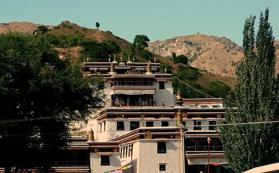 Wudangzhao (Wudang Lamasery), Inner Mongolia, photographed in 2005.
Wudang Lamasery五当召
Wudang Lamasery, also called Badekar Monastery, spreads up a mountain valley northeast of Baotou. White, flat-roofed buildings form a Tibetan architectural ensemble, with larger teaching and assembly halls set among smaller…
Read the place guide →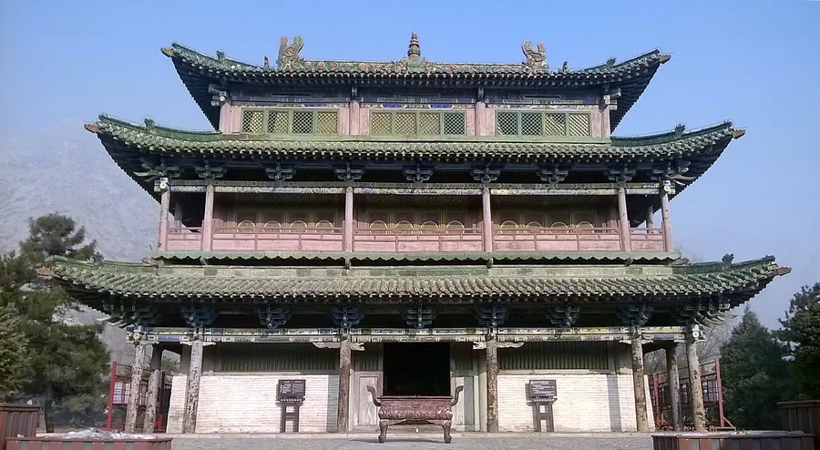 Liuli Hall inside the walled Meidaizhao complex, Inner Mongolia; 3 January 2016.
Meidaizhao美岱召
Meidaizhao combines a fortified settlement, princely residence and Buddhist monastery within one walled enclosure. Taihe Gate gives the first clue to its civic scale, while the halls inside show Chinese roof forms alongside…
Read the place guide →Baotou's skyline (包头), viewed across the greenery of Saihantala. Photograph date recorded by the source: Taken on 23 September 2023.Baotou包头
Baotou combines an industrial-city identity with older trading routes and substantial urban green space. The museum's rock art and regional-history displays reach back beyond the steelworks, while Saihantala preserves an open…
Read the place guide → AI illustration · AI 示意图(仅供参考,非该地点实拍)
Chunkun Mountain春坤山
Chunkun Mountain rises into high meadow country northeast of Guyang. Its main summit, Hongqi Peak, reaches 2,340 metres, and the open upper slopes give a very different outlook from the industrial city of Baotou to the south…
Read the place guide →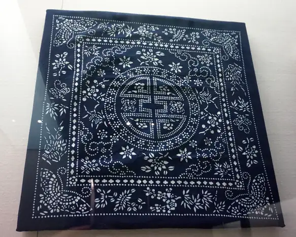 Baotou Museum · 包头博物馆
Baotou Museum包头博物馆
Baotou Museum connects the city's trading history with the older cultures of the Yinshan region. Its rock-art collection is especially useful: animal figures, hunting and pastoral scenes preserve a visual record that differs…
Read the place guide → Sunset over a yurt camp at Xilamuren Grassland, Darhan Muminggan United Banner · 包头市达尔罕茂明安联合旗希拉穆仁草原夕阳蒙古包 Source-recorded photograph date: Taken on 1 June 2013.
Xilamuren Grassland希拉穆仁草原
Xilamuren is a plateau grassland in Darhan Muminggan United Banner, where the Xilamuren River passes the Qing-period Puhui Temple.
Read the place guide →Local life & food
Baotou local specialties
包头市特色美食 · 10 specialties to discover
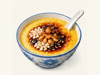 Baotou millet tea paste 包头老茶汤AI illustration · AI 示意图
The texture is thick and spoonable, with toasted-grain warmth and contrasting crunch from the toppings. It is more substantial than its name suggests.
Source ↗Read the dish guide →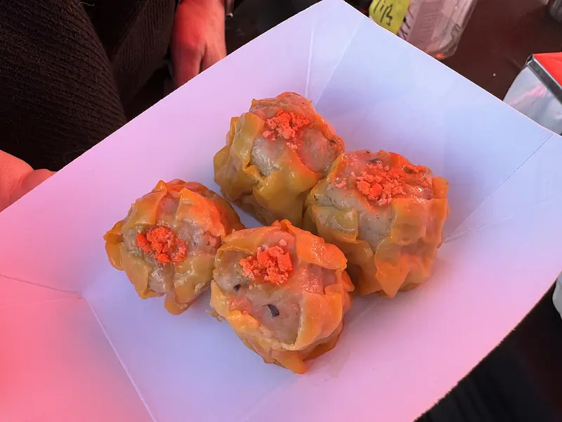 Baotou Shaomai Dumplings 包头烧麦Reference photo of a similar dish · 同类菜品参考照片
Baotou Shaomai Dumplings (包头烧麦) are thin-skinned steamed dumplings filled with mutton, eaten for breakfast in Baotou (包头), Inner Mongolia, with vinegar and a pot of tea.
Read the dish guide →
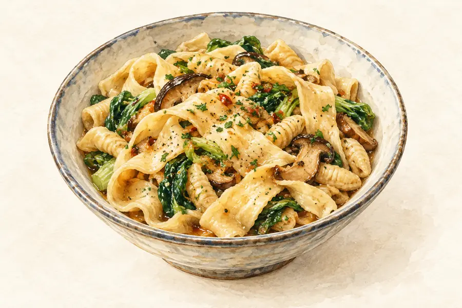 Beiguozi Hotpot 背锅子AI illustration · AI 示意图(仅供参考,非实拍)
Beiguozi Hotpot (背锅子) is listed among the local specialties of Baotou, Inner Mongolia. It is grouped here with hotpots & shared pots; retain the complete Chinese name when comparing local menus.
Read the dish guide →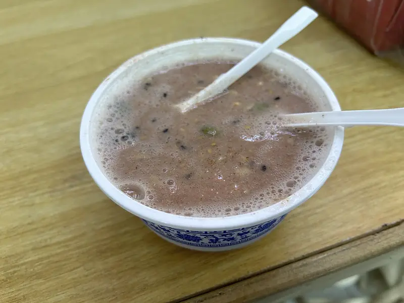 Chatang Millet Flour Pudding 茶汤
Chatang Millet Flour Pudding (茶汤) is a heritage snack of Hohhot (呼和浩特), made from proso millet flour (糜子面) with boiling water poured from a copper kettle.
Read the dish guide →
 Hand-Torn Boiled Meat 手扒肉
Hand-Torn Boiled Meat (手扒肉) is lamb cooked in large pieces in plain water and eaten with the hands, a Mongol dish that Baotou (包头) in Inner Mongolia counts among its local specialities.
Read the dish guide →Photo adjustments
EXIF orientation normalized; resized without changing aspect ratio; converted to WebP. No subject edits.
 Iron-Pot Braised Noodles 铁锅焖面AI illustration · AI 示意图(仅供参考,非实拍)
Iron-Pot Braised Noodles (铁锅焖面) are a home-style noodle dish of Baotou (包头), Inner Mongolia.
Read the dish guide →Guyang Naked-Oat Noodles 固阳莜面AI illustration · AI 示意图(仅供参考,非实拍)
Guyang Naked-Oat Noodles (固阳莜面) are made from youmian (莜面), the flour milled from naked oats (莜麦) grown in Guyang County (固阳县) in Baotou (包头), Inner Mongolia.
Read the dish guide →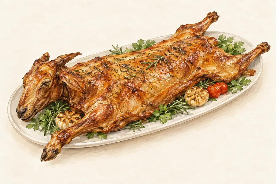 Damao Roast Saddle of Lamb 达茂烤羊背AI illustration · AI 示意图(仅供参考,非实拍)
Damao Roast Saddle of Lamb (达茂烤羊背) is a roast back of lamb from Darhan Muminggan United Banner (达尔罕茂明安联合旗), usually shortened to Damao Banner, a herding banner of Baotou (包头) that borders Mongolia to the north.
Read the dish guide →All dish names · 全部菜名 (10)
- Baotou millet tea paste · 包头老茶汤
- Baotou Shaomai Dumplings · 包头烧麦
- Beiguozi Hotpot · 背锅子
- Chatang Millet Flour Pudding · 茶汤
- Hand-Torn Boiled Meat · 手扒肉
- Iron-Pot Braised Noodles · 铁锅焖面
- Guyang Naked-Oat Noodles · 固阳莜面
- Damao Roast Saddle of Lamb · 达茂烤羊背
- Yellow River Spring Thaw Fish · 黄河开河鱼
- Lamb Shaomai Dumplings · 羊肉烧卖
More dishes from across Inner Mongolia are in the Inner Mongolia food guide.
Counties & districts in Baotou
9 areas belong directly to Baotou.
9 areas
Donghe District 东河区
Donghe District (Mongolian: ᠳ᠋ᠦᠩ ᠾᠧ ᠲᠣᠭᠣᠷᠢᠭ; Chinese: 东河区) is a district of Baotou, the largest city of Inner Mongolia, China.
Explore the area →DistrictHondlon District 昆都仑区
Hondlon District (Mongolian: ᠬᠥᠨᠳᠡᠯᠡᠨ ᠲᠣᠭᠣᠷᠢᠭ; Chinese: 昆都仑区) is a district of Baotou, the largest city of Inner Mongolia, China.
Explore the area →DistrictQingshan District 青山区
Qingshan District (Mongolian: ᠴᠢᠩᠱᠠᠨ ᠲᠣᠭᠣᠷᠢᠭ; Chinese: 青山区) is a district of the city of Baotou, Inner Mongolia, China.
Explore the area →DistrictShiguai District 石拐区
Shiguai District or Xiguit District is an outlying district of Baotou, the largest city of Inner Mongolia, China.
Explore the area →Show fewer areas
Bayan Obo Mining District 白云鄂博矿区
Bayan'obo Mining District (Mongolian: ᠪᠠᠶᠠᠨ ᠣᠪᠣᠭ᠋ ᠠ ᠠᠭᠤᠷᠬᠠᠢ ᠶᠢᠨ ᠲᠣᠭᠣᠷᠢᠭ, Chinese: 白云鄂博矿区), or Baiyun-Obo or Baiyun'ebo, is a mining district in the west of Inner Mongolia, China.
Explore the area →DistrictJiuyuan District 九原区
Jiuyuan District (Mongolian: ᠵᠢᠦ ᠶᠤᠸᠠᠨ ᠲᠣᠭᠣᠷᠢᠭ; Chinese: 九原区) is a district of Baotou, the largest city of Inner Mongolia, China.
Explore the area →BannerTumed Right Banner 土默特右旗
Tumed Right Banner (Mongolian: ᠲᠦᠮᠡᠳ ᠪᠠᠷᠠᠭᠤᠨ ᠬᠣᠰᠢᠭᠤ, Chinese: 土默特右旗) is a banner of western Inner Mongolia, China. It is under the administration of Baotou City, 59 kilometres (37 mi) to the west, and is…
Explore the area →CountyGuyang County 固阳县
Guyang County (Mongolian: ᠭᠦᠶᠠᠩ ᠰᠢᠶᠠᠨ; Chinese: 固阳县) is a county in western Inner Mongolia, China. It is under the administration of Baotou City, the downtown of which is 44 kilometres (27 mi) to the…
Explore the area →BannerDarhan Muminggan United Banner 达尔罕茂明安联合旗
Darhan Muminggan United Banner (Mongolian: ᠳᠠᠷᠬᠠᠨ ᠮᠤᠤᠮᠢᠩᠭᠠᠨ ᠬᠣᠯᠪᠣᠭᠠᠲᠤ ᠬᠣᠰᠢᠭᠤ; Chinese: 达尔罕茂明安联合旗) is a banner of west-central Inner Mongolia, People's Republic of China.
Explore the area →No areas match this name.
Plan your visit
Getting there
Search for 包头市 in a map app to find stations and your accommodation.
Where to stay →Build your route
Wudang Lamasery and Meidaizhao are about 40 km apart in a straight line. The linked place guides have entrance and visit details.
Continue with Inner Mongolia →More in Inner Mongolia
Sources & geographic information
Administrative names and parent areas: Official geographic directory · Reference date 2026-09-06.
Background text adapted from Baotou — Wikipedia contributors, under CC BY-SA 4.0. Text has been shortened and reorganized; source revision 1367294181.
Photo: Wudang Lamasery · Lukacs (Lukacs~commonswiki) · CC BY 2.5. Proportionally resized and converted to WebP without cropping, retouching or changing the photographed subject.

Photo: Meidaizhao · 三猎 · CC BY-SA 4.0. Proportionally resized and converted to WebP without cropping, retouching or changing the photographed subject.

Photo: Baotou · 柏尔莫华 · CC BY-SA 4.0. Full frame retained; proportionally resized and converted to WebP. No retouching or changes to the photographed subject. Card displays may crop the view.

Photo: Baotou Museum · Source photographer · License not provided. EXIF orientation normalized; resized without changing aspect ratio; converted to WebP. No subject edits.

Photo: Xilamuren Grassland · Nyx Ning · CC BY-SA 3.0. Full frame retained; proportionally resized and converted to WebP. No retouching or changes to the photographed subject. Card displays may crop the view.

Map data © OpenStreetMap contributors. Pins mark approximate centres, not entrances or boundaries.