


Get to know Shannan
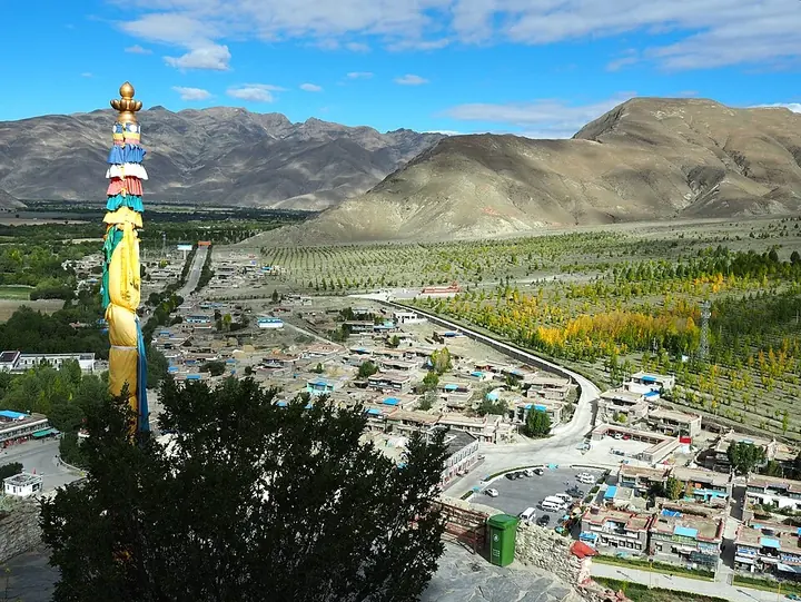
Photo adjustments
Full frame retained; proportionally resized and converted to WebP. No retouching or changes to the photographed subject. Card displays may crop the view.
- Administrative area
- Prefecture-level city · 地级市
- Part of
- Tibet (Xizang)
- Chinese name
- 山南市
- Local areas
- 12 local areas
Area & population
- Area in the source
- 79,700.00 km²
- Population · 2020
- 354,035
- Administrative seat
- Nêdong District (Zêtang)
Source: cited geographic source, as of the dates shown.
Located on the middle and lower reaches of the Yarlung Valley, formed by the Yarlung Tsangpo River, Lhoka region is often regarded as the birthplace of Tibetan civilization. It is bounded by the city of Lhasa to the north, Nyingchi to the east, Shigatse on the west and the international border with India and Bhutan on the south. The city measures 420 kilometres (260 mi) east to west and 329 kilometres (204 mi) from north to south. Its uniqueness stems from the fact that Tibet's earliest agricultural farmland, its first palace and first Buddhist monastery are all located in Lhoka. It also has the distinction of having held the first lhamo performance. Ethnic Tibetans constitute 98% of the population, the remaining 2% being Han, Hui, Mönpa, Lhoba and other ethnic groups.
Landmarks
The city has very unusual and rich historical monuments, natural geological features such as lakes and caves, scenic regions and religiously linked mountains. This has given a boost to the tourism industry. Some of the important landmarks are; the Lagyable Palace; the Yungbulakang Palace, the first palace in Tibet; the Tombs of Tibetan Kings; Jagsamqionpori, Gangobari of Zatong and Habort mountains, which are venerated; lakes such as Yamzogh Yumcog in Nagarzê County and the Lhamai Laco of Gyacha, which are considered as sacred; and religious places of worship such as the Dorje Drak Monastery (also spelt Do-rje-brag, or Dorjezha Monastery), the Quamzhub Monastery which is under state control, the Samding Monastery, the Samyas Monastery (the first monastery built in Tibet), Quinpu Meditation Cave and the Zayang Zang Karst Cave. Some of the notable monuments and monasteries are in the National Heritage list.
Transport and infrastructure
The city has a very large network of roads amounting to 3700 km, covering all villages and towns. The road emanates from the Tsetang town and spreads to all its 12 counties. The strategic bridge, Qu Shui Bridge across the Yarlung Zangbo River, links Shannan with Lhasa. The city also has the Lhasa Gonggar Airport in Gonggar County, which is 65 km from Lhasa and which is known as the "air way door" to Tibet, as well as the Shannan Longzi Airport in Lhünzê County. The Lhasa airport has direct air links with Beijing, Chengdu, Shanghai, Guangzhou, Chongqing, Xi'an, and Kunming. In addition, there are also international flights to Kathmandu and Hong Kong. It is 191 km from Lhasa. Regular buses operate from the two cities of Tsetang and Lhasa every day to the airport.
From the time Tibet Autonomous Region has been opened for other countries, development of many infrastructure and social sectors have recorded dramatic progress such as education, telecommunications and tourism.
Entry & permits for Tibet (Xizang)
Foreign tourists need Tibet entry approval, commonly called a Tibet Travel Permit, and an organised visit arranged through a specialist travel agency in China. Confirm your approved route before booking transport. Requirements differ for Taiwan residents and for travellers using mainland or Hong Kong/Macao Chinese resident documents; check the document guide before you book.
Check the travel-document requirements →Policy scope verified: 2026-09-06. UK FCDO: China regional travel advice ↗ State Council Taiwan Affairs Office: Tibet entry approval ↗ Xizang Department of Culture and Tourism: Medog border permit notice ↗
Explore Shannan
Core places to explore, with English and Chinese names.
Samye 桑耶寺
Yumbulagang 雍布拉康
Tradruk Temple 昌珠寺
Yamdrok Lake 羊卓雍措
Lhamo La-tso 拉姆拉错
Tsedang 泽当
Lhasa Gonggar Airport 拉萨贡嘎机场
Chimpu Hermitage Official Route 青朴修行地正规开放路线
Zhegu Lake 哲古措
Lajiali Royal Palace Ruins 拉加里王宫遗址
Kajiu Monastery 卡久寺
Sekhar Guthok Monastery 赛卡古托寺
Puma Yumco Lake 普莫雍错
Yamdrok Yumtso Lakeshore 羊卓雍错湖岸
Tombs of the Tibetan Kings 藏王墓
Gampa La Pass Yamdrok Lake Viewpoint 羊卓雍错岗巴拉观景区
Lebu Valley Official Route 勒布沟正规开放线路
Nêdong District 乃东区
Zhanang County 扎囊县
Gonggar County 贡嘎县
Sangri County 桑日县
Qonggyai County 琼结县
Qusum County 曲松县
Comai County 措美县
Lhozhag County 洛扎县
Gyaca County 加查县
Lhünzê County 隆子县
Nagarzê County 浪卡子县
Cona 错那市
Places to explore around Shannan
 Samye Monastery · 桑耶寺
Samye桑耶寺
Samye’s plan represents a Buddhist universe in built form. The central Utse hall stands for Mount Meru, with surrounding temples, four differently coloured stupas and a circular enclosure completing the composition. Founded…
Read the place guide →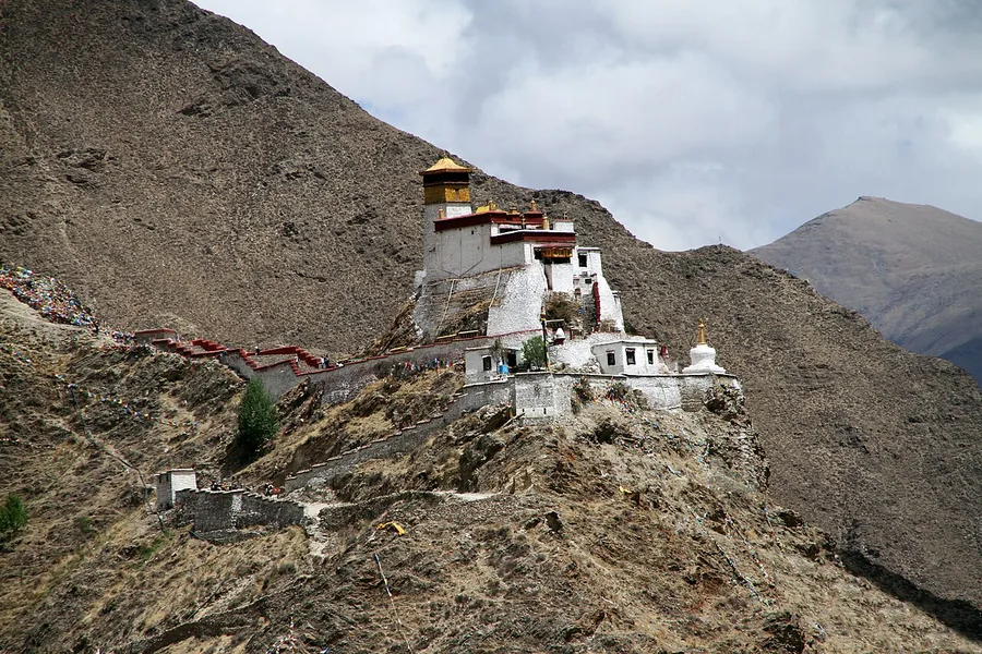 Yumbulagang palace on its rocky hill above the Yarlung Valley, Tibet. Photographed on 27 May 2014.
Yumbulagang雍布拉康
Yumbulagang stands on Tashi Tsering hill above the cultivated Yarlung Valley. Tibetan tradition connects it with the first kings and the beginnings of settled agriculture; the surviving palace-temple has been reconstructed after…
Read the place guide → Entrance forecourt of Tradruk Temple · 昌珠寺 Photograph date recorded by the source: 27 May 2014, 15:03:17.
Tradruk Temple昌珠寺
Tradruk, known locally as Changzhu Temple, belongs to the early religious landscape of the Yarlung Valley. Its columned assembly hall is surrounded by smaller shrines and a circumambulatory passage. The temple is especially…
Read the place guide →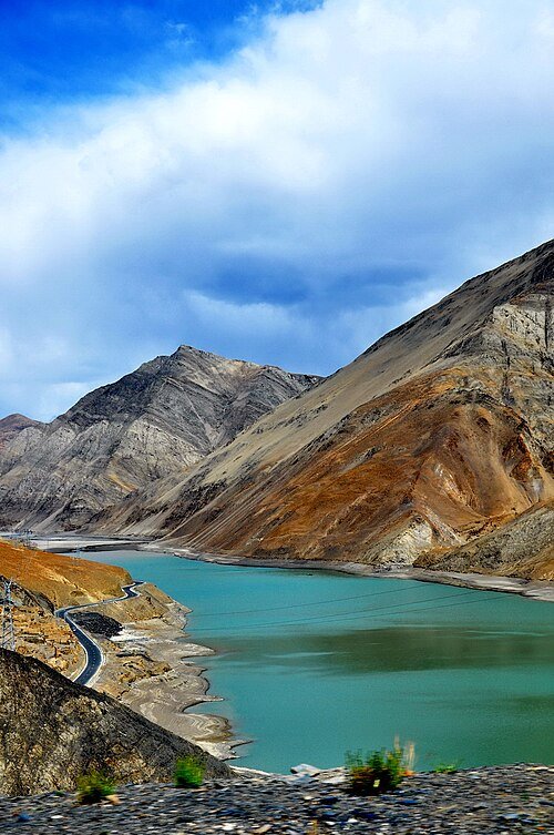 Yamdrok Yumtso Lake · 羊卓雍措
Yamdrok Lake羊卓雍措
Yamdrok’s branching shoreline winds between rounded mountain slopes, making the lake look different from each height and direction. The water occupies a high basin in Nangartse/Langkazi and carries a strong sacred association in…
Read the place guide → Lhamo La-tso · 拉姆拉错
Lhamo La-tso拉姆拉错
Lhamo La-tso is a small oracle lake in the mountains of Gyaca, associated with Palden Lhamo and the search for reincarnate lamas. Its significance comes from a tradition of contemplative lake-watching, rather than from a large…
Read the place guide → A wide street in a new town: rows of cream apartment towers on both sides with Tibetan-style lotus street lamps and red lanterns, a red traffic light reading 12, an empty dual carriageway with a zebra crossing, low green hills and a rocky mountain wall behind, and rain droplets on the lens in the upper sky.
Tsedang泽当
Tsedang’s old-town setting beneath Gongbori Mountain connects the modern Shannan base with the traditions of the Yarlung Valley. Local origin stories associate the mountain with the ancestors of the Tibetan people, while the…
Read the place guide → Terminal 3 of Lhasa Gonggar Airport, Gonggar County, Shannan · 山南市贡嘎县拉萨贡嘎机场T3航站楼 Source-recorded photograph date: 2025-09-02 07:48:18.
Lhasa Gonggar Airport拉萨贡嘎机场
Lhasa Gonggar is the main air gateway for Lhasa, but the airport is in Gonggar rather than the city centre. Terminal choice matters before planning a pickup: the official airport guide assigns domestic flights to T3 and…
Read the place guide →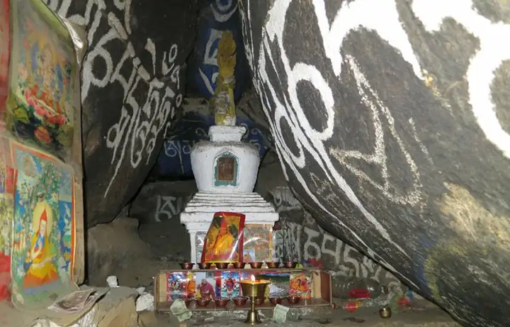 Chimpu Hermitage Official Route · 青朴修行地正规开放路线
Chimpu Hermitage Official Route青朴修行地正规开放路线
Qingpu (青朴) is a Tibetan Buddhist retreat site in Zhanang County, in the Shannan municipality of Tibet, which the county government describes as a valley-type scenic area enclosed by mountains on three sides at an elevation of 4,300 metres.
Read the place guide → Zhegu Lake · 哲古措
Zhegu Lake哲古措
Zhegu Co (哲古措, also written 哲古湖, Zhegu Lake) is a high-altitude lake at 4,600 metres in Comai County, in the Shannan municipality of Tibet, lying at the seat of Zhegu town and fed mainly by melting snow and ice.
Read the place guide → AI illustration · AI 示意图(仅供参考,非该地点实拍)
Lajiali Royal Palace Ruins拉加里王宫遗址
Ruined 13th to 18th century palace of the Lhagyari dynasty on an earth-pillar terrace on the south side of Qusum town, Shannan; a national key site since 2001.
Read the place guide →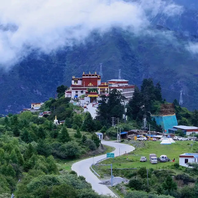 Kajiu Monastery · 卡久寺
Kajiu Monastery卡久寺
Kajiu Monastery (卡久寺), whose full name the Lhozhag County government gives as 吉祥隐修院, stands on a cloud-wrapped summit called 佳普晋 behind Lakang town in Lhozhag County, in the Shannan municipality of Tibet, 75 kilometres from the county seat.
Read the place guide → Sekhar Guthok Monastery · 赛卡古托寺
Sekhar Guthok Monastery赛卡古托寺
Saikagutuo Monastery (赛卡古托寺, also written 塞卡尔古陀寺, 色喀谷托寺, 桑噶古多寺 and 桑喀古托寺) stands at the seat of Se township in Lhozhag County, in the Shannan municipality of Tibet, 43 kilometres from the county town at an elevation of 3,700 metres, and is built around a tower whose name means, in Tibetan, the nine-storey castle built for the young lord.
Read the place guide → Lake Puma Yumco with surrounding mountains, Nagarze, Lhoka (Shannan), Tibet · 西藏自治区山南市浪卡子县普莫雍错 Source-recorded photograph date: 12 November 2014 (original upload date).
Puma Yumco Lake普莫雍错
Freshwater lake at about 5,010 m in Nagarzê County, south-west of Yamdrok Lake, fed by meltwater, with patterned ice in winter.
Read the place guide →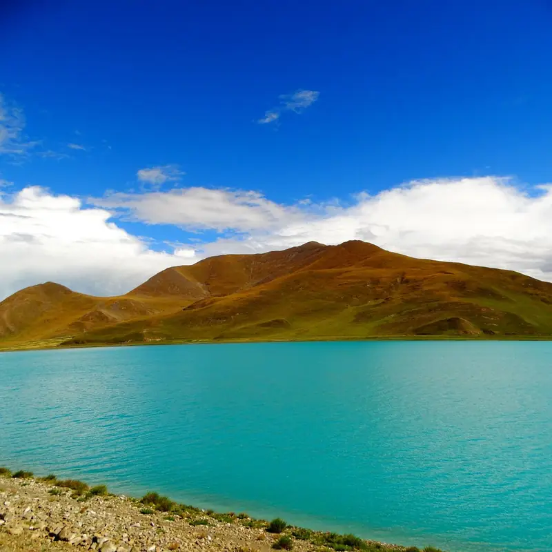 Yamdrok Yumtso Lakeshore · 羊卓雍错湖岸
Yamdrok Yumtso Lakeshore羊卓雍错湖岸
Yamdrok Yumtso (羊卓雍措) is a high plateau lake lying south of the Yarlung Zangbo in Nagarze County, in the Shannan municipality of Tibet; its shore, ringed by mountains on all four sides, is grazing country, and the water itself is what the county calls the jade lake of the upper pasture.
Read the place guide →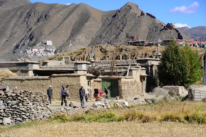 The Qonggyai valley near the Tibetan Kings' tombs, with a flag-draped burial mound visible on the hillside, Qonggyai County, Shannan. · 山南市琼结县藏王墓所在琼结河谷,山坡上可见挂满经幡的王陵封土。 Source-recorded photograph date: 2008-09-25.
Tombs of the Tibetan Kings藏王墓
Burial mounds of 7th to 9th century Tubo rulers at Qonggyai, Shannan, including Songtsen Gampo's tomb and the 7.18 m Tride Songtsen stele.
Read the place guide →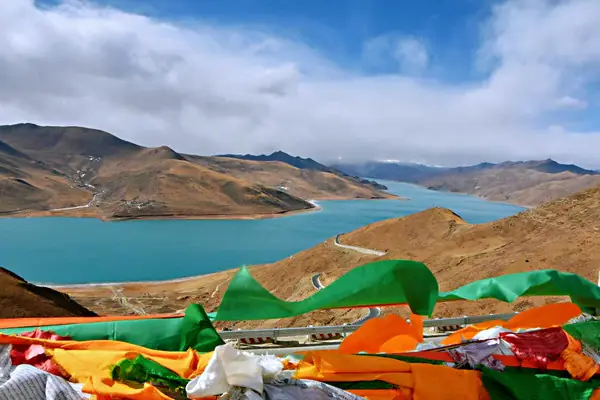 Gampa La Pass Yamdrok Lake Viewpoint · 羊卓雍错岗巴拉观景区
Gampa La Pass Yamdrok Lake Viewpoint羊卓雍错岗巴拉观景区
The Gampa La viewing area is the high pass on the road by which, the Shannan Municipal Tourism Development Bureau says, most visitors reach Yamdrok Yumtso in the Shannan municipality of Tibet; the bureau puts the pass at 4,790 metres and the lake surface it looks down on at 4,441 metres.
Read the place guide → Lebu Valley Official Route · 勒布沟正规开放线路
Lebu Valley Official Route勒布沟正规开放线路
Lebu Gorge (勒布沟) cuts the southern slope of the Himalaya in the south-west of Cona, in the Shannan municipality of Tibet, adjoining Bhutan on the west and bordering India on the south; the county tourism development commission's page heads it a national AAA-grade scenic area and an autonomous-region scenic and historic area, and gives its average elevation as about 2,400 metres.
Read the place guide →Local life & food
Shannan local specialties
山南市特色美食 · 10 specialties to discover
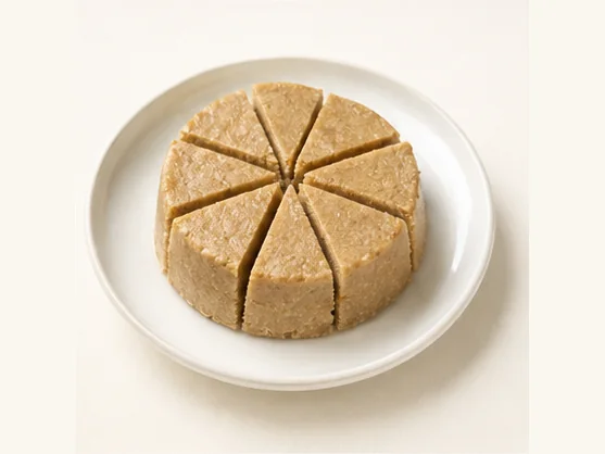 Tibetan masen barley & butter sweet 西藏玛森AI dish illustration / AI 菜品示意图
Expect toasted grain, rich dairy and sweetness, with a slightly crumbly or compact mouthfeel. Small curd pieces can add a tangy contrast to the butter and sugar.
Source ↗Read the dish guide →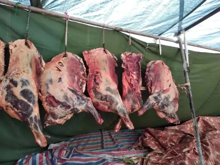 Shannan Yarlung Wind-Dried Meat 山南雅砻风干肉
Shannan Yarlung Wind-Dried Meat (山南雅砻风干肉) is raw beef and mutton that Tibetan households cut into strips and hang to dry in the cold, dry air of the Tibetan winter.
Read the dish guide →Photo adjustments
EXIF orientation normalized; resized without changing aspect ratio; converted to WebP. No subject edits.
 Lhunze Black Highland Barley Tsampa 隆子黑青稞糌粑AI illustration · AI 示意图(仅供参考,非实拍)
Lhunze Black Highland Barley Tsampa (隆子黑青稞糌粑) is tsampa (糌粑), the Tibetan staple of roasted barley flour, made from the black highland barley (黑青稞) of Lhunze County (隆子县) in Shannan (山南), Tibet.
Read the dish guide → Qonggyai Highland Barley Wine 琼结青稞酒AI illustration · AI 示意图(仅供参考,非实拍)
Qonggyai Highland Barley Wine (琼结青稞酒) is highland barley wine from Qonggyai County (琼结县) in Shannan (山南).
Read the dish guide → Gyaca Walnut Cake 加查核桃饼AI illustration · AI 示意图(仅供参考,非实拍)
Gyaca Walnut Cake (加查核桃饼) is listed among the local specialties of Shannan, Tibet (Xizang). The name includes 核桃 (walnuts). The term 饼 points to cakes or flatbreads.
Read the dish guide →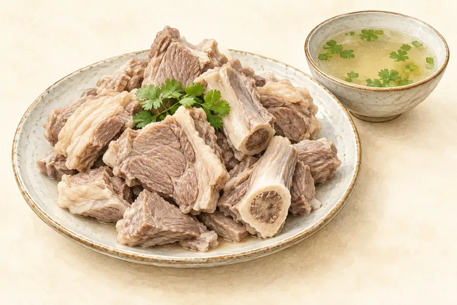 Comai Mutton 措美羊肉AI illustration · AI 示意图(仅供参考,非实拍)
Comai Mutton (措美羊肉) is sheep meat from Comai County (措美县) in Tibet (西藏). A December 2024 Comai County Media Centre (措美县融媒体中心) feature published by Xinhua (新华网) follows its production and sale, including flocks in Gudui Township (古堆乡).
Read the dish guide →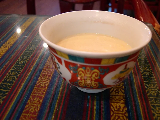 Butter tea 酥油茶
The flavor is savory, tea-bitter and rich, with a smooth fatty mouthfeel rather than the sweetness of commercial milk tea.
Source ↗Read the dish guide →
 Tibetan Blood Sausage 藏式血肠
Tibetan Blood Sausage (藏式血肠) is a traditional Lhasa (拉萨) dish made by filling an animal-intestine casing with blood and other ingredients.
Read the dish guide →Photo adjustments
EXIF orientation normalized; resized without changing aspect ratio; converted to WebP. No subject edits.
All dish names · 全部菜名 (10)
- Tibetan masen barley & butter sweet · 西藏玛森
- Shannan Yarlung Wind-Dried Meat · 山南雅砻风干肉
- Lhunze Black Highland Barley Tsampa · 隆子黑青稞糌粑
- Qonggyai Highland Barley Wine · 琼结青稞酒
- Gyaca Walnut Cake · 加查核桃饼
- Comai Mutton · 措美羊肉
- Butter tea · 酥油茶
- Tibetan Blood Sausage · 藏式血肠
- Rice with Droma Tubers · 人参果饭
- Yak Meat Soup · 牦牛肉汤
More dishes from across Tibet (Xizang) are in the Tibet (Xizang) food guide.
Counties & districts in Shannan
12 areas belong directly to Shannan.
12 areas
Nêdong District 乃东区
Nêdong District (Tibetan: སྣེ་གདོང་ཆུས།; Chinese: 乃东区) is a district of Shannan in the Tibet Autonomous Region, China.
Explore the area →CountyZhanang County 扎囊县
Zhanang County or Dranang (Tibetan: གྲ་ནང་རྫོང, Chinese: 扎囊县) is a county of Shannan (Lhokha) in the Tibet Autonomous Region, China.
Explore the area →CountyGonggar County 贡嘎县
Gonggar County, also Gongkar (Tibetan: གོང་དཀར་རྫོང་།; Chinese: 贡嘎县), is one of the 12 counties of Shannan in the southeastern part of Tibet Autonomous Region, China.
Explore the area →CountySangri County 桑日县
Sangri County (Tibetan: ཟངས་རི་རྫོང་།; Chinese: 桑日县) is a county of Shannan in the Tibet Autonomous Region, China.
Explore the area →Show fewer areas
Qonggyai County 琼结县
Qonggyai County or Chongye (Tibetan: འཕྱོངས་རྒྱས་རྫོང, Chinese: 琼结县) is a county under jurisdiction of Shannan in the Tibet Autonomous Region, China.
Explore the area →CountyQusum County 曲松县
Qusum County (Tibetan: ཆུ་གསུམ་རྫོང; Chinese: 曲松县) is a county under the administration of the prefecture-level city of Shannan in the Tibet Autonomous Region, China.
Explore the area →CountyComai County 措美县
Comai County (Tibetan: མཚོ་སྨད་རྫོང་།, Chinese: 措美县) is a county of Shannan located in the south-east of the Tibet Autonomous Region, China.
Explore the area →CountyLhozhag County 洛扎县
Lhozhag County (Tibetan: ལྷོ་བྲག་རྫོང་།; Chinese: 洛扎县) is a county of Shannnan located in the south-east of the Tibet Autonomous Region, China.
Explore the area →CountyGyaca County 加查县
Gyaca County (Tibetan: རྒྱ་ཚ་རྫོང་།; Chinese: 加查县) is a county of Shannan located in the south-east of the Tibet Autonomous Region, China.
Explore the area →CountyLhünzê County 隆子县
Lhünzê County (Tibetan: ལྷུན་རྩེ་རྫོང་།; Chinese: 隆子县, English: Lhöntse Dzong) is a county of Shannan located in the south-east of the Tibet Autonomous Region, China.
Explore the area →CountyNagarzê County 浪卡子县
Nagarzê County (Tibetan: སྣ་དཀར་རྩེ་རྫོང་།, Chinese: 浪卡子县) is a county of Shannan located in the south-east of the Tibet Autonomous Region, China. The Yarlung Tsangpo river dominates the county.
Explore the area →County-level cityCona 错那市
Tsona City (Tibetan: མཚོ་སྣ་གྲོང་ཁྱེར།, Chinese: 错那市), formerly Tsona County, is a county-level city in Shannan Prefecture in the southeastern part of the Tibet region of China.
Explore the area →No areas match this name.
Plan your visit
Getting there
Search for 山南市 in a map app to find stations and your accommodation.
Where to stay →Build your route
Samye and Yumbulagang are about 35 km apart in a straight line. The linked place guides have entrance and visit details.
Continue with Tibet (Xizang) →More in Tibet (Xizang)
Sources & geographic information
Administrative names and parent areas: Official geographic directory · Reference date 2026-09-06.
Background text adapted from Shannan, Tibet — Wikipedia contributors, under CC BY-SA 4.0. Text has been shortened and reorganized; source revision 1333357029.
Photo: Samye · Original uploader was Quadell at commons.wikipedia · CC BY-SA 2.0. Resized and WebP compressed; subject not altered.

Photo: Yumbulagang · Gerd Eichmann · CC BY-SA 4.0. Proportionally resized and converted to WebP without cropping, retouching or changing the photographed subject.

Photo: Tradruk Temple · Gerd Eichmann · CC BY-SA 4.0. Full frame retained; proportionally resized and converted to WebP. No retouching or changes to the photographed subject. Card displays may crop the view.

Photo: Yamdrok Lake · Michel Royon (User:Royonx) · CC0. Wikimedia thumbnail; fitted to the ranking-card frame.

Photo: Lhamo La-tso · Source photographer · License not provided. EXIF orientation normalized; resized without changing aspect ratio; converted to WebP. No subject edits.
Photo: Tsedang · NAN LIU · CC BY-SA 4.0. Full frame retained; proportionally resized and converted to WebP. No retouching or changes to the photographed subject. Card displays may crop the view.
.jpg)
Photo: Lhasa Gonggar Airport · NAN LIU · CC BY-SA 4.0. Full frame retained; proportionally resized and converted to WebP. No retouching or changes to the photographed subject. Card displays may crop the view.
.jpg)
Photo: Chimpu Hermitage Official Route · Source photographer · License not provided. EXIF orientation normalized; resized without changing aspect ratio; converted to WebP. No subject edits.
Photo: Zhegu Lake · Source photographer · License not provided. EXIF orientation normalized; resized without changing aspect ratio; converted to WebP. No subject edits.
Photo: Kajiu Monastery · Source photographer · License not provided. EXIF orientation normalized; resized without changing aspect ratio; converted to WebP. No subject edits.
Photo: Sekhar Guthok Monastery · Source photographer · License not provided. EXIF orientation normalized; resized without changing aspect ratio; converted to WebP. No subject edits.
Photo: Puma Yumco Lake · Hiroki Ogawa · CC BY 3.0. Full frame retained; proportionally resized and converted to WebP. No retouching or changes to the photographed subject. Card displays may crop the view.

Photo: Yamdrok Yumtso Lakeshore · Source photographer · License not provided. EXIF orientation normalized; resized without changing aspect ratio; converted to WebP. No subject edits.
Photo: Tombs of the Tibetan Kings · Reurinkjan · CC BY 2.0. Full frame retained; proportionally resized and converted to WebP. No retouching or changes to the photographed subject. Card displays may crop the view.

Photo: Gampa La Pass Yamdrok Lake Viewpoint · Source photographer · License not provided. EXIF orientation normalized; resized without changing aspect ratio; converted to WebP. No subject edits.
Photo: Lebu Valley Official Route · Source photographer · License not provided. EXIF orientation normalized; resized without changing aspect ratio; converted to WebP. No subject edits.
Map data © OpenStreetMap contributors. Pins mark approximate centres, not entrances or boundaries.