


Get to know Ili Kazakh Autonomous Prefecture
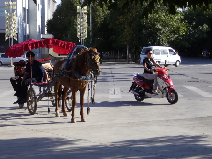
Photo adjustments
Full frame retained; proportionally resized and converted to WebP. No retouching or changes to the photographed subject. Card displays may crop the view.
- Administrative area
- Autonomous prefecture · 自治州
- Part of
- Xinjiang
- Chinese name
- 伊犁哈萨克自治州
- Local areas
- 11 local areas
Area & population
- Population · 2020
- 6,582,500
- Administrative seat
- Yining
Source: cited geographic source, as of the dates shown.
Ili is the only prefecture-level division that has other prefecture-level divisions (Altay and Tacheng Prefectures) under its administration. The term "sub-provincial autonomous prefecture" (副省级自治州) has often been applied to Ili, but the term has no legal basis and is a misnomer.
Tourism
Ili's major tourist attractions include the Narati Grassland, Guozigou Lake, and Kanas Lake.
Explore Ili Kazakh Autonomous Prefecture
Core places to explore, with English and Chinese names.
Liuxing Street 六星街
Kazanqi Folk Culture Scenic Area 喀赞其民俗旅游区
Ili River Scenic Area 伊犁河风景区
Xibe Ancient City 锡伯古城
Tangbula Hundred-Mile Gallery 唐布拉百里画廊
Duku Highway Qiao'erma Rest Stop 独库公路乔尔玛段正规停靠点
Kuerdening Scenic Area 库尔德宁
Qiaxi Forest Park 恰西
Nalati Grassland 那拉提
Xiata Scenic Area 夏塔
Zhaosu Grassland 昭苏草原
Zhaosu Wetland Park 昭苏湿地公园
Kalajun Grassland 喀拉峻
Tekes Bagua City 特克斯八卦城
Qiongkushitai Village 琼库什台
Kuokesu Grand Canyon 阔克苏大峡谷
Huiyuan Ancient City 惠远古城
Guozigou Valley Official Viewpoint 果子沟正规观景点
Princess Jieyou Lavender Garden 解忧公主薰衣草园
Khorgos National Gate Visitor Area 霍尔果斯国门正规参访区
Yining 伊宁市
Kuytun 奎屯市
Khorgos 霍尔果斯市
Yining County 伊宁县
Qapqal Xibe Autonomous County 察布查尔锡伯自治县
Huocheng County 霍城县
Tokkuztara County 巩留县
Künes County 新源县
Zhaosu County 昭苏县
Tekes County 特克斯县
Nilka County 尼勒克县
Places to explore around Ili Kazakh Autonomous Prefecture
 The mosque on Liuxing Street (Six Star Street), Yining · 伊犁哈萨克自治州伊宁市六星街清真寺 Source-recorded photograph date: 2025-10-10 12:26:32.
Liuxing Street六星街
Liuxing Street (六星街, "Six-Star Street") is a historic residential quarter in Yining (伊宁市), the seat of Ili Kazakh Autonomous Prefecture in Xinjiang. The prefecture government says the name comes from its six-armed street pattern, laid out across six fan-shaped sectors.
Read the place guide → Kazanqi Folk Culture Scenic Area · 喀赞其民俗旅游区
Kazanqi Folk Culture Scenic Area喀赞其民俗旅游区
Kazanqi Folk Customs Tourist Area (喀赞其民俗旅游区) is a historic residential quarter in the old town of Yining (伊宁市) in Ili Kazakh Autonomous Prefecture, Xinjiang. The city's tourism bureau describes it as an area for showing Ili's Uyghur folk customs while keeping the original houses, ways and residents in place.
Read the place guide →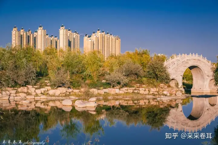 Ili River Scenic Area · 伊犁河风景区
Ili River Scenic Area伊犁河风景区
The Ili River Scenic Area (伊犁河风景区) is the riverside park and wetland corridor along the Ili River at Yining (伊宁市) in Ili Kazakh Autonomous Prefecture, Xinjiang. The city's tourism bureau describes it as a fully open scenic area and the city's ecological greenway.
Read the place guide →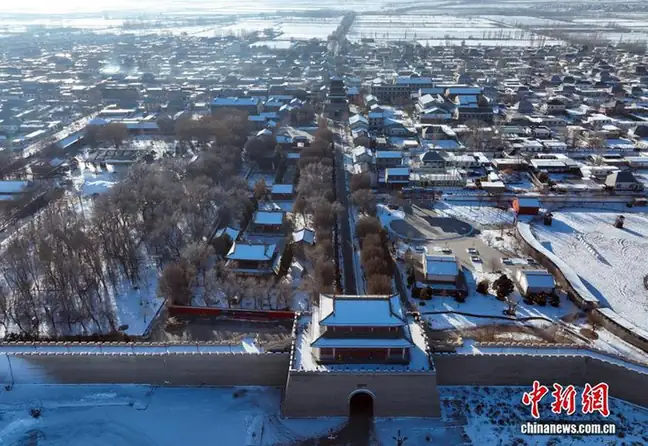 Xibe Ancient City · 锡伯古城
Xibe Ancient City锡伯古城
Xibe Ancient Town (锡伯古城) is a purpose-built cultural tourism area at Sunzhaqi Niru Town in Qapqal Xibe Autonomous County (察布查尔锡伯自治县), Ili Kazakh Autonomous Prefecture, Xinjiang. It presents the history and customs of the Xibe people, including the westward migration that the county places at the centre of their story and their long record of garrison farming in Xinjiang.
Read the place guide →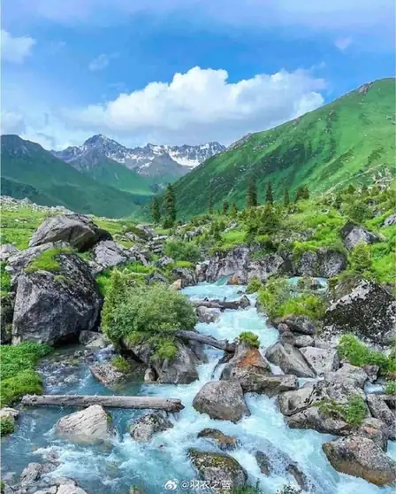 Tangbula Hundred-Mile Gallery · 唐布拉百里画廊
Tangbula Hundred-Mile Gallery唐布拉百里画廊
Tangbula Hundred-Mile Gallery (唐布拉百里画廊) is the landscape of the Tangbula section of Provincial Road S315 in the east of Nilka County (尼勒克县), Ili Kazakh Autonomous Prefecture, Xinjiang. The prefecture government gives that stretch the name "a hundred-li scroll, a natural gallery", and the county government records that the Tangbula scenic area there is a national-level forest park.
Read the place guide → AI illustration · AI 示意图(仅供参考,非该地点实拍)
Duku Highway Qiao'erma Rest Stop独库公路乔尔玛段正规停靠点
Qiao'erma (乔尔玛) is the place on the Duku Highway (独库公路) in Nilka County (尼勒克县), Ili Kazakh Autonomous Prefecture, Xinjiang, where National Highway 217 meets Provincial Road S315. The county government places the Qiao'erma Martyrs' Cemetery at that junction, in terrain it describes as glacier country between two mountain ranges.
Read the place guide →AI illustration · AI 示意图(仅供参考,非该地点实拍)Kuerdening Scenic Area库尔德宁
Kuerdening (库尔德宁) is a nature reserve and scenic area in the south-east of Gongliu County (巩留县), Ili Kazakh Autonomous Prefecture, Xinjiang, 88 km from the county seat. The county government describes it as a national-level snow-ridge spruce nature reserve, and the prefecture government records that it is a national 4A-level tourist attraction and a component of the "Xinjiang Tianshan" world natural heritage site.
Read the place guide →AI illustration · AI 示意图(仅供参考,非该地点实拍)Qiaxi Forest Park恰西
Qiaxi (恰西) is a national forest park and scenic area in the eastern hills of Gongliu County (巩留县), Ili Kazakh Autonomous Prefecture, Xinjiang. The prefecture government describes it as a broad mountain valley formed by an ancient moraine-dammed lake, and the county government records that the scenic area was established in 1988.
Read the place guide → Grazing livestock on the grassland of Nalati, Xinyuan County, Xinjiang, with the snow-capped Tian Shan in the background. · 新疆伊犁新源县那拉提草原,远处天山雪峰,牧民放牧场景。 Source-recorded photograph date: 2017-05-12 14:19:26.
Nalati Grassland那拉提
Nalati (那拉提) is a scenic area in the Tianshan hinterland at the eastern end of the Ili valley in Xinyuan County (新源县), Ili Kazakh Autonomous Prefecture, Xinjiang. The county government gives its planned area as 1,848 square kilometres and records that Kazakh herders there have kept the grassland customs the page describes.
Read the place guide →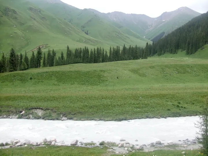 The 夏塔 gorge: a milky grey glacial river in the foreground with boulders along its bank, a broad green meadow rising behind it, a band of dark spruce on the slope, and snow-patched rocky peaks closing the head of the valley under an overcast sky.
Xiata Scenic Area夏塔
Xiate (夏塔) is a 4A-level scenic area in Zhaosu County (昭苏县), Ili Kazakh Autonomous Prefecture, Xinjiang. The county government describes its landscape as a vertical mountain sequence of snow mountains, meadow, forest and river formed by glaciation, and records that the scenic area contains the Xiate ancient road.
Read the place guide → Horses wading in a river on Zhaosu grassland, with a rider and distant mountains · 昭苏草原上,马群涉水,远处群山连绵 Source-recorded photograph date: 2025-10-18 13:32:29.
Zhaosu Grassland昭苏草原
The Zhaosu grassland (昭苏草原) is the grassland of Zhaosu County (昭苏县) in the south-west of Ili Kazakh Autonomous Prefecture, Xinjiang, a high intermontane basin ringed by mountains at an average elevation of 2,018 m. The county government records 7.36 million mu of natural pasture in the county, and the Ministry of Agriculture and Rural Affairs lists the Zhaosu grassland horse-herding system among China's important agricultural heritage.
Read the place guide →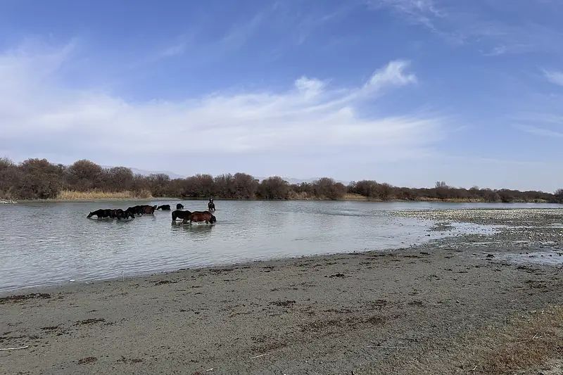 Zhaosu Wetland Park (昭苏湿地公园), Zhaosu County. Photograph: "新疆昭苏草原马牧养系统封面".
Zhaosu Wetland Park昭苏湿地公园
Zhaosu Wetland Park (昭苏湿地公园) is a wetland park on the north bank of the river in Zhaosu County (昭苏县), Ili Kazakh Autonomous Prefecture, Xinjiang. The county government records that it covers 1.04 million mu, a third of the wetland area of the whole prefecture, and that it is laid out in nine named zones.
Read the place guide →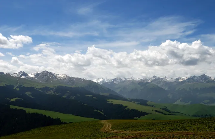 Rolling grassland and snow-capped peaks at the Kalajun grassland, Tekes County · 伊犁哈萨克自治州特克斯县喀拉峻草原及雪山 Source-recorded photograph date: 2009-07-03 13:15.
Kalajun Grassland喀拉峻
Kalajun (喀拉峻) is an international eco-tourism area in Tekes County (特克斯县), Ili Kazakh Autonomous Prefecture, Xinjiang, on the northern slopes of the Biyike mountain in the central Tianshan. The county government records that it is a world natural heritage site and a national AAAAA-level tourist attraction, and that the name means "black wilderness" in Kazakh.
Read the place guide → An elevated view over the centre of Tekes: a paved roundabout with a red-pillared paifang on its garden island, straight tree-lined avenues radiating away between low white-tiled commercial blocks, and a low brown mountain range along the horizon under a pale sky.
Tekes Bagua City特克斯八卦城
Tekes Bagua City (特克斯八卦城) is the county town of Tekes County (特克斯县), Ili Kazakh Autonomous Prefecture, Xinjiang, laid out on the eight trigrams of the Yijing. The county government records that it was approved by the State Council as a national historical and cultural city in 2007 and rated a national AAAA-level tourist attraction in November 2020.
Read the place guide → Qiongkushitai Village · 琼库什台
Qiongkushitai Village琼库什台
Qiongkushitai (琼库什台) is a village in the southern hills of Tekes County (特克斯县), Ili Kazakh Autonomous Prefecture, Xinjiang, at the northern entrance of the Wusun ancient road. The county government records that it was named a Chinese historical and cultural village in December 2010, and the village lies across the river from the Kalajun grassland.
Read the place guide →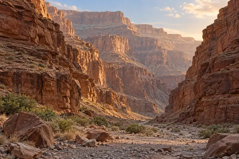 AI illustration · AI 示意图(仅供参考,非该地点实拍)
Kuokesu Grand Canyon阔克苏大峡谷
Kuoksu Grand Canyon (阔克苏大峡谷) is a canyon in the south of Tekes County (特克斯县), Ili Kazakh Autonomous Prefecture, Xinjiang. China Daily records that it was formed by geological movement and meltwater erosion in the central Tianshan and that it is a core component of the Kalajun world natural heritage scenic area.
Read the place guide → The east gate of the old city wall at Huiyuan Ancient City ruins, Huocheng County · 伊犁哈萨克自治州霍城县惠远古城遗址东门 Source-recorded photograph date: 2025-10-14 12:46:29.
Huiyuan Ancient City惠远古城
Huiyuan (惠远古城) is a Qing-era walled town in Huocheng County (霍城县), Ili Kazakh Autonomous Prefecture, Xinjiang, on the north bank of the Ili river. The county government records that its old city was first built in 1763 and that until 1884 Huiyuan was the political and military centre of Xinjiang and the first of the nine Ili cities; the prefecture government records that the Ili General's Office there was listed as a national key cultural relic protection unit in 1996.
Read the place guide →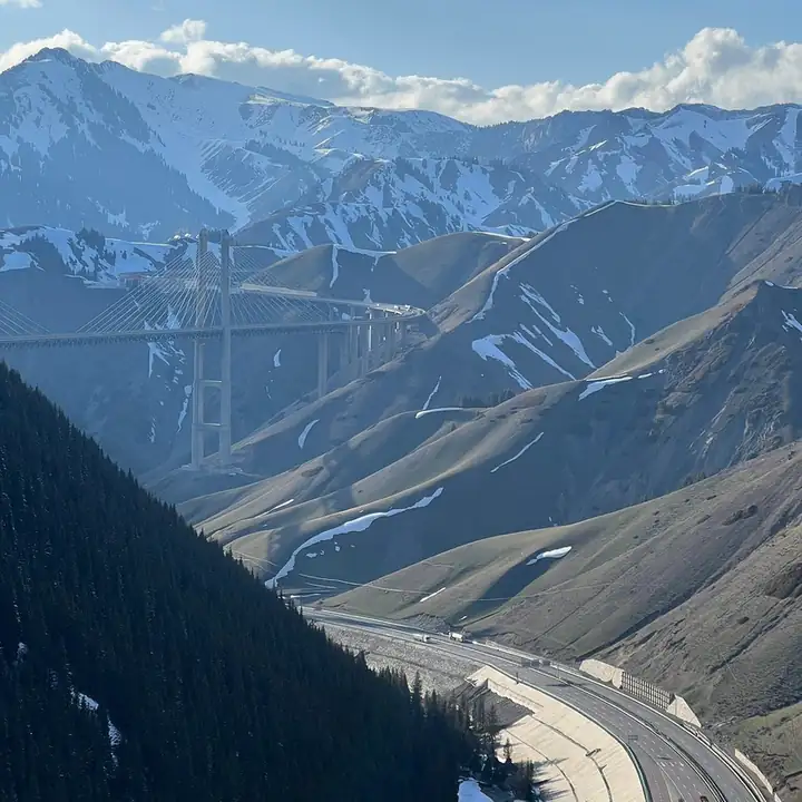 Guozigou Valley Official Viewpoint · 果子沟正规观景点
Guozigou Valley Official Viewpoint果子沟正规观景点
Guozigou (果子沟) is a gorge running the length of the northern Tianshan in Huocheng County (霍城县), Ili Kazakh Autonomous Prefecture, Xinjiang. The county and prefecture governments both record it as a long-standing landmark of Xinjiang, and Xinhua records that the Guozigou section of the Lianhuo expressway crosses the Tianshan mountains, and that the Lianhuo expressway bridge merges into the natural landscape.
Read the place guide →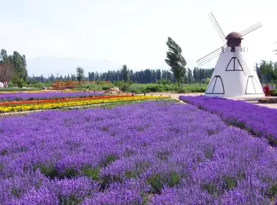 Princess Jieyou Lavender Garden · 解忧公主薰衣草园
Princess Jieyou Lavender Garden解忧公主薰衣草园
Jieyou Gongzhu Lavender Park (解忧公主薰衣草园) is a lavender growing and processing park at Qingshuihe town (清水河镇), Huocheng County (霍城县), Ili Kazakh Autonomous Prefecture, Xinjiang, on the northern foot of the Tianshan in the Ili river valley. The county government records it as a national AAAA-level tourist attraction, and the county tourism bureau records that its rebuilt industry park was put fully into use on 1 June 2024.
Read the place guide →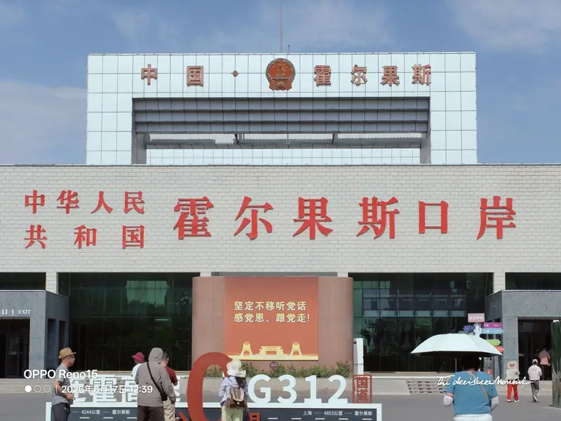 Khorgos National Gate Visitor Area · 霍尔果斯国门正规参访区
Khorgos National Gate Visitor Area霍尔果斯国门正规参访区
The Khorgos national gate area (霍尔果斯国门) is the border-crossing and border-tourism site at Khorgos City (霍尔果斯市), Ili Kazakh Autonomous Prefecture, Xinjiang, on the boundary with Kazakhstan. The municipal government records it as the Guomen scenic area, with a culture exhibition hall, inside the national AAAA-level Khorgos China–Kazakhstan international cultural tourism area, and the People's Daily records that the port has been in use since 1881.
Read the place guide →Local life & food
Ili Kazakh Autonomous Prefecture local specialties
伊犁哈萨克自治州特色美食 · 13 specialties to discover
 Ili Horse Sausage 伊犁马肠子AI illustration · AI 示意图(仅供参考,非实拍)
Ili Horse Sausage (伊犁马肠子) is horse meat stuffed into the horse's own intestine and dried, a traditional food of the Kazakh (哈萨克族) people of the Ili (伊犁) region.
Read the dish guide →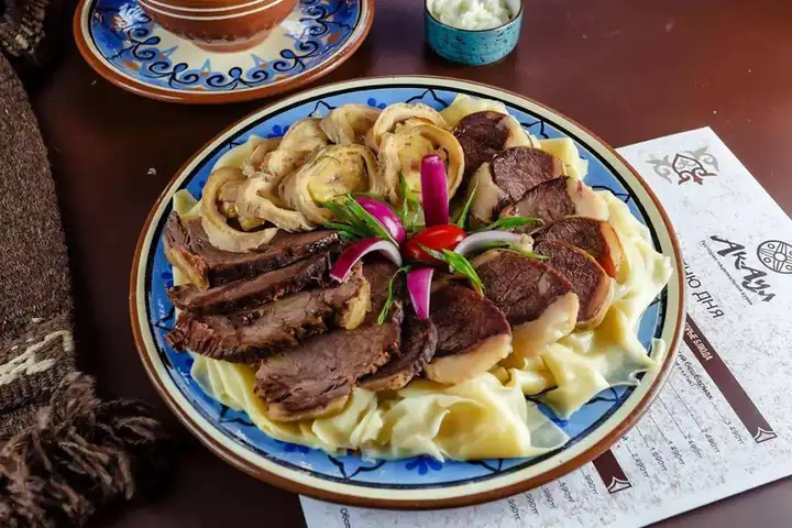 Smoked Horse Meat 熏马肉
Smoked Horse Meat (熏马肉) is a Kazakh cured meat of the Ili Kazakh Autonomous Prefecture (伊犁哈萨克自治州), Xinjiang.
Read the dish guide →Photo adjustments
EXIF orientation normalized; resized without changing aspect ratio; converted to WebP. No subject edits.
 Naryn Noodles with Boiled Meat 纳仁
Naryn Noodles with Boiled Meat (纳仁) is a dish of noodles or flat noodle pieces cooked in meat broth and served under chunks of boiled meat and onion.
Read the dish guide →Photo adjustments
EXIF orientation normalized; resized without changing aspect ratio; converted to WebP. No subject edits.
 Hand-Grabbed Boiled Meat 手抓肉
Hand-Grabbed Boiled Meat (手抓肉) is a way of preparing bone-in meat associated with pastoral communities of the Junggar Basin (准噶尔盆地) and other northern grasslands.
Source ↗Read the dish guide →.jpg)
Photo adjustments
Full frame retained; proportionally resized and converted to WebP. No retouching or changes to the photographed subject. Card displays may crop the view.
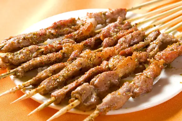 Grilled Lamb 烤羊肉
Grilled Lamb (烤羊肉) is listed among the local specialties of Karamay, Xinjiang. The name includes 羊肉 (lamb or mutton). 烤 describes roasting or grilling.
Read the dish guide →Photo adjustments
EXIF orientation normalized; resized without changing aspect ratio; converted to WebP. No subject edits.
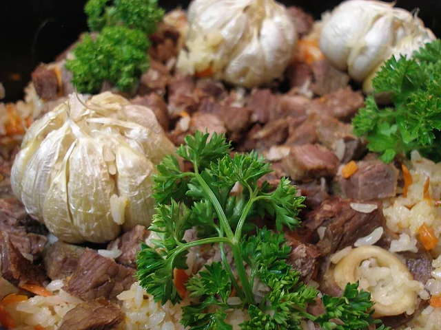 Polo rice 抓饭
The rice is rich and separate-grained, with sweet carrot, savory meat and occasional fruit sweetness rather than a sticky porridge texture.
Source ↗Read the dish guide →
Photo adjustments
EXIF orientation applied where present; resized proportionally to at most 640 px on the long edge and encoded as WebP. No crop, retouching, recoloring or subject changes.
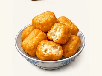 Baursak fried dough 包尔萨克AI illustration · AI 示意图
They have a lightly crisp surface and a soft, airy middle, with a mild fried-dough flavor that works with tea or richer foods.
Source ↗Read the dish guide →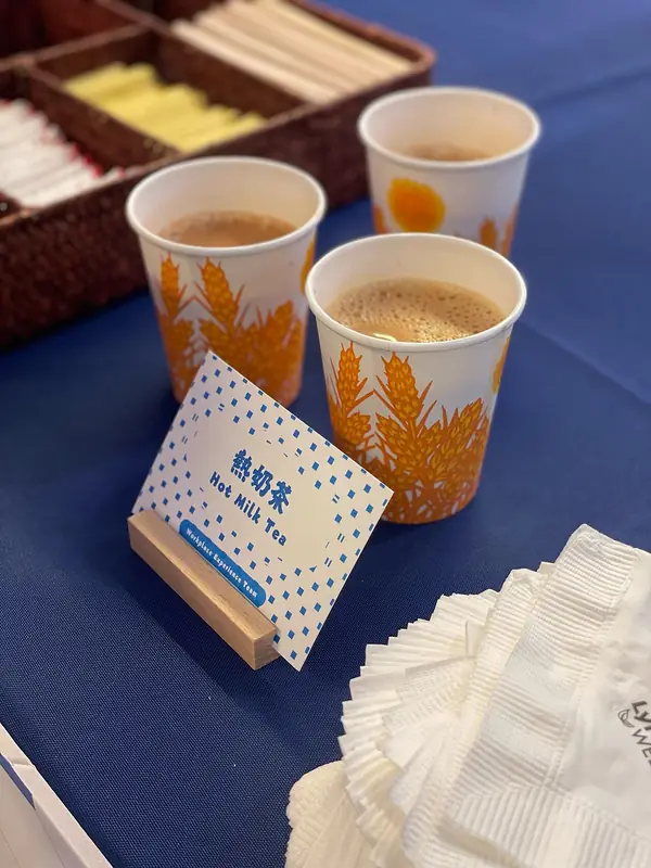 Salted Milk Tea 奶茶
Salted Milk Tea (奶茶) is brick tea mixed with boiled milk, hot water and salt. The Keketuohai Scenic Area Management Committee in Altay calls it the most important item of Kazakh food and drink, and in Ürümqi (乌鲁木齐) Xinjiang milk tea (新疆奶茶) is one of the common drinks.
Read the dish guide →
Photo adjustments
EXIF orientation normalized; resized without changing aspect ratio; converted to WebP. No subject edits.
All dish names · 全部菜名 (13)
- Ili Horse Sausage · 伊犁马肠子
- Smoked Horse Meat · 熏马肉
- Naryn Noodles with Boiled Meat · 纳仁
- Hand-Grabbed Boiled Meat · 手抓肉
- Grilled Lamb · 烤羊肉
- Polo rice · 抓饭
- Baursak fried dough · 包尔萨克
- Salted Milk Tea · 奶茶
- Kazakh dried yogurt curds · 酸奶疙瘩
- Khorgos Flour-Filled Lung · 霍尔果斯面肺子
- Zhaosu Horse Meat · 昭苏马肉
- Yining Baked Buns · 伊宁烤包子
- Smoked horse sausage · 熏马肠
More dishes from across Xinjiang are in the Xinjiang food guide.
Counties & districts in Ili Kazakh Autonomous Prefecture
11 areas belong directly to Ili Kazakh Autonomous Prefecture.
11 areas
Yining 伊宁市
Yining, also known as Ghulja (Uyghur: غۇلجا) or Kulja (Kazakh: قۇلجا), is a county-level city in northwestern Xinjiang, China.
Explore the area →County-level cityKuytun 奎屯市
Kuytun (Uyghur: كۈيتۇن) or Kuitun is a county-level city with about 285,000 residents (2000 census) in Ili Kazakh Autonomous Prefecture, Xinjiang, China.
Explore the area →County-level cityKhorgos 霍尔果斯市
Khorgos (from Russian: Хоргос; Chinese: 霍尔果斯), officially known as Korgas (Kazakh: قورعاس; Uyghur: قورغاس), is a county-level city in Ili Kazakh Autonomous Prefecture, Xinjiang, China.
Explore the area →CountyYining County 伊宁县
Yining County, also transliterated from Uyghur as Ghulja County (Uyghur: غۇلجا ناھىيىسى; Chinese: 固勒扎县), is a county of the Ili Kazakh Autonomous Prefecture in the Xinjiang Uyghur Autonomous Region of China.
Explore the area →Show fewer areas
Qapqal Xibe Autonomous County 察布查尔锡伯自治县
Qapqal Xibe Autonomous County in Ili Kazakh Autonomous Prefecture in Northern Xinjiang, is the only Xibe autonomous county of China, bordering Kazakhstan's Almaty Region to the west.
Explore the area →CountyHuocheng County 霍城县
Huocheng County, also known as Korgas County (Kazakh: قورعاس اۋدانى; Uyghur: قورغاس ناھىيىسى; Chinese: 霍尔果斯县), is situated within the Xinjiang Uyghur Autonomous Region and falls under the administration of…
Explore the area →CountyTokkuztara County 巩留县
Gongliu County as the official romanized name, also transliterated from Uyghur as Tokkuztara County (Uyghur: توققۇزتارا ناھىيىسى; Chinese: 特克斯塔留县), is a county situated within the Xinjiang Uyghur Autonomous…
Explore the area →CountyKünes County 新源县
Xinyuan County as the official romanized name, also transliterated from Uyghur as Künas County (Uyghur: كۈنەس ناھىيىسى; Chinese: 巩乃斯县; pinyin: Gǒngnǎisī xiàn), is a county in the Xinjiang Uyghur Autonomous…
Explore the area →CountyZhaosu County 昭苏县
Zhaosu County, also known as Mongolküre County (from Uyghur: موڭغۇلكۈرە, romanized: Mongghulküre, lit. 'Temple of the Mongols'), is a county in northwestern Xinjiang, China.
Explore the area →CountyTekes County 特克斯县
Tekes County is a county within the Xinjiang Uyghur Autonomous Region and is under the administration of the Ili Kazakh Autonomous Prefecture. It contains an area of 8,067 km².
Explore the area →CountyNilka County 尼勒克县
Nilka County is a county situated in Xinjiang Uyghur Autonomous Region, China and is under the administration of the Ili Kazakh Autonomous Prefecture. It contains an area of 10,121 km² (3,908 sq mi).
Explore the area →No areas match this name.
Plan your visit
Getting there
Search for 伊犁哈萨克自治州 in a map app to find stations and your accommodation.
Where to stay →Build your route
Liuxing Street and Kazanqi Folk Culture Scenic Area are both listed here. The linked place guides have entrance and visit details.
Continue with Xinjiang →More in Xinjiang
Sources & geographic information
Administrative names and parent areas: Official geographic directory · Reference date 2026-09-06.
Background text adapted from Ili Kazakh Autonomous Prefecture — Wikipedia contributors, under CC BY-SA 4.0. Text has been shortened and reorganized; source revision 1370643094.
Photo: Liuxing Street · HaziiDozen · CC BY-SA 4.0. Full frame retained; proportionally resized and converted to WebP. No retouching or changes to the photographed subject. Card displays may crop the view.

Photo: Kazanqi Folk Culture Scenic Area · Source photographer · License not provided. EXIF orientation normalized; resized without changing aspect ratio; converted to WebP. No subject edits.
Photo: Ili River Scenic Area · Source photographer · License not provided. EXIF orientation normalized; resized without changing aspect ratio; converted to WebP. No subject edits.
Photo: Xibe Ancient City · Source photographer · License not provided. EXIF orientation normalized; resized without changing aspect ratio; converted to WebP. No subject edits.
Photo: Tangbula Hundred-Mile Gallery · Source photographer · License not provided. EXIF orientation normalized; resized without changing aspect ratio; converted to WebP. No subject edits.
Photo: Nalati Grassland · Voidvector · CC BY-SA 4.0. Full frame retained; proportionally resized and converted to WebP. No retouching or changes to the photographed subject. Card displays may crop the view.
.jpg)
Photo: Xiata Scenic Area · Nyx Ning · CC BY-SA 3.0. Full frame retained; proportionally resized and converted to WebP. No retouching or changes to the photographed subject. Card displays may crop the view.

Photo: Zhaosu Grassland · HaziiDozen · CC BY-SA 4.0. Full frame retained; proportionally resized and converted to WebP. No retouching or changes to the photographed subject. Card displays may crop the view.

Photo: Zhaosu Wetland Park · HaziiDozen · CC BY-SA 4.0. Full frame retained; EXIF orientation normalized, proportionally resized to at most 800 pixels and converted to WebP. No generated pixels or subject changes. Cards may crop the display.

Photo: Kalajun Grassland · lwtt93 from Shanghai, China · CC BY 2.0. Full frame retained; proportionally resized and converted to WebP. No retouching or changes to the photographed subject. Card displays may crop the view.
.jpg)
Photo: Tekes Bagua City · Nyx Ning · CC BY-SA 3.0. Full frame retained; proportionally resized and converted to WebP. No retouching or changes to the photographed subject. Card displays may crop the view.

Photo: Qiongkushitai Village · Source photographer · License not provided. EXIF orientation normalized; resized without changing aspect ratio; converted to WebP. No subject edits.
Photo: Huiyuan Ancient City · HaziiDozen · CC BY-SA 4.0. Full frame retained; proportionally resized and converted to WebP. No retouching or changes to the photographed subject. Card displays may crop the view.

Photo: Guozigou Valley Official Viewpoint · Source photographer · License not provided. EXIF orientation normalized; resized without changing aspect ratio; converted to WebP. No subject edits.
Photo: Princess Jieyou Lavender Garden · Source photographer · License not provided. EXIF orientation normalized; resized without changing aspect ratio; converted to WebP. No subject edits.
Photo: Khorgos National Gate Visitor Area · Source photographer · License not provided. EXIF orientation normalized; resized without changing aspect ratio; converted to WebP. No subject edits.
Map data © OpenStreetMap contributors. Pins mark approximate centres, not entrances or boundaries.