


Get to know Hulunbuir
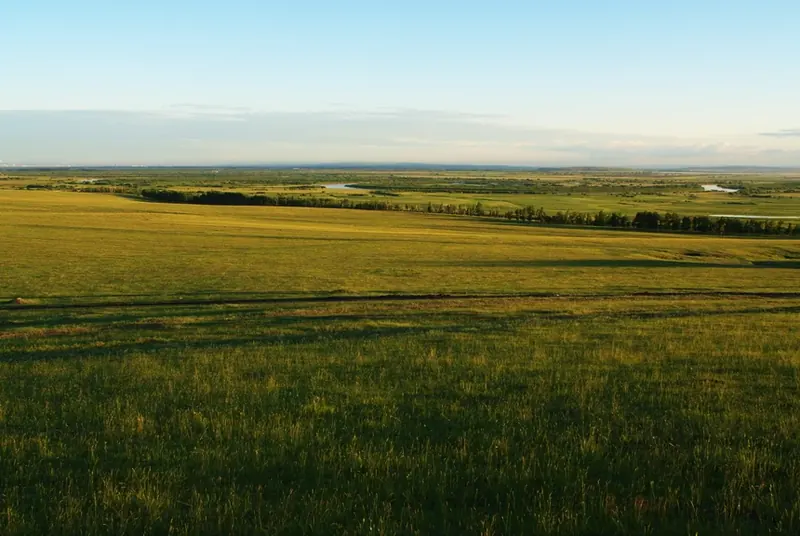
Photo adjustments
Full frame retained; proportionally resized and converted to WebP. No retouching or changes to the photographed subject. Card displays may crop the view.
- Administrative area
- Prefecture-level city · 地级市
- Part of
- Inner Mongolia
- Chinese name
- 呼伦贝尔市
- Local areas
- 14 local areas
Area & population
- Area in the source
- 263,953.00 km²
- Population · 2010
- 2,549,278
- Administrative seat
- Hailar District
Source: cited geographic source, as of the dates shown.
Transport
Airports include: Hulunbuir Hailar Airport – Hailar Zhalantun Chengjisihan Airport – Zhalantun Xinbarag Youqi Baogede Airport – New Barag Right Banner
Explore Hulunbuir
Core places to explore, with English and Chinese names.
Hulun Lake 呼伦湖
Manzhouli 满洲里
Hailar, Hulunbuir 呼伦贝尔海拉尔
Ergun wetlands 额尔古纳湿地
Shiwei 室韦
Manzhouli Matryoshka Square 满洲里套娃广场
Manzhouli Beihu Park 满洲里北湖公园
Mordaoga National Forest Park 莫尔道嘎国家森林公园
Manzhouli National Gate Visitor Center 满洲里国门景区游客中心
Erguna Birch Forest Visitor Center 额尔古纳白桦林景区游客中心
Manzhouli China-Russia Border Tourism Area 满洲里中俄边境旅游区
Morigele River Scenic Area 莫尔格勒河景区
Chaihe Moon Town 柴河月亮小镇
Aoluguya Reindeer Tribe Scenic Area 敖鲁古雅使鹿部落景区
Manzhouli China-Russia Border Scenic Area 中俄边境旅游区
Manzhouli Matryoshka Doll Scenic Area 套娃景区
Gaxian Cave 嘎仙洞
Darbin Lake Forest Park 达尔滨湖森林公园
Enhe Russian Ethnic Township 恩和俄罗斯族民族乡
Ergun White Birch Forest Scenic Area 白桦林景区
Hailar District 海拉尔区
Jalainur District 扎赉诺尔区
Arun Banner 阿荣旗
Morin Dawa Daur Autonomous Banner 莫力达瓦达斡尔族自治旗
Oroqen Autonomous Banner 鄂伦春自治旗
Ewenki Autonomous Banner 鄂温克族自治旗
Old Barag Banner 陈巴尔虎旗
New Barag Left Banner 新巴尔虎左旗
New Barag Right Banner 新巴尔虎右旗
Manzhouli 满洲里市
Yakeshi 牙克石市
Zalantun 扎兰屯市
Ergun 额尔古纳市
Genhe 根河市
Places to explore around Hulunbuir
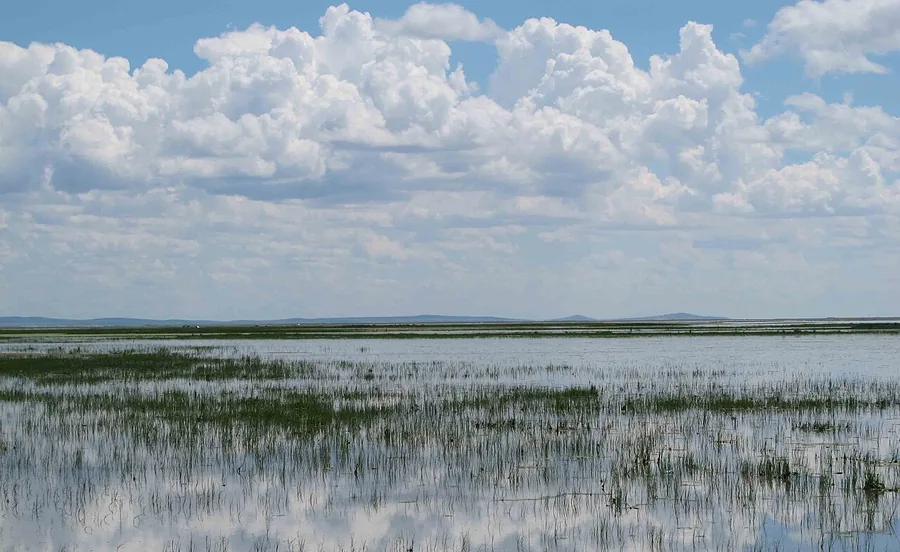 The reed-fringed water and open sky of Hulun Lake in Inner Mongolia, July 2010.
Hulun Lake呼伦湖
Hulun Lake spreads across a shallow basin in the western Hulunbuir grassland. Reeds and wetlands around its margins form important habitat, while the managed Xiaohekou visitor shore provides the familiar open-water view. The…
Read the place guide →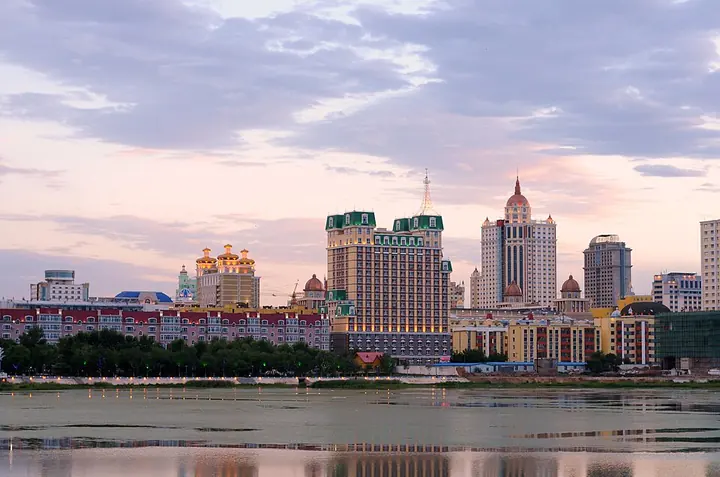 Manzhouli’s cityscape, photographed in July 2007 · 满洲里 Photograph date recorded by the source: Taken on 15 July 2007.
Manzhouli满洲里
Manzhouli grew around the railway station built at the start of the twentieth century and still carries the character of a border trading city. Its visitor landmarks express that connection in different ways: the National Gate…
Read the place guide →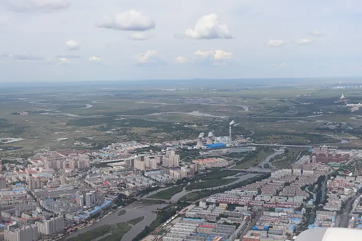 An aerial view of Hailar's urban area and river · 海拉尔城区与河流的航拍视角 Source-recorded photograph date: 2025-07-18 12:33:10.
Hailar, Hulunbuir呼伦贝尔海拉尔
Hailar is Hulunbuir's urban gateway, with the Yimin River running through the city. The reconstructed Hulunbuir Ancient City on Zhengyang Street recalls the Qing trading settlement through gateways, shopfronts and the…
Read the place guide →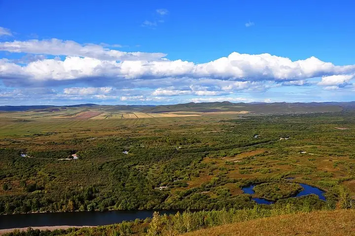 Matidao river bend in Ergun wetlands · 额尔古纳湿地马蹄岛河曲 Capture date not established by the retained file page.
Ergun wetlands额尔古纳湿地
Ergun's urban centre at Labudalin stands beside the broad Gen River wetland landscape. From the visitor overlook, winding channels divide grass, willow growth and wooded patches into a changing pattern. This close-to-town…
Read the place guide →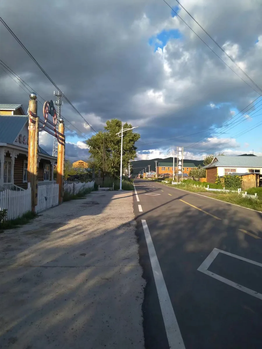 A street in Shiwei township, Inner Mongolia. Photographed on 27 August 2017.
Shiwei室韦
Shiwei faces the Russian village of Olochi across the Argun River. Russian-influenced buildings and the lively central square give the settlement a distinctive border-town appearance, but the most revealing view is along the…
Read the place guide → AI illustration; an interpretive view, not a photograph. AI 示意图,非景点实拍。
Manzhouli Matryoshka Square满洲里套娃广场
Manzhouli's Matryoshka complex turns the Russian nesting doll into architecture, scenery and entertainment. The giant doll-shaped hotel anchors a theme park whose buildings borrow Russian decorative forms. Inside, the Matryoshka…
Read the place guide →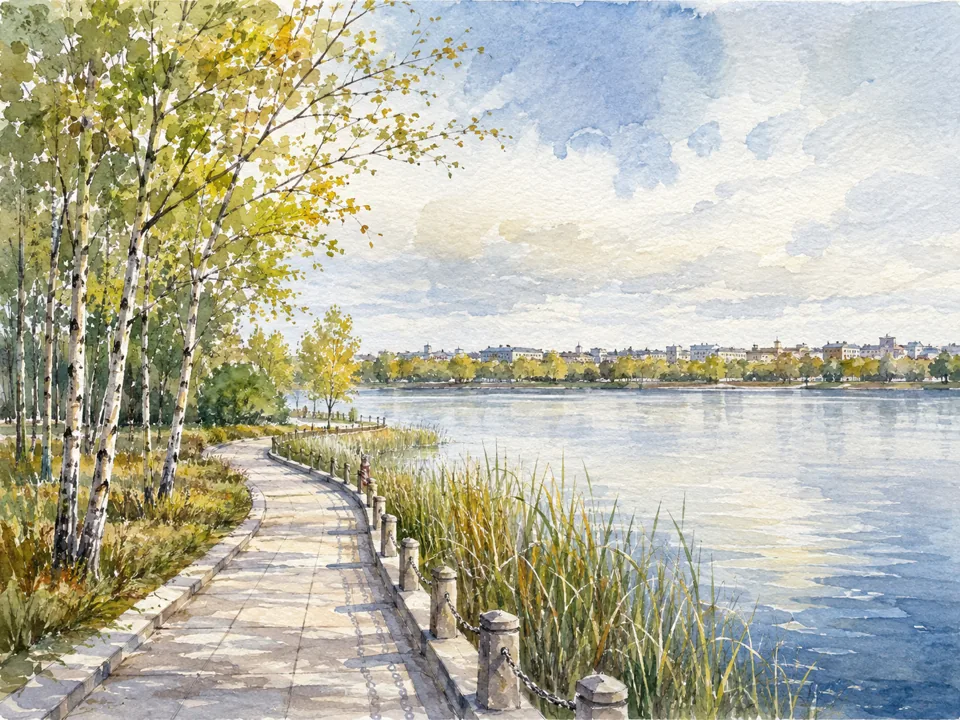 AI illustration; an interpretive view, not a photograph. AI 示意图,非景点实拍。
Manzhouli Beihu Park满洲里北湖公园
Beihu Park is a small urban-lake retreat in northwestern Manzhouli. Its appeal comes from the water, planted edges and views back toward the surrounding city, rather than a long sightseeing checklist. A circuit along the…
Read the place guide → Mordaoga National Forest Park entrance · 莫尔道嘎国家森林公园大门 Photograph date recorded by the source: 14 July 2025, 14:20:17.
Mordaoga National Forest Park莫尔道嘎国家森林公园
Mordaoga Forest Park introduces the larch and birch landscapes of the Greater Khingan Range. Hongdoupo, named for its northern lingonberries, shows the layered vegetation beneath the trees, while the Yimu Jiuling viewpoint opens…
Read the place guide →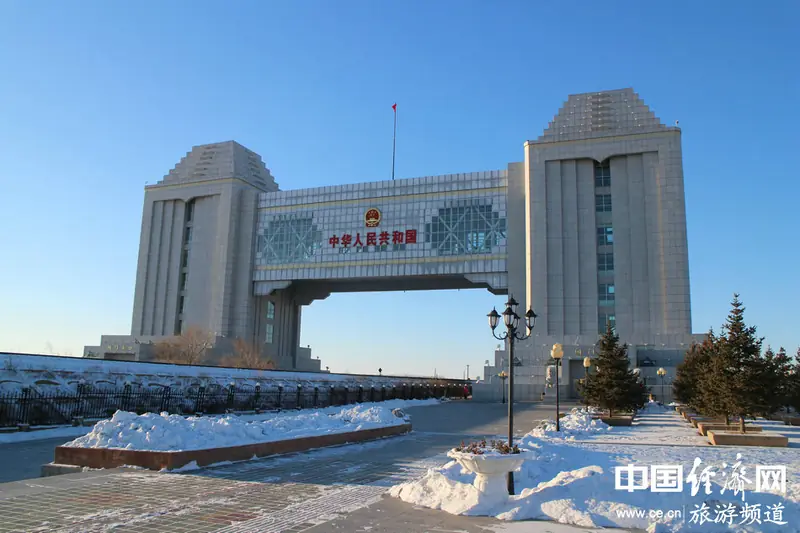 Manzhouli National Gate Visitor Center · 满洲里国门景区游客中心
Manzhouli National Gate Visitor Center满洲里国门景区游客中心
The National Gate visitor complex presents Manzhouli's border and railway history around the monumental gate above the rail corridor. Boundary Monument No. 41 marks the frontier, while Locomotive Square makes the railway…
Read the place guide →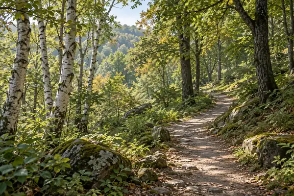 AI illustration · AI 示意图(仅供参考,非该地点实拍)
Erguna Birch Forest Visitor Center额尔古纳白桦林景区游客中心
Erguna's birch-forest scenic area is built around tall white trunks marked with dark patches and a bright seasonal canopy. Ground-level boardwalks let visitors follow the forest floor, while an elevated walkway provides a…
Read the place guide →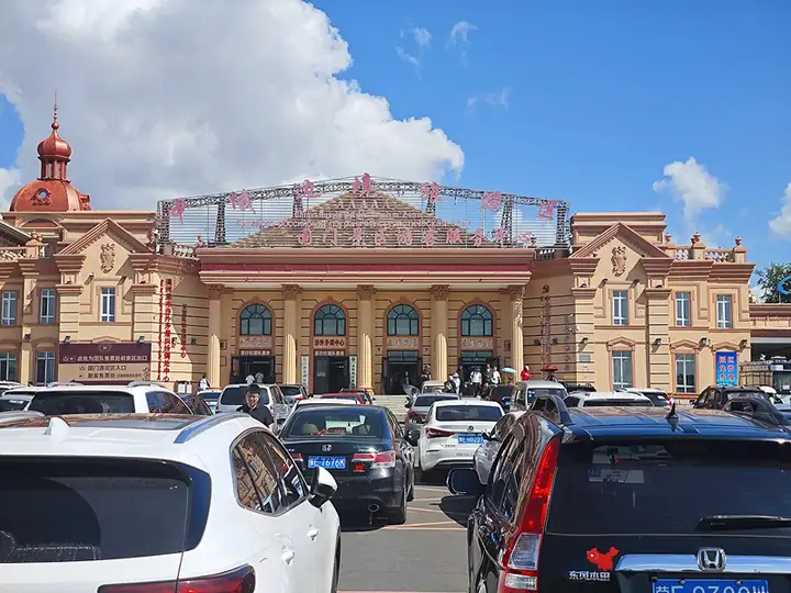 Manzhouli China-Russia Border Tourism Area · 满洲里中俄边境旅游区
Manzhouli China-Russia Border Tourism Area满洲里中俄边境旅游区
Manzhouli's border tourism area brings together the China Gate visitor attraction and a Russian-doll-themed resort.
Read the place guide → Grassland at the Morigele River Scenic Area, Chen Barag Banner · 陈巴尔虎旗莫尔格勒河景区草原风光 Source-recorded photograph date: 2025-07-13 09:51:40.
Morigele River Scenic Area莫尔格勒河景区
The Morigele River winds through the grassland of Chen Barag Banner, creating the river-bend views associated with the Hulunbuir prairie.
Read the place guide →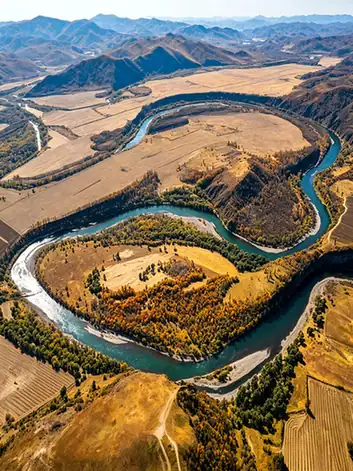 Chaihe Moon Town · 柴河月亮小镇
Chaihe Moon Town柴河月亮小镇
Chaihe, also called Moon Town, is a forest settlement in the Greater Khingan landscape of Zhalantun. Its volcanic lakes and wooded surroundings make it a separate base from the main visitor area of Arxan National Forest Park.
Read the place guide →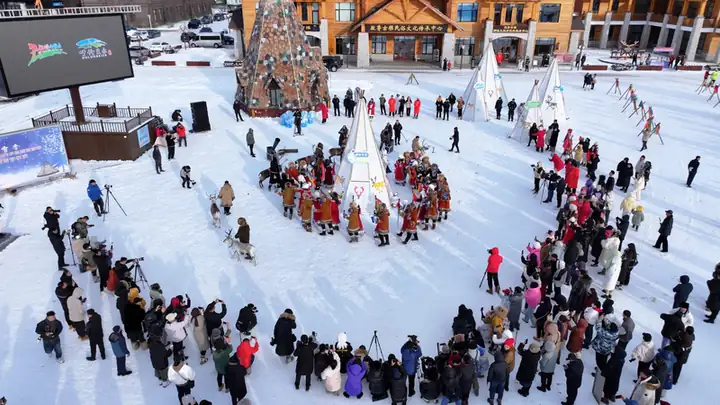 Aoluguya Reindeer Tribe Scenic Area · 敖鲁古雅使鹿部落景区
Aoluguya Reindeer Tribe Scenic Area敖鲁古雅使鹿部落景区
Aoluguya Reindeer Tribe Scenic Area is a cultural visitor complex west of Genhe that presents Evenki reindeer traditions through woodland, museums, crafts and camp spaces.
Read the place guide → The visitor service center building at the China-Russia Border Tourism Zone, Manzhouli · 满洲里市中俄边境旅游区国门景区游客服务中心 Source-recorded photograph date: 2025-07-17 09:59:38.
Manzhouli China-Russia Border Scenic Area中俄边境旅游区
Manzhouli's China–Russia Border Tourism Area combines the Guomen border-history section with the Russian-themed Taowa visitor complex.
Read the place guide →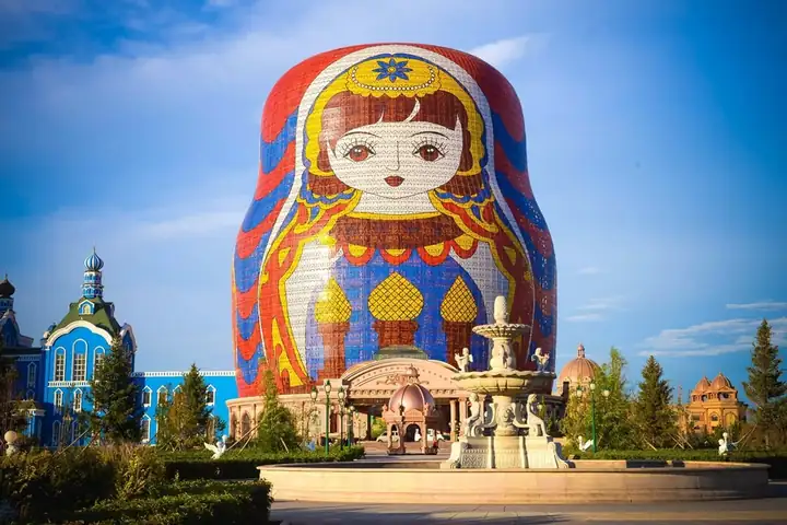 Manzhouli Matryoshka Doll Scenic Area · 套娃景区
Manzhouli Matryoshka Doll Scenic Area套娃景区
Taowa is the matryoshka-themed section of Manzhouli's China–Russia Border Tourism Area, combining a Russian-inspired park, entertainment venues and a giant doll-shaped hotel.
Read the place guide →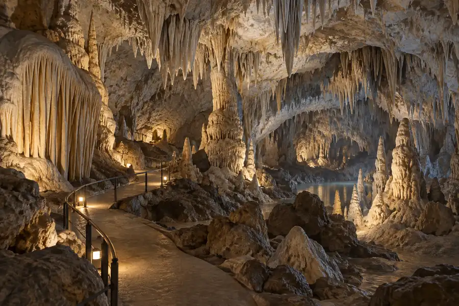 AI illustration · AI 示意图(仅供参考,非该地点实拍)
Gaxian Cave嘎仙洞
Granite cliff cave in Oroqen Banner with a Northern Wei inscription of 443 naming it the ancestral shrine of the Tuoba Xianbei; found in 1980.
Read the place guide →AI illustration · AI 示意图(仅供参考,非该地点实拍)Darbin Lake Forest Park达尔滨湖森林公园
Darbin Lake Forest Park brings together dark volcanic rock fields, forest and wild Dahurian rhododendrons on the southeastern slopes of the Greater Khingan Range.
Read the place guide →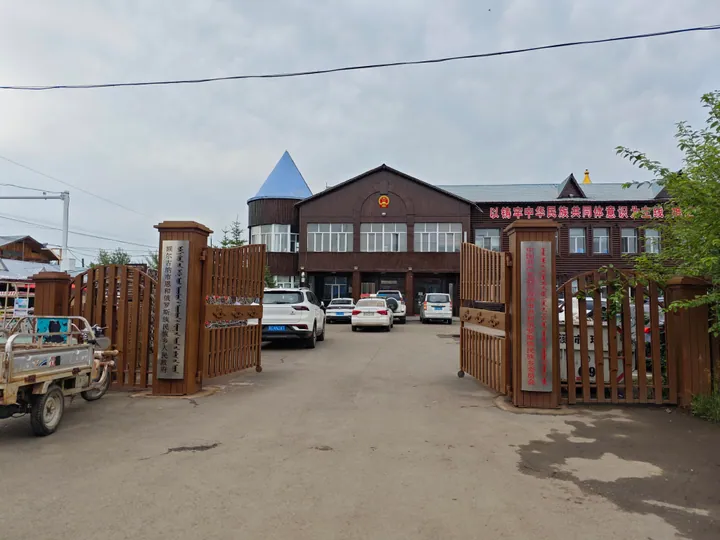 The government office building of Enhe Russian Ethnic Township, Ergun, with its log-cabin-style architecture · 额尔古纳市恩和俄罗斯族民族乡政府,木刻楞风格建筑 Source-recorded photograph date: 2025-07-15 15:17:20.
Enhe Russian Ethnic Township恩和俄罗斯族民族乡
China's only Russian ethnic township, on the Argun River border in Ergun, with log-house streets and families of mixed Chinese-Russian descent.
Read the place guide →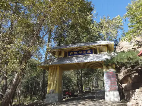 Ergun White Birch Forest Scenic Area · 白桦林景区
Ergun White Birch Forest Scenic Area白桦林景区
Ergun's White Birch Forest Scenic Area is a developed woodland attraction with wooden boardwalks, an elevated forest walk and fairy-tale-themed spaces among the birches.
Read the place guide →Local life & food
Hulunbuir local specialties
呼伦贝尔市特色美食 · 11 specialties to discover
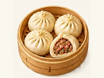 Buryat steamed buns 布里亚特包子AI illustration · AI 示意图
The filling is succulent and strongly savory, while the wrapper offers a gentle chew rather than a fluffy bread texture.
Source ↗Read the dish guide →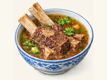 Nantun simmered beef ribs 水煮南屯牛排AI illustration · AI 示意图
The attraction is substantial beef flavor and the contrast between meat, fat and softer connective tissue. This is a boiled-meat preparation rather than a Western grilled steak.
Source ↗Read the dish guide →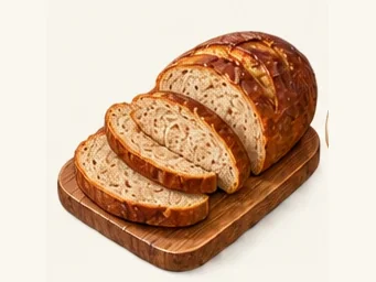 Russian-style leba bread 俄罗斯列巴AI illustration · AI 示意图
The crumb is relatively dense and chewy, with a firm crust and sometimes a mild fermented tang. Added dried fruit brings pockets of sweetness.
Source ↗Read the dish guide →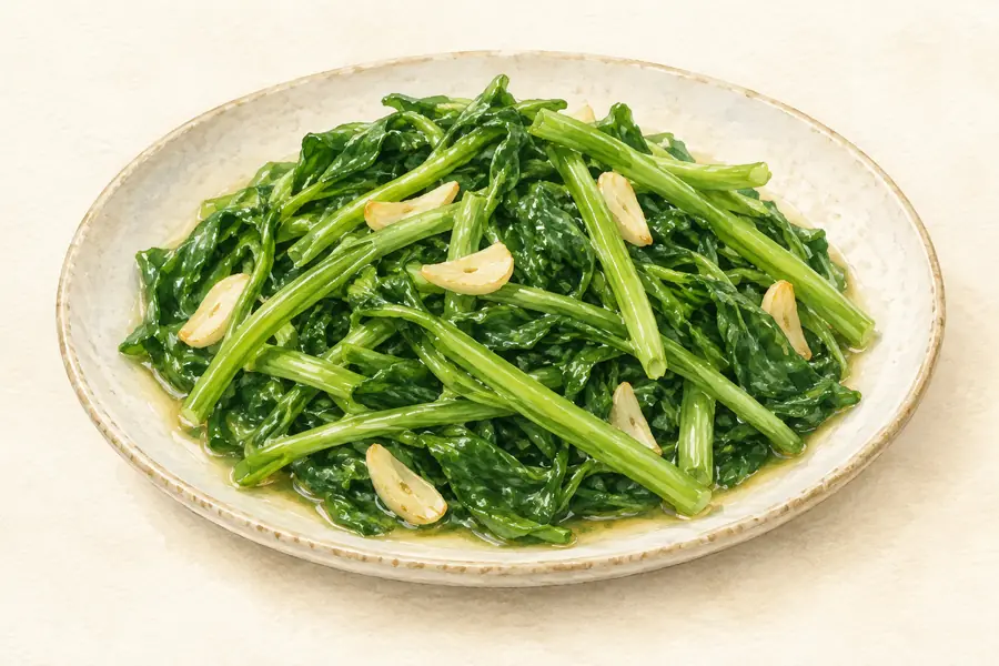 Wild Wormwood Shoots 柳蒿芽AI illustration · AI 示意图(仅供参考,非实拍)
Wild Wormwood Shoots (柳蒿芽) are the young stems and leaves of a wild plant that the Daur (达斡尔族) people living along both banks of the Nen River (嫩江) pick and cook in soups and stews. The Daur name for the plant is 'kunmile' (昆米勒).
Read the dish guide → Shoubarou 手把肉
The meat's own flavor leads, with tender flesh contrasting with richer fatty sections. The broth can be a valuable part of the meal.
Source ↗Read the dish guide →
Photo adjustments
EXIF orientation applied where present; resized proportionally to at most 640 px on the long edge and encoded as WebP. No crop, retouching, recoloring or subject changes.
 Roast Lamb Ribs 烤羊排
Roast Lamb Ribs (烤羊排) belong to the barbecue of Wuhai (乌海), the Inner Mongolian city on the Yellow River with the Ordos grassland (鄂尔多斯草原) at its back.
Read the dish guide →Photo adjustments
EXIF orientation normalized; resized without changing aspect ratio; converted to WebP. No subject edits.
 Salty Milk Tea 奶茶AI illustration · AI 示意图(仅供参考,非实拍)
Salty Milk Tea (奶茶) is Mongolian milk tea: green brick tea (青砖茶) boiled and mixed with fresh milk and salt.
Read the dish guide →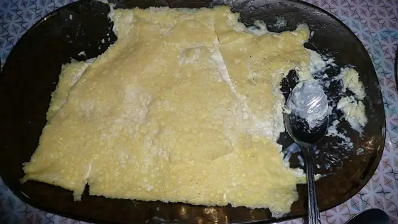 Mongolian Milk Skin 奶皮子
Mongolian Milk Skin (奶皮子), called öröm (өрөм) in Mongolian, is one of the milk foods of the Mongolian people: a dairy product that forms as a skin on the surface of slowly boiled fresh milk.
Source ↗Read the dish guide →
Photo adjustments
Resized and WebP compressed; subject not altered.
All dish names · 全部菜名 (11)
More dishes from across Inner Mongolia are in the Inner Mongolia food guide.
Counties & districts in Hulunbuir
14 areas belong directly to Hulunbuir.
14 areas
Hailar District 海拉尔区
Hailar District, formerly a county-level city, is an urban district that serves as the seat of the prefecture-level city Hulunbuir in northeastern Inner Mongolia, China.
Explore the area →DistrictJalainur District 扎赉诺尔区
Jalainur District or Zhalainuo'er District (Mongolian: ᠵᠠᠯᠠᠢᠨᠠᠭᠤᠷ ᠲᠣᠭᠤᠷᠢᠭ; Chinese: 扎赉诺尔区), an urban district under Manzhouli's administration, is listed as a district of Hulunbuir officially and located in…
Explore the area →BannerArun Banner 阿荣旗
Arun Banner (Mongolian: ᠠᠷᠤᠨ ᠬᠣᠰᠢᠭᠤ; Chinese: 阿荣旗) is a banner of northeastern Inner Mongolia, China, bordering Heilongjiang province to the south and east.
Explore the area →Autonomous bannerMorin Dawa Daur Autonomous Banner 莫力达瓦达斡尔族自治旗
Morin Dawa Daur Autonomous Banner (Mongolian: ᠮᠣᠷᠢᠨ ᠳᠠᠪᠠᠭ ᠠ ᠳᠠᠭᠤᠷ ᠥᠪᠡᠷᠲᠡᠭᠡᠨ ᠵᠠᠰᠠᠬᠤ ᠬᠣᠰᠢᠭᠤ; Dagur: Морин Даваа Даор Ихькиеву Гуасей, ᠮᠣᡵᢈᠨ ᡩᠠᠸᠠᡝ ᡩᠠᡠᠷ ᠸᡝᡝᡵᢈᡝ ᢈᡧᡴᢈᡝᠸᡠ ᡤᡠᠠᠰᡝᢈ; Chinese: 莫力达瓦达斡尔族自治旗), often…
Explore the area →Show fewer areas
Oroqen Autonomous Banner 鄂伦春自治旗
Oroqen Autonomous Banner (Oroqen: ɔrɔtʃeenŋi buwaan; Mongolian: ᠣᠷᠴᠣᠨ ᠤ ᠥᠪᠡᠷᠲᠡᠭᠡᠨ ᠵᠠᠰᠠᠬᠤ ᠬᠣᠰᠢᠭᠤ; Chinese: 鄂伦春自治旗) is an autonomous banner that lies east of the urban district of Hailar in the prefecture-level…
Explore the area →Autonomous bannerEwenki Autonomous Banner 鄂温克族自治旗
Ewenki Autonomous Banner or Evenk Autonomous Banner (Evenki:; Mongolian: ᠡᠸᠡᠩᠬᠢ ᠥᠪᠡᠷᠲᠡᠭᠡᠨ ᠵᠠᠰᠠᠬᠤ ᠬᠣᠰᠢᠭᠤ; Chinese: 鄂温克族自治旗) is an autonomous banner that lies on the border between northwestern Greater Khingan…
Explore the area →BannerOld Barag Banner 陈巴尔虎旗
Old Barag Banner (Mongolian: ᠬᠠᠭᠤᠴᠢᠨ ᠪᠠᠷᠭᠤ ᠬᠣᠰᠢᠭᠤ; Chinese: 陈巴尔虎旗) is a banner of northeastern Inner Mongolia, China.
Explore the area →BannerNew Barag Left Banner 新巴尔虎左旗
New Barag Left Banner (Mongolian: ᠰᠢᠨ ᠡ ᠪᠠᠷᠭᠤ ᠵᠡᠭᠦᠨ ᠬᠣᠰᠢᠭᠤ; Chinese: 新巴尔虎左旗) is a banner of Inner Mongolia, China, bordering Mongolia to the south. It is under the administration of Hulunbuir City.
Explore the area →BannerNew Barag Right Banner 新巴尔虎右旗
New Barag Right Banner (Mongolian: ᠰᠢᠨ ᠡ ᠪᠠᠷᠭᠤ ᠪᠠᠷᠠᠭᠤᠨ ᠬᠣᠰᠢᠭᠤ; Chinese: 新巴尔虎右旗), also romanized as Xin Barag Youqi, is a banner of northern Inner Mongolia, China, bordering Mongolia in all directions but the…
Explore the area →County-level cityManzhouli 满洲里市
Manzhouli is a sub-prefectural city in the Hulunbuir prefecture-level city jurisdiction, Inner Mongolia Autonomous Region, China.
Explore the area →County-level cityYakeshi 牙克石市
Yakeshi (Mongolian: ᠶᠠᠭᠰᠢ ᠬᠣᠲᠠ; Chinese: 牙克石) is a county-level city of Hulunbuir, Inner Mongolia, China.
Explore the area →County-level cityZalantun 扎兰屯市
Zalantun (Manchu ᠵᠠ ᠯᠠᠨ ᠠᡳ᠌ᠯ; J̌alan Ai"l) or ᠵᠠ ᠯᠠᠨ ᡨᡠ᠋ᠨ; Jalan Tun or Zhalantun) (simplified Chinese: 扎兰屯; traditional Chinese: 札蘭屯; pinyin: Zā lán tún) (Mongolian: ᠵᠠᠯᠠᠨ ᠠᠢ᠌ᠯ; Жалан-Айл), is a city and…
Explore the area →County-level cityErgun 额尔古纳市
Ergun, formerly Ergun Right Banner, is a county-level city in Hulunbuir, Inner Mongolia, containing the autonomous region's northernmost point.
Explore the area →County-level cityGenhe 根河市
Genhe City or Gegengol (Mongolian: ᠭᠡᠭᠡᠨ ᠭᠣᠤᠯ ᠬᠣᠲᠠ; Chinese: 根河市), formerly Ergun Left Banner, is a county-level city in the far northeast of Inner Mongolia, China, under the administration of Hulunbuir City.
Explore the area →No areas match this name.
Plan your visit
Getting there
Search for 呼伦贝尔市 in a map app to find stations and your accommodation.
Where to stay →Build your route
Hulun Lake and Manzhouli are about 70 km apart in a straight line. The linked place guides have entrance and visit details.
Continue with Inner Mongolia →More in Inner Mongolia
Sources & geographic information
Administrative names and parent areas: Official geographic directory · Reference date 2026-09-06.
Background text adapted from Hulunbuir — Wikipedia contributors, under CC BY-SA 4.0. Text has been shortened and reorganized; source revision 1345759264.
Photo: Hulun Lake · Fanghong · CC BY-SA 3.0. Proportionally resized and converted to WebP without cropping, retouching or changing the photographed subject.

Photo: Manzhouli · mayanming · CC BY-SA 3.0. Full frame retained; proportionally resized and converted to WebP. No retouching or changes to the photographed subject. Card displays may crop the view.

Photo: Hailar, Hulunbuir · Liuxingy · CC BY-SA 4.0. Full-frame source proportionally resized and converted to WebP for display. No subject alteration. Source-supplied marks and edits remain; cards may crop the view.

Photo: Ergun wetlands · 中国郑开亮 · CC BY-SA 3.0. The exact downloaded source bytes are separately retained and hashed. Prepared JPEG is proportionally reduced to a maximum 720-pixel long edge; full frame retained, no subject alteration. Final website rendition: full frame retained, proportionally resized to at most 720 pixels and converted to WebP. No additional retouching or subject alteration. Card displays may crop the view.

Photo: Shiwei · 西安兵马俑 · CC BY-SA 3.0. Proportionally resized and converted to WebP without cropping, retouching or changing the photographed subject.

Photo: Mordaoga National Forest Park · Liuxingy · Liuxingy — 额尔古纳 莫尔道嘎国家森林公园大门.jpg — CC BY-SA 4.0 · CC BY-SA 4.0. The exact downloaded source bytes are separately retained and hashed. Prepared JPEG is proportionally reduced to a maximum 720-pixel long edge; full frame retained, no subject alteration. Final website rendition: full frame retained, proportionally resized to at most 720 pixels and converted to WebP. No additional retouching or subject alteration. Card displays may crop the view.

Photo: Manzhouli National Gate Visitor Center · Source photographer · License not provided. EXIF orientation normalized; resized without changing aspect ratio; converted to WebP. No subject edits.
Photo: Manzhouli China-Russia Border Tourism Area · Liuxingy · CC BY-SA 4.0. EXIF orientation normalized; resized without changing aspect ratio; converted to WebP. No subject edits.

Photo: Morigele River Scenic Area · Liuxingy · CC BY-SA 4.0. Full frame retained; proportionally resized and converted to WebP. No retouching or changes to the photographed subject. Card displays may crop the view.

Photo: Chaihe Moon Town · Source photographer · License not provided. EXIF orientation normalized; resized without changing aspect ratio; converted to WebP. No subject edits.
Photo: Aoluguya Reindeer Tribe Scenic Area · Source photographer · License not provided. EXIF orientation normalized; resized without changing aspect ratio; converted to WebP. No subject edits.
Photo: Manzhouli China-Russia Border Scenic Area · Liuxingy · CC BY-SA 4.0. Full frame retained; proportionally resized and converted to WebP. No retouching or changes to the photographed subject. Card displays may crop the view.

Photo: Manzhouli Matryoshka Doll Scenic Area · Source photographer · License not provided. EXIF orientation normalized; resized without changing aspect ratio; converted to WebP. No subject edits.
Photo: Enhe Russian Ethnic Township · Liuxingy · CC BY-SA 4.0. Full frame retained; proportionally resized and converted to WebP. No retouching or changes to the photographed subject. Card displays may crop the view.

Photo: Ergun White Birch Forest Scenic Area · rheins · CC BY 3.0. EXIF orientation normalized; resized without changing aspect ratio; converted to WebP. No subject edits.

Map data © OpenStreetMap contributors. Pins mark approximate centres, not entrances or boundaries.