


Get to know Shangrao
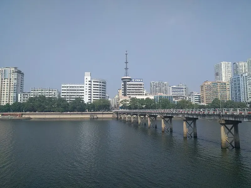
Photo adjustments
Full frame retained; proportionally resized and converted to WebP. No retouching or changes to the photographed subject. Card displays may crop the view.
- Administrative area
- Prefecture-level city · 地级市
- Part of
- Jiangxi
- Chinese name
- 上饶市
- Local areas
- 12 local areas
Area & population
- Area in the source
- 22,791.00 km²
- Population · 2020 census
- 6,491,088
- Administrative seat
- Xinzhou District
Source: cited geographic source, as of the dates shown.
Shangrao (simplified Chinese: 上饶; traditional Chinese: 上饒; pinyin: Shàngráo) is a medium-sized prefecture-level city located in the northeast of Jiangxi province, People's Republic of China. The city borders the province of Anhui to the north, the province of Zhejiang to the east, and the province of Fujian to the south. Also, the city's western reaches extend into Poyang Lake. Shangrao itself is at the very western edge of the Wu-speaking areas, while most of its associated counties speak Gan.
Explore Shangrao
Core places to explore, with English and Chinese names.
Sanqingshan 三清山
Wuyuan 婺源
Huangling, Wuyuan 篁岭
Wangxian Valley 望仙谷
Guifeng 龟峰
Shangrao 上饶
Wangkou 汪口
Shangrao Museum 上饶博物馆
Wuyuan Jiangwan Scenic Area 婺源江湾景区
Sixi and Yancun Villages 思溪延村
Jiangling Scenic Area 江岭
Likeng Village 李坑
Jiangwan Village 江湾
Shicheng Village 石城
Lingshan Mountains 灵山
Geyuan Fujian-Zhejiang-Jiangxi Revolutionary Sites 葛源镇闽浙赣革命旧址
Poyang Lake National Wetland Park 鄱阳湖国家湿地公园
Hekou Ancient Town 河口古镇
Mount Gexian 葛仙山
Gexian Village Resort 葛仙村度假区
Xinzhou District 信州区
Guangfeng District 广丰区
Guangxin District 广信区
Yushan County 玉山县
Yanshan County 铅山县
Hengfeng County 横峰县
Yiyang County 弋阳县
Yugan County 余干县
Poyang County 鄱阳县
Wannian County 万年县
Wuyuan County 婺源县
Dexing 德兴市
Places to explore around Shangrao
 San Qing Shan · 三清山
Sanqingshan三清山
Sanqingshan’s granite pillars rise above forested slopes in shapes that have acquired memorable names. In Nanqingyuan, the narrow Giant Python column and the profile of the Oriental Goddess provide two contrasting examples of…
Read the place guide →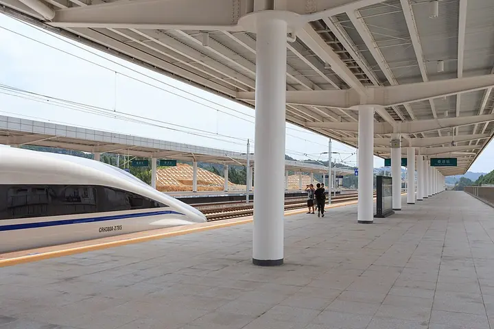 Wuyuan Railway Station on the Hefei–Fuzhou line’s opening day in 2015 · 婺源站 Photograph date recorded by the source: 28 June 2015, 11:15:05.
Wuyuan婺源
Wuyuan’s appeal lies in a dispersed landscape of Huizhou-style villages, tiled roofs and cultivated hillsides. Huangling gives a concentrated view of restored houses, drying trays and terraces, while Wangkou preserves a…
Read the place guide → Huangling Tourism Resort · 篁岭
Huangling, Wuyuan篁岭
Huangling climbs a hillside above Wuyuan’s fields, its white walls and dark tiles arranged around the reconstructed Tianjie street. Wooden racks and round drying trays create the village’s celebrated shaiqiu imagery. The…
Read the place guide → AI illustration; an interpretive view, not a photograph. AI 示意图,非景点实拍。
Wangxian Valley望仙谷
Wangxian Valley is a modern visitor landscape built around a restored former stone-production area in the Lingshan foothills. Its most striking buildings cling to the cliffs above the valley, while traditional-style lanes and…
Read the place guide → Cliff inscriptions beside the path at Guifeng in Yiyang, Jiangxi, July 2015.
Guifeng龟峰
Guifeng near Yiyang is named for rock formations that resemble turtles. Its Danxia landscape includes clusters of peaks, isolated pillars, natural bridges and caves.
Read the place guide →A riverside view in Xinzhou District, Shangrao (上饶信州区), photographed in October 2017. Photograph date recorded by the source: 2017-10-28 11:32:24.Shangrao上饶
Shangrao’s city centre offers a quieter cultural stop between the mountain and village excursions of northeastern Jiangxi. The municipal museum introduces regional crafts, including inkstones and bronze mirrors. Across the Xin…
Read the place guide →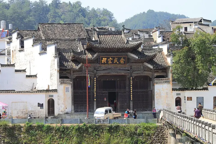 The Yu Family Ancestral Hall in Wangkou village · 汪口俞氏宗祠 Photograph date recorded by the source: 31 March 2012, 13:29:54.
Wangkou汪口
Wangkou is a Huizhou village in Jiangwan, Wuyuan, surrounded by water on three sides. Founded in the Song period, it developed as a settlement of the Yu lineage.
Read the place guide → AI illustration · AI 示意图(仅供参考,非该地点实拍)
Shangrao Museum上饶博物馆
Shangrao Museum draws attention to crafts and scholarship rooted in northeastern Jiangxi. Its collection includes finds from Song-period She inkstone workshops and Raozhou bronze mirrors, alongside material on early rice…
Read the place guide →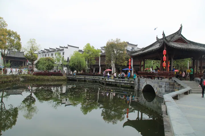 A stone arch bridge and lakeside pavilion at Jiangwan Scenic Area, Wuyuan County · 婺源江湾景区石拱桥与临水亭台 Source-recorded photograph date: Taken on 2 April 2016.
Wuyuan Jiangwan Scenic Area婺源江湾景区
Jiangwan is a historic village destination in northeastern Wuyuan, with a distinctive network of streets and lanes.
Read the place guide →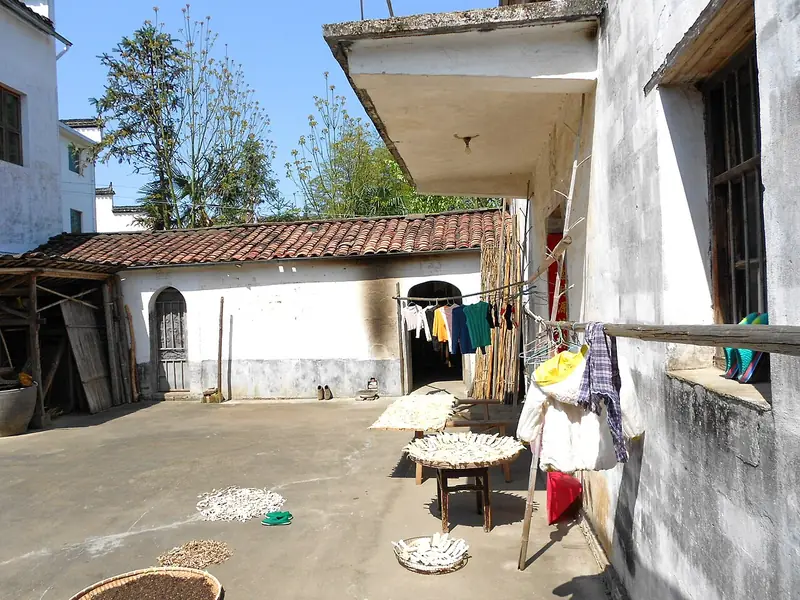 Sixi and Yancun Villages (思溪延村), Wuyuan County. Photograph: "Backyard in Yancun Village - panoramio".
Sixi and Yancun Villages思溪延村
Sixi Yancun (思溪延村) is a pair of neighbouring old villages in Sikou Town, Wuyuan County, Shangrao, Jiangxi, built on the profits of merchants who traded timber, tea and salt far beyond the county.
Read the place guide →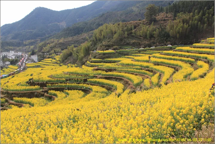 Terraced rapeseed-flower fields on a hillside above a village at Jiangling Scenic Area, Wuyuan County · 婺源江岭梯田油菜花景观,婺源县 Source-recorded photograph date: 2014-03-23 11:02.
Jiangling Scenic Area江岭
Jiangling (江岭) is a terraced upland in Wuyuan County, Shangrao, Jiangxi, where hillside rice terraces are sown with rapeseed and flower in spring above scattered whitewashed villages.
Read the place guide →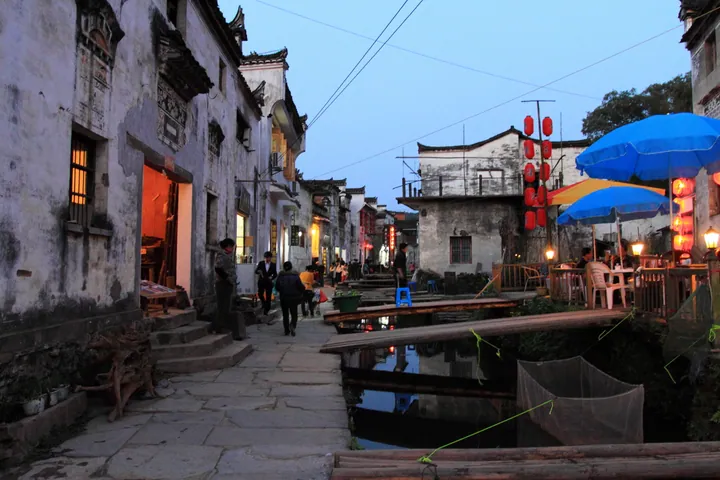 An evening view of Likeng Village village's canal-side street, Wuyuan County · 婺源李坑村水圳沿岸街景,黄昏 Source-recorded photograph date: 2012-03-31 18:42:01.
Likeng Village李坑
Likeng (李坑) is an old village in Qiukou Town, Wuyuan County, Shangrao, Jiangxi, built along a stream that runs through the middle of the settlement and crossed by stone-slab bridges.
Read the place guide →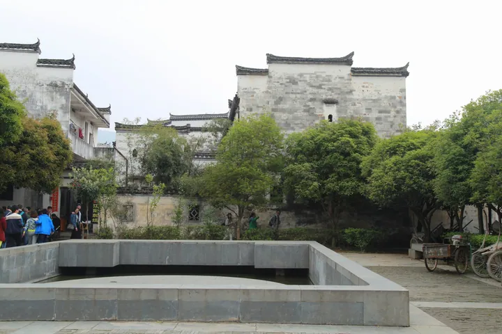 A paved village square in Wuyuan: white-walled Hui-style houses with grey tiled roofs and stepped horse-head gables behind a sunken rectangular stone-walled pool, a large tree in front, a group of visitors at the left, a tricycle and parked bicycles at the right, under a blank pale sky.
Jiangwan Village江湾
Jiangwan (江湾) is an old village and township centre in the north-east of Wuyuan County, Shangrao, Jiangxi, laid out as a single street with six lanes running off it.
Read the place guide →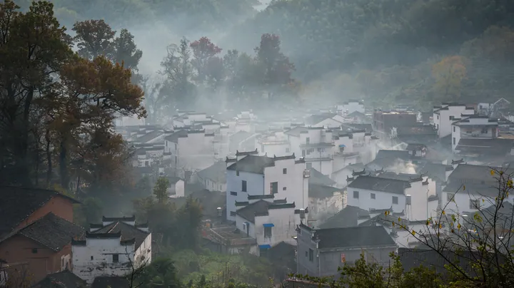 A hillside village of white-walled, grey-roofed houses packed into a wooded valley, autumn foliage in red and orange among the trees, mist or wood smoke drifting between the roofs, a few small modern buildings at the left and a wooded ridge behind.
Shicheng Village石城
Shicheng (石城) is a small village in Dazhangshan Township, Wuyuan County, Shangrao, Jiangxi, set in a valley among tall old maples and known for the autumn colour recorded by the county as one of the features of the Lingyandong scenic area.
Read the place guide → Hikers on the cliffside boardwalk beneath the granite peaks of Lingshan, Shangrao · 上饶灵山,花岗岩峰下的栈道与游人 Source-recorded photograph date: Taken on 6 April 2014.
Lingshan Mountains灵山
Lingshan (灵山) is a granite mountain range in the north of Guangxin District, Shangrao, Jiangxi, protected as a national scenic area and known locally as the Sleeping Beauty for the shape of its skyline.
Read the place guide →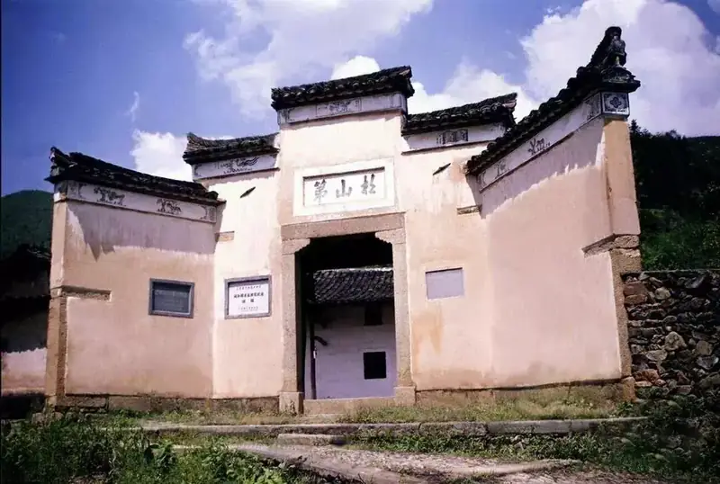 Geyuan Fujian-Zhejiang-Jiangxi Revolutionary Sites · 葛源镇闽浙赣革命旧址
Geyuan Fujian-Zhejiang-Jiangxi Revolutionary Sites葛源镇闽浙赣革命旧址
The Geyuan revolutionary sites (葛源镇闽浙赣革命旧址) stand at Geyuan Town in Hengfeng County, Shangrao, Jiangxi, in what was the seat of the Min-Zhe-Gan revolutionary base area during the Agrarian Revolutionary War.
Read the place guide → Poyang Lake National Wetland Park · 鄱阳湖国家湿地公园
Poyang Lake National Wetland Park鄱阳湖国家湿地公园
The Poyang Lake National Wetland Park (鄱阳湖国家湿地公园) lies in Poyang County, Shangrao, Jiangxi, on the eastern side of China's largest freshwater lake.
Read the place guide →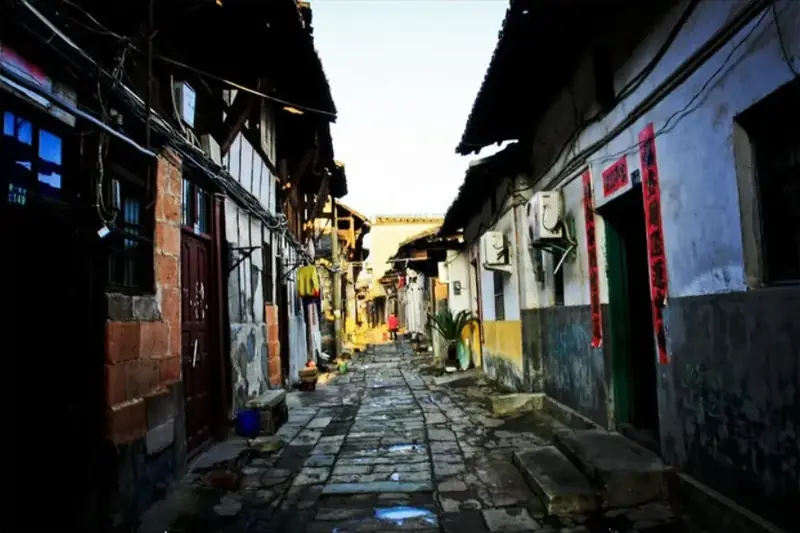 Hekou Ancient Town · 河口古镇
Hekou Ancient Town河口古镇
Hekou (河口古镇) is the county town of Yanshan in Shangrao, Jiangxi, a river port whose Ming and Qing commercial street still has more than three hundred old commercial buildings and dwellings standing along it.
Read the place guide →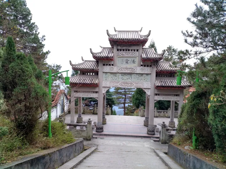 The stone memorial archway on the summit approach of Mount Gexian, Yanshan County · 铅山县葛仙山山顶牌坊 Source-recorded photograph date: 2016-12-12 15:09:30.
Mount Gexian葛仙山
Mount Gexian (葛仙山) is a Taoist mountain in central Yanshan County, Shangrao, Jiangxi, a spur of the Wuyi range whose summit temple complex is dedicated to the Han-era Taoist adept Ge Xuan.
Read the place guide →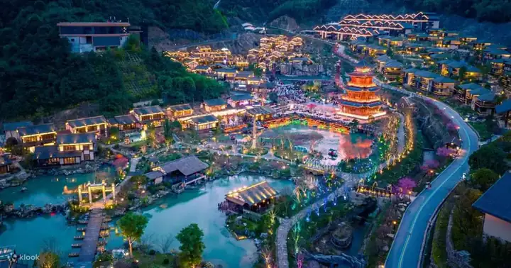 Gexian Village Resort · 葛仙村度假区
Gexian Village Resort葛仙村度假区
Gexian Village Resort (葛仙村度假区) is a purpose-built tourism and holiday complex at the foot of Mount Gexian in Yanshan County, Shangrao, Jiangxi, laid out as a village of Han- and Tang-style buildings and themed on the mountain's Taoist lore.
Read the place guide →Local life & food
Shangrao local specialties
上饶市特色美食 · 11 specialties to discover
 Yiyang rice cake 弋阳年糕AI dish illustration · AI 菜品示意图
Yiyang rice cake is valued for a smooth surface and a resilient, chewy bite that stays distinct in a dish. It absorbs surrounding seasonings without contributing a strong flavor of its own.
Source ↗Read the dish guide → Yanshan hot rice-noodle soup 铅山烫粉AI illustration · AI 示意图
The bowl combines tender strands with a warming, meat-scented liquid; pepper and chili can make the finish more assertive. Topping choices vary by stall.
Source ↗Read the dish guide →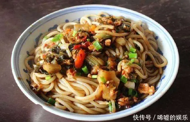 Guangfeng Stir-Fried Rice Noodles 广丰炒粉
Guangfeng Stir-Fried Rice Noodles (广丰炒粉) are fresh rice noodles stir-fried to order in Guangfeng (广丰), a district of Shangrao in Jiangxi, where the district government calls them springy, smooth and richly savoury.
Read the dish guide →Photo adjustments
EXIF orientation normalized; resized without changing aspect ratio; converted to WebP. No subject edits.
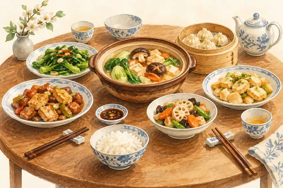 Dexing Wulao Dumplings 德兴乌佬果AI illustration · AI 示意图(仅供参考,非实拍)
Dexing Wulao Dumplings (德兴乌佬果) are filled, steamed parcels from Dexing (德兴) in Shangrao (上饶), Jiangxi, whose translucent wrapper was traditionally made from the starch of wild fern roots.
Read the dish guide →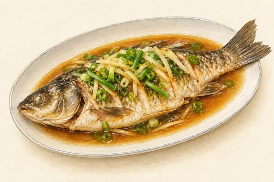 Wuyuan Purse Red Carp 婺源荷包红鲤鱼AI illustration · AI 示意图(仅供参考,非实拍)
Wuyuan Purse Red Carp (婺源荷包红鲤鱼) is a bright orange-red carp from Wuyuan county (婺源县) in Shangrao (上饶), Jiangxi, which the county government lists among its local products under the heading "state-banquet delicacy" (国宴珍肴).
Read the dish guide → Wuyuan Steamed Rice Cake 婺源汽糕AI illustration · AI 示意图(仅供参考,非实拍)
Wuyuan Steamed Rice Cake (婺源汽糕) is a large, round, fermented rice cake from Wuyuan County (婺源县) in Shangrao (上饶), Jiangxi, steamed on a gauze-lined sieve. Its Chinese name means a cake made by steam.
Read the dish guide → Poyang Rice Dumplings 鄱阳米饺AI illustration · AI 示意图(仅供参考,非实拍)
Poyang Rice Dumplings (鄱阳米饺) are steamed dumplings with a wrapper made from rice, a snack of Poyang County (鄱阳县) in Shangrao (上饶), Jiangxi.
Read the dish guide →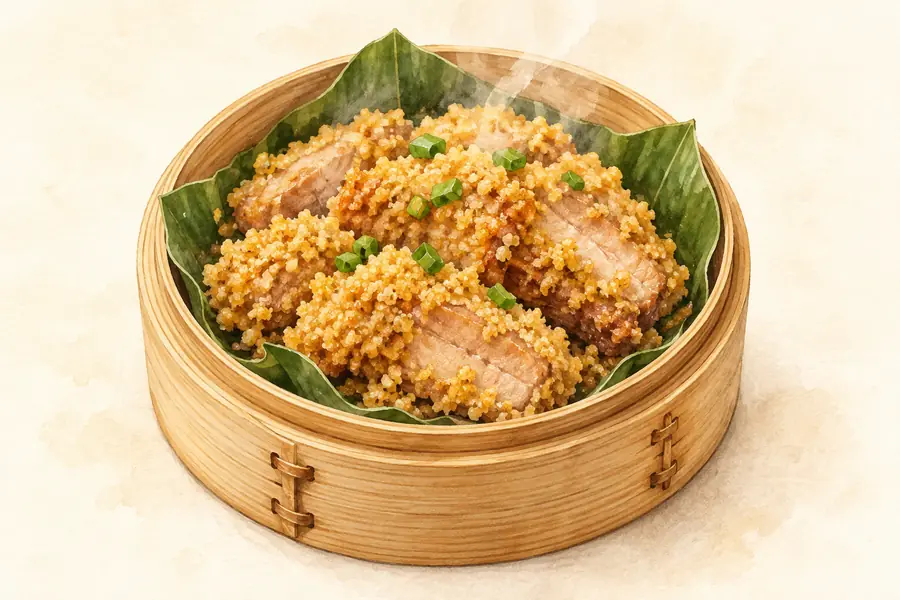 Wannian Tribute Rice Steamed Pork 万年贡米蒸肉AI illustration · AI 示意图(仅供参考,非实拍)
Wannian Tribute Rice Steamed Pork (万年贡米蒸肉) is listed among the local specialties of Shangrao, Jiangxi. 蒸 describes steaming.
Read the dish guide →All dish names · 全部菜名 (11)
- Yiyang rice cake · 弋阳年糕
- Yanshan hot rice-noodle soup · 铅山烫粉
- Guangfeng Stir-Fried Rice Noodles · 广丰炒粉
- Dexing Wulao Dumplings · 德兴乌佬果
- Wuyuan Purse Red Carp · 婺源荷包红鲤鱼
- Wuyuan Steamed Rice Cake · 婺源汽糕
- Poyang Rice Dumplings · 鄱阳米饺
- Wannian Tribute Rice Steamed Pork · 万年贡米蒸肉
- Yugan chili-and-pork stir-fry · 余干辣椒炒肉
- Sanqingshan Rock Frog · 三清山石鸡
- Hengfeng Gangbian Goose · 横峰港边鹅
More dishes from across Jiangxi are in the Jiangxi food guide.
Counties & districts in Shangrao
12 areas belong directly to Shangrao.
12 areas
Xinzhou District 信州区
Xinzhou District is an urban district and the seat of the city of Shangrao, Jiangxi province, China.
Explore the area →DistrictGuangfeng District 广丰区
Guangfeng District (simplified Chinese: 广丰区; traditional Chinese: 廣豐區; pinyin: Guǎngfēng Qū; lit. 'Wide and luxuriant') is a district of the city of Shangrao, located in Northeastern Jiangxi Province, Eastern…
Explore the area →DistrictGuangxin District 广信区
Guangxin District (simplified Chinese: 广信区; traditional Chinese: 廣信區; pinyin: Guǎngxìn qū) formerly, Shangrao County (simplified Chinese: 上饶县; traditional Chinese: 上饒縣; pinyin: Shàngráo Xiàn), is a district…
Explore the area →CountyYushan County 玉山县
Yushan is a county in the northeast of Jiangxi province, China. The county is Jiangxi's gateway to bordering Zhejiang province. It covers 1,731 km² (668 sq mi) and the population now reaches 560,000.
Explore the area →Show fewer areas
Yanshan County 铅山县
Yanshan is a county in Shangrao Municipality, in north-eastern Jiangxi province.
Explore the area →CountyHengfeng County 横峰县
Hengfeng County (simplified Chinese: 横峰; traditional Chinese: 橫峰; pinyin: Héngfēng) is a small county under the administration of Shangrao city, Jiangxi province, China.
Explore the area →CountyYiyang County 弋阳县
Yiyang (simplified Chinese: 弋阳县; traditional Chinese: 弋陽縣; pinyin: Yìyáng Xiàn) is a county located in the center of the prefecture-level city of Shangrao, in the northeast of Jiangxi province, People's…
Explore the area →CountyYugan County 余干县
Yugan County (simplified Chinese: 余干县; traditional Chinese: 餘干縣; pinyin: Yúgān Xiàn) is a county in the north of Jiangxi province, People's Republic of China, containing part of the southern end of Poyang…
Explore the area →CountyPoyang County 鄱阳县
Poyang County is a county under the administration of Shangrao city in the northeast of Jiangxi Province of the People's Republic of China, bordering Anhui Province to the north.
Explore the area →CountyWannian County 万年县
Wannian (simplified Chinese: 万年县; traditional Chinese: 萬年縣; pinyin: Wànnián Xiàn; lit. 'Ten thousand years') is a county in the northeast of Jiangxi province, China.
Explore the area →CountyWuyuan County 婺源县
Wuyuan (simplified Chinese: 婺源县; traditional Chinese: 婺源縣; pinyin: Wùyuán Xiàn) is a county in northeastern Jiangxi province, People's Republic of China, bordering the provinces of Zhejiang to the east and…
Explore the area →County-level cityDexing 德兴市
Dexing (simplified Chinese: 德兴; traditional Chinese: 德興市; pinyin: Déxīng) is a county-level city in the northeast of Jiangxi province, China, bordering Zhejiang province to the east.
Explore the area →No areas match this name.
Plan your visit
Getting there
Search for 上饶市 in a map app to find stations and your accommodation.
Where to stay →Build your route
Sanqingshan and Wuyuan are about 45 km apart in a straight line. The linked place guides have entrance and visit details.
Continue with Jiangxi →More in Jiangxi
Sources & geographic information
Administrative names and parent areas: Official geographic directory · Reference date 2026-09-06.
Background text adapted from Shangrao — Wikipedia contributors, under CC BY-SA 4.0. Text has been shortened and reorganized; source revision 1356901094.
Photo: Sanqingshan · xiquinhosilva · CC BY 2.0. Wikimedia thumbnail; fitted to the ranking-card frame.
.jpg)
Photo: Wuyuan · Zhangzhugang · CC BY-SA 4.0. Full frame retained; proportionally resized and converted to WebP. No retouching or changes to the photographed subject. Card displays may crop the view.

Photo: Huangling, Wuyuan · EditQ · CC BY-SA 4.0. Wikimedia thumbnail; fitted to the ranking-card frame.

Photo: Guifeng · Zhangzhugang · CC BY-SA 4.0. Proportionally resized and converted to WebP without cropping, retouching or changing the photographed subject.

Photo: Shangrao · Qa003qa003 · CC BY-SA 4.0. Full frame retained; proportionally resized and converted to WebP. No retouching or changes to the photographed subject. Card displays may crop the view.

Photo: Wangkou · Zhangzhugang · CC BY-SA 4.0. Full frame retained; proportionally resized and converted to WebP. No retouching or changes to the photographed subject. Card displays may crop the view.

Photo: Wuyuan Jiangwan Scenic Area · 江上清风1961 · CC BY 3.0. Full frame retained; proportionally resized and converted to WebP. No retouching or changes to the photographed subject. Card displays may crop the view.
.jpg)
Photo: Sixi and Yancun Villages · Raki_Man · CC BY 3.0. Full frame retained; EXIF orientation normalized, proportionally resized to at most 800 pixels and converted to WebP. No generated pixels or subject changes. Cards may crop the display.

Photo: Jiangling Scenic Area · Kware Ji from Shenzhen, China · CC BY 2.0. Full frame retained; proportionally resized and converted to WebP. No retouching or changes to the photographed subject. Card displays may crop the view.
.jpg)
Photo: Likeng Village · Zhangzhugang · CC BY-SA 4.0. Full frame retained; proportionally resized and converted to WebP. No retouching or changes to the photographed subject. Card displays may crop the view.

Photo: Jiangwan Village · 江上清风1961 · CC BY 3.0. Full frame retained; proportionally resized and converted to WebP. No retouching or changes to the photographed subject. Card displays may crop the view.

Photo: Shicheng Village · liuzr99 · CC BY-SA 2.0. Full frame retained; proportionally resized and converted to WebP. No retouching or changes to the photographed subject. Card displays may crop the view.
.jpg)
Photo: Lingshan Mountains · 江上清风1961 · CC BY 3.0. Full frame retained; proportionally resized and converted to WebP. No retouching or changes to the photographed subject. Card displays may crop the view.
.jpg)
Photo: Geyuan Fujian-Zhejiang-Jiangxi Revolutionary Sites · Source photographer · License not provided. EXIF orientation normalized; resized without changing aspect ratio; converted to WebP. No subject edits.
Photo: Poyang Lake National Wetland Park · Source photographer · License not provided. EXIF orientation normalized; resized without changing aspect ratio; converted to WebP. No subject edits.
Photo: Hekou Ancient Town · Source photographer · License not provided. EXIF orientation normalized; resized without changing aspect ratio; converted to WebP. No subject edits.
Photo: Mount Gexian · Zhangzhugang · CC BY-SA 4.0. Full frame retained; proportionally resized and converted to WebP. No retouching or changes to the photographed subject. Card displays may crop the view.

Photo: Gexian Village Resort · Source photographer · License not provided. EXIF orientation normalized; resized without changing aspect ratio; converted to WebP. No subject edits.
Map data © OpenStreetMap contributors. Pins mark approximate centres, not entrances or boundaries.